Property Record
405 Route 46 Ken, Mine Hill, NJ 07803


NEARBY LISTINGS FOR SALE OR LEASE
Property Detail
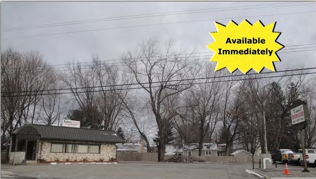
405 Route 46 Ken
Newark, NJ
Morris
36-02619-0000-00004
New Jersey
Restaurantbuilding
4
2024
0.24 AC
2025
Western Morris
045200
Northern New Jersey
1,433 SF
DEMOGRAPHICS near 405 Route 46 Ken
1 Mile
3 Mile
5 Mile
2024 Total Population
3,283
49,038
119,530
2029 Population
3,226
48,992
119,603
Pop Growth 2024-2029
(1.74%)
(0.09%)
+ 0.06%
Average Age
42
42
42
2024 Total Households
1,210
18,271
44,150
HH Growth 2024-2029
(1.82%)
(0.11%)
+ 0.07%
Median Household Inc
$84,523
$93,321
$102,674
Avg Household Size
2.70
2.60
2.60
2024 Avg HH Vehicles
2.00
2.00
2.00
Median Home Value
$336,123
$365,292
$389,878
Median Year Built
1958
1971
1971
Nearby Places
Map Layers
Map Styles
 Street
 Aerial
- Restaurants
- Banks
- Shops
- Fitness
- Groceries
PUBLIC TRANSPORTATION
COMMUTER RAIL
Mount Arlington (Montclair-Boonton Line - NJ Transit Commuter Rail (NJ Transit), Morris & Essex Morristown Line - NJ Transit Commuter Rail (NJ Transit))
DRIVE
WALK
Distance
Mount Arlington (Montclair-Boonton Line - NJ Transit Commuter Rail (NJ Transit), Morris & Essex Morristown Line - NJ Transit Commuter Rail (NJ Transit))
6 min
3.1 mi
Dover (Montclair-Boonton Line - NJ Transit Commuter Rail (NJ Transit), Morris & Essex Morristown Line - NJ Transit Commuter Rail (NJ Transit))
DRIVE
WALK
Distance
Dover (Montclair-Boonton Line - NJ Transit Commuter Rail (NJ Transit), Morris & Essex Morristown Line - NJ Transit Commuter Rail (NJ Transit))
6 min
3.3 mi
AIRPORT
Newark Liberty International
DRIVE
WALK
Distance
Newark Liberty International
44 min
32.8 mi
Freight Ports
Maher Terminal
DRIVE
WALK
Distance
Maher Terminal
48 min
33.4 mi
Nearby Properties
Address
Land Use
TOTAL SIZE
Lot Size
Zoning
Address
Land Use
TOTAL SIZE
Lot Size
Zoning
1,023 SF
143.31 AC
OR-3
Address
Land Use
TOTAL SIZE
Lot Size
Zoning
222.79 AC
R1
Address
Land Use
TOTAL SIZE
Lot Size
Zoning
64.62 AC
R3
Address
Land Use
TOTAL SIZE
Lot Size
Zoning
30.13 AC
I-3
Address
Land Use
TOTAL SIZE
Lot Size
Zoning
25.63 AC
B-3
Address
Land Use
TOTAL SIZE
Lot Size
Zoning
23.66 AC
I1
Address
Land Use
TOTAL SIZE
Lot Size
Zoning
20.05 AC
R-1
Address
Land Use
TOTAL SIZE
Lot Size
Zoning
3.01 AC
Address
Land Use
TOTAL SIZE
Lot Size
Zoning
23.74 AC
B-3
Address
Land Use
TOTAL SIZE
Lot Size
Zoning
Address
Land Use
TOTAL SIZE
Lot Size
Zoning
276,378 SF
40.50 AC
OSGU
Address
Land Use
TOTAL SIZE
Lot Size
Zoning
8.19 AC
B-3
Address
Land Use
TOTAL SIZE
Lot Size
Zoning
440.89 AC
POLI
Address
Land Use
TOTAL SIZE
Lot Size
Zoning
Address
Land Use
TOTAL SIZE
Lot Size
Zoning
19.47 AC
R-4
Address
Land Use
TOTAL SIZE
Lot Size
Zoning
8.08 AC
I-1
Address
Land Use
TOTAL SIZE
Lot Size
Zoning
13.53 AC
R10
Address
Land Use
TOTAL SIZE
Lot Size
Zoning
457,072 SF
64.13 AC
I-1
Address
Land Use
TOTAL SIZE
Lot Size
Zoning
126,875 SF
7.02 AC
Address
Land Use
TOTAL SIZE
Lot Size
Zoning
30.90 AC
I-2
Address
Land Use
TOTAL SIZE
Lot Size
Zoning
55.26 AC
PUD
Address
Land Use
TOTAL SIZE
Lot Size
Zoning
16.21 AC
R-4
Address
Land Use
TOTAL SIZE
Lot Size
Zoning
42.43 AC
R-5
Address
Land Use
TOTAL SIZE
Lot Size
Zoning
79,962 SF
27.80 AC
GU
Address
Land Use
TOTAL SIZE
Lot Size
Zoning
22,289 SF
5 AC
R1
Address
Land Use
TOTAL SIZE
Lot Size
Zoning
9.81 AC
B2
Address
Land Use
TOTAL SIZE
Lot Size
Zoning
20.85 AC
I-3
Address
Land Use
TOTAL SIZE
Lot Size
Zoning
8.43 AC
B-3
Address
Land Use
TOTAL SIZE
Lot Size
Zoning
68,844 SF
5 AC
PUD
Address
Land Use
TOTAL SIZE
Lot Size
Zoning
4,200 SF
34.12 AC
GU
The World's #1 Commercial Real Estate Marketplace
Connect with us
© 2026 CoStar Group
The information above has been obtained from sources believed reliable. While we do not doubt its accuracy we have not verified it and make no guarantee, warranty or representation about it. It is your responsibility to independently confirm its accuracy and completeness. Any projections, opinions, assumptions, or estimates used are for example only and do not represent the current or future performance of the property. The value of this transaction to you depends on tax and other factors which should be evaluated by your tax, financial, and legal advisors. You and your advisors should conduct a careful, independent investigation of the property to determine to your satisfaction the suitability of the property for your needs.