Property Record
100 Pantigo Pl, East Hampton, NY 11937
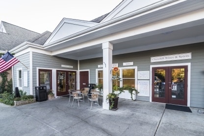
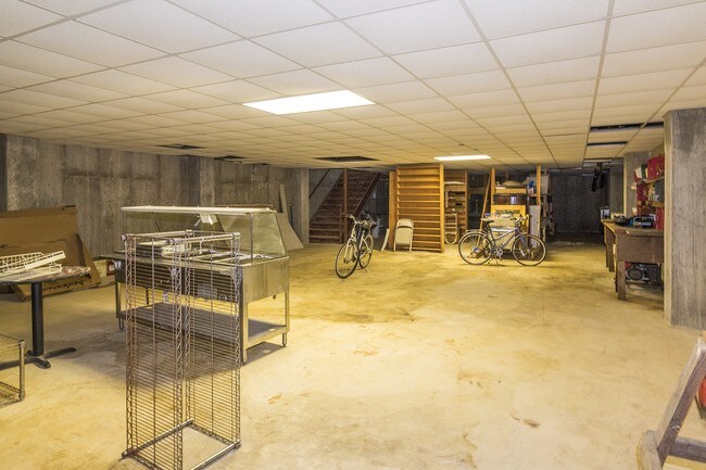

Property Detail
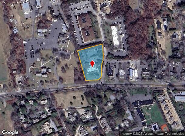
100 Pantigo Pl
Nassau County-Suffolk County, NY
Map Pospisil Associates
0300-188-00-01-00-008-001
BLK LOT 1
Commercialnec
Suffolk
X
New York
36103C0558H
8
2024
1 AC
2024
Eastern Suffolk
201005
Long Island (New York)
NEARBY LISTINGS FOR SALE OR LEASE
DEMOGRAPHICS near 100 Pantigo Pl
1 mile
3 mile
5 mile
2024 Total Population
4,059
17,768
29,936
2029 Population
4,240
18,625
31,427
Pop Growth 2024-2029
+ 4.46%
+ 4.82%
+ 4.98%
Average Age
43
44
44
2024 Total Households
1,497
6,736
11,490
HH Growth 2024-2029
+ 4.74%
+ 4.94%
+ 5.07%
Median Household Inc
$105,502
$124,230
$131,318
Avg Household Size
2.60
2.60
2.60
2024 Avg HH Vehicles
2.00
2.00
2.00
Median Home Value
$1,050,156
$1,032,624
$993,639
Median Year Built
1974
1979
1980
Nearby Places
Map Layers
Map Styles
 Street
 Aerial
Transit
 Traffic
 Biking
Places
Listings with unknown addresses are not visible on the map
- Restaurants
- Banks
- Shops
- Fitness
- Groceries
PUBLIC TRANSPORTATION
COMMUTER RAIL
East Hampton Station (Montauk Branch - Long Island Rail Road)
Drive
Walk
Distance
East Hampton Station (Montauk Branch - Long Island Rail Road)
4 min
1.5 mi
Amagansett Station (Montauk Branch - Long Island Rail Road)
Drive
Walk
Distance
Amagansett Station (Montauk Branch - Long Island Rail Road)
6 min
2.3 mi
Freight Ports
Port of New Haven
Drive
Walk
Distance
Port of New Haven
201 min
90.2 mi
SALE & LEASE HISTORY
LISTING DATE
SALE/LEASE

Nov 17, 2016
For Sale
Apr 22, 2019
For Sale
Nearby Properties
Address
Land Use
TOTAL SIZE
Lot Size
Zoning
Address
Land Use
TOTAL SIZE
Lot Size
Zoning
9,080 SF
2.99 AC
R120
Address
Land Use
TOTAL SIZE
Lot Size
Zoning
7,052 SF
2.16 AC
R120
Address
Land Use
TOTAL SIZE
Lot Size
Zoning
3,872 SF
1.52 AC
R120
Address
Land Use
TOTAL SIZE
Lot Size
Zoning
2,340 SF
0.70 AC
R120
Address
Land Use
TOTAL SIZE
Lot Size
Zoning
2,112 SF
0.33 AC
R120
Address
Land Use
TOTAL SIZE
Lot Size
Zoning
6,267 SF
1.15 AC
R40
Address
Land Use
TOTAL SIZE
Lot Size
Zoning
2,240 SF
19.46 AC
R40
Address
Land Use
TOTAL SIZE
Lot Size
Zoning
4,353 SF
1 AC
CR80
Address
Land Use
TOTAL SIZE
Lot Size
Zoning
5,349 SF
0.87 AC
VILLA
Address
Land Use
TOTAL SIZE
Lot Size
Zoning
3,344 SF
4 AC
CR200
Address
Land Use
TOTAL SIZE
Lot Size
Zoning
3,920 SF
0.84 AC
VILLA
Address
Land Use
TOTAL SIZE
Lot Size
Zoning
2,122 SF
0.48 AC
VILLA
Address
Land Use
TOTAL SIZE
Lot Size
Zoning
1.12 AC
VILLA
Address
Land Use
TOTAL SIZE
Lot Size
Zoning
4,639 SF
0.47 AC
VILLA
Address
Land Use
TOTAL SIZE
Lot Size
Zoning
5,285 SF
1.20 AC
VILLA
Address
Land Use
TOTAL SIZE
Lot Size
Zoning
3,516 SF
0.37 AC
R20
Address
Land Use
TOTAL SIZE
Lot Size
Zoning
3,120 SF
1.35 AC
R40
Address
Land Use
TOTAL SIZE
Lot Size
Zoning
4,058 SF
1.02 AC
R15
Address
Land Use
TOTAL SIZE
Lot Size
Zoning
3,337 SF
1.90 AC
VILLA
Address
Land Use
TOTAL SIZE
Lot Size
Zoning
3,504 SF
1.20 AC
R40
Address
Land Use
TOTAL SIZE
Lot Size
Zoning
3,508 SF
1.27 AC
VILLA
Address
Land Use
TOTAL SIZE
Lot Size
Zoning
3,160 SF
5 AC
CR200
Address
Land Use
TOTAL SIZE
Lot Size
Zoning
2,451 SF
1.09 AC
VILLA
Address
Land Use
TOTAL SIZE
Lot Size
Zoning
2,164 SF
0.49 AC
VILLA
Address
Land Use
TOTAL SIZE
Lot Size
Zoning
2,996 SF
0.72 AC
R40
Address
Land Use
TOTAL SIZE
Lot Size
Zoning
3,787 SF
1.16 AC
VILLA
Address
Land Use
TOTAL SIZE
Lot Size
Zoning
3,558 SF
2.23 AC
R40
Address
Land Use
TOTAL SIZE
Lot Size
Zoning
1,189 SF
0.78 AC
R20
Address
Land Use
TOTAL SIZE
Lot Size
Zoning
2,246 SF
1 AC
VILLA
Address
Land Use
TOTAL SIZE
Lot Size
Zoning
4,132 SF
1.08 AC
R40
The World's #1 Commercial Real Estate Marketplace
Connect with us
© 2026 CoStar Group
The information above has been obtained from sources believed reliable. While we do not doubt its accuracy we have not verified it and make no guarantee, warranty or representation about it. It is your responsibility to independently confirm its accuracy and completeness. Any projections, opinions, assumptions, or estimates used are for example only and do not represent the current or future performance of the property. The value of this transaction to you depends on tax and other factors which should be evaluated by your tax, financial, and legal advisors. You and your advisors should conduct a careful, independent investigation of the property to determine to your satisfaction the suitability of the property for your needs.