Property Record
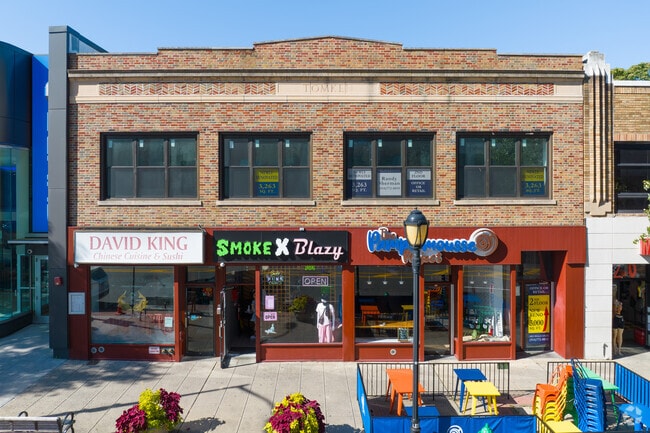
124 Mamaroneck Ave, White Plains, NY 10601


Property Detail
124 Mamaroneck Ave
1700-125-084-00001-000-0004
Westchester
Commercialofficeresidentialmixeduse
New York
CB-2
4.000
B and X Area of moderate flood hazard, usually the area between the limits of the 100-year and 500-year floods.
0.14 AC
2025
White Plains CBD
2024
Westchester/So Connecticut
009300
New York-Jersey City-White Plains, NY-NJ
7,604 SF
NEARBY LISTINGS FOR SALE OR LEASE
DEMOGRAPHICS near 124 Mamaroneck Ave
1 mile
3 mile
5 mile
2025 Total Population
44,960
115,596
219,553
2030 Population
46,102
117,548
222,359
Pop Growth 2025-2030
+ 2.54%
+ 1.69%
+ 1.28%
Average Age
42
43
42
2025 Total Households
19,668
44,722
79,490
HH Growth 2025-2030
+ 2.75%
+ 1.85%
+ 1.40%
Median Household Inc
$98,216
$127,640
$148,243
Avg Household Size
2.20
2.40
2.60
2025 Avg HH Vehicles
1.00
2.00
2.00
Median Home Value
$487,067
$689,037
$783,246
Median Year Built
1965
1961
1959
Nearby Places
Map Layers
Map Styles
 Street
 Aerial
Transit
 Traffic
 Biking
Places
Listings with unknown addresses are not visible on the map
- Restaurants
- Banks
- Shops
- Fitness
- Groceries
PUBLIC TRANSPORTATION
TRANSIT/SUBWAY
White Plains Station (Harlem Line - Metro-North Commuter Railroad Company (Metro-North))
Drive
Walk
Distance
White Plains Station (Harlem Line - Metro-North Commuter Railroad Company (Metro-North))
3 min
16 min
0.8 mi
COMMUTER RAIL
White Plains Station (Harlem Line - Metro-North Commuter Railroad Company (Metro-North))
Drive
Walk
Distance
White Plains Station (Harlem Line - Metro-North Commuter Railroad Company (Metro-North))
3 min
16 min
0.8 mi
North White Plains Station (Harlem Line - Metro-North Commuter Railroad Company (Metro-North))
Drive
Walk
Distance
North White Plains Station (Harlem Line - Metro-North Commuter Railroad Company (Metro-North))
5 min
1.9 mi
AIRPORT
Westchester County
Drive
Walk
Distance
Westchester County
13 min
7.6 mi
LaGuardia
Drive
Walk
Distance
LaGuardia
41 min
23.4 mi
John F Kennedy International
Drive
Walk
Distance
John F Kennedy International
47 min
30.9 mi
Freight Ports
NY - Red Hook Container Terminal
Drive
Walk
Distance
NY - Red Hook Container Terminal
56 min
33.9 mi
SALE & LEASE HISTORY
LISTING DATE
SALE/LEASE

Jun 11, 2020
For Lease
Dec 08, 2016
For Sale
Aug 28, 2017
For Sale
Aug 25, 2017
For Sale
Aug 09, 2023
For Sale
Nearby Properties
Address
Land Use
TOTAL SIZE
Lot Size
Zoning
Address
Land Use
TOTAL SIZE
Lot Size
Zoning
358.83 AC
Address
Land Use
TOTAL SIZE
Lot Size
Zoning
Address
Land Use
TOTAL SIZE
Lot Size
Zoning
4.45 AC
B
Address
Land Use
TOTAL SIZE
Lot Size
Zoning
381,836 SF
16.68 AC
A3
Address
Land Use
TOTAL SIZE
Lot Size
Zoning
75.87 AC
R-20
Address
Land Use
TOTAL SIZE
Lot Size
Zoning
66 AC
R-20
Address
Land Use
TOTAL SIZE
Lot Size
Zoning
237,313 SF
22.67 AC
A1
Address
Land Use
TOTAL SIZE
Lot Size
Zoning
16.22 AC
UR
Address
Land Use
TOTAL SIZE
Lot Size
Zoning
22.44 AC
R-20
Address
Land Use
TOTAL SIZE
Lot Size
Zoning
7.98 AC
CA
Address
Land Use
TOTAL SIZE
Lot Size
Zoning
1,975 SF
13.80 AC
CA
Address
Land Use
TOTAL SIZE
Lot Size
Zoning
29.42 AC
PUD
Address
Land Use
TOTAL SIZE
Lot Size
Zoning
10.90 AC
UR
Address
Land Use
TOTAL SIZE
Lot Size
Zoning
3.16 AC
Address
Land Use
TOTAL SIZE
Lot Size
Zoning
5.57 AC
AA1
Address
Land Use
TOTAL SIZE
Lot Size
Zoning
64.41 AC
R-20
Address
Land Use
TOTAL SIZE
Lot Size
Zoning
1,200 SF
21.21 AC
R-20
Address
Land Use
TOTAL SIZE
Lot Size
Zoning
7.98 AC
M-14
Address
Land Use
TOTAL SIZE
Lot Size
Zoning
0.58 AC
B
Address
Land Use
TOTAL SIZE
Lot Size
Zoning
48,267 SF
11.04 AC
A2 A
Address
Land Use
TOTAL SIZE
Lot Size
Zoning
1,823 SF
6.89 AC
Address
Land Use
TOTAL SIZE
Lot Size
Zoning
11.21 AC
R-20
Address
Land Use
TOTAL SIZE
Lot Size
Zoning
84,450 SF
3.19 AC
B
Address
Land Use
TOTAL SIZE
Lot Size
Zoning
5.43 AC
R-40
Address
Land Use
TOTAL SIZE
Lot Size
Zoning
320 SF
5.38 AC
LI
Address
Land Use
TOTAL SIZE
Lot Size
Zoning
1,348 SF
5.67 AC
CA
Address
Land Use
TOTAL SIZE
Lot Size
Zoning
6.09 AC
DS
Address
Land Use
TOTAL SIZE
Lot Size
Zoning
1,630 SF
2.64 AC
LOB
Address
Land Use
TOTAL SIZE
Lot Size
Zoning
2,100 SF
24.12 AC
A3
Address
Land Use
TOTAL SIZE
Lot Size
Zoning
121.29 AC
The World's #1 Commercial Real Estate Marketplace
Connect with us
© 2026 CoStar Group
The information above has been obtained from sources believed reliable. While we do not doubt its accuracy we have not verified it and make no guarantee, warranty or representation about it. It is your responsibility to independently confirm its accuracy and completeness. Any projections, opinions, assumptions, or estimates used are for example only and do not represent the current or future performance of the property. The value of this transaction to you depends on tax and other factors which should be evaluated by your tax, financial, and legal advisors. You and your advisors should conduct a careful, independent investigation of the property to determine to your satisfaction the suitability of the property for your needs.