Property Record
27 Route 59, Nyack, NY 10960
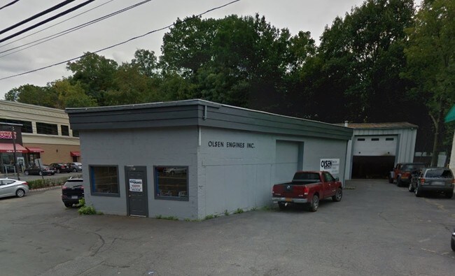


Property Detail
27 Route 59
New York-Jersey City-White Plains, NY-NJ
134-A-29
392005-065-035-0001-016-000-0000
Rockland
Autorepair
New York
B and X Area of moderate flood hazard, usually the area between the limits of the 100-year and 500-year floods.
16.0
2023
0.53 AC
2024
Rockland County
011102
Northern New Jersey
5,749 SF
NEARBY LISTINGS FOR SALE OR LEASE
DEMOGRAPHICS near 27 Route 59
1 mile
3 mile
5 mile
2025 Total Population
13,371
35,266
128,716
2030 Population
13,696
36,297
132,107
Pop Growth 2025-2030
+ 2.43%
+ 2.92%
+ 2.63%
Average Age
43
43
43
2025 Total Households
5,935
13,374
46,645
HH Growth 2025-2030
+ 2.46%
+ 2.92%
+ 2.60%
Median Household Inc
$121,388
$126,943
$125,989
Avg Household Size
2.20
2.50
2.60
2025 Avg HH Vehicles
2.00
2.00
2.00
Median Home Value
$627,447
$690,852
$694,078
Median Year Built
1962
1963
1964
Nearby Places
Map Layers
Map Styles
 Street
 Aerial
Transit
 Traffic
 Biking
Places
Listings with unknown addresses are not visible on the map
- Restaurants
- Banks
- Shops
- Fitness
- Groceries
PUBLIC TRANSPORTATION
COMMUTER RAIL
Nanuet (Pascack Valley Line - NJ Transit Commuter Rail (NJ Transit))
Drive
Walk
Distance
Nanuet (Pascack Valley Line - NJ Transit Commuter Rail (NJ Transit))
10 min
5.4 mi
Tarrytown Station (Hudson Line - Metro-North Commuter Railroad Company (Metro-North))
Drive
Walk
Distance
Tarrytown Station (Hudson Line - Metro-North Commuter Railroad Company (Metro-North))
13 min
7.4 mi
AIRPORT
Westchester County
Drive
Walk
Distance
Westchester County
28 min
19.1 mi
LaGuardia
Drive
Walk
Distance
LaGuardia
47 min
31.8 mi
New York Stewart International
Drive
Walk
Distance
New York Stewart International
58 min
39.5 mi
Freight Ports
Maher Terminal
Drive
Walk
Distance
Maher Terminal
56 min
36.5 mi
SALE & LEASE HISTORY
LISTING DATE
SALE/LEASE

Dec 05, 2016
For Sale
Aug 30, 2019
For Sale
Nearby Properties
Address
Land Use
TOTAL SIZE
Lot Size
Zoning
Address
Land Use
TOTAL SIZE
Lot Size
Zoning
415,374 SF
8.43 AC
H
Address
Land Use
TOTAL SIZE
Lot Size
Zoning
4,540,462 SF
30.89 AC
Address
Land Use
TOTAL SIZE
Lot Size
Zoning
237,408 SF
14.97 AC
R-40
Address
Land Use
TOTAL SIZE
Lot Size
Zoning
298,975 SF
63.32 AC
03 - MULTI
Address
Land Use
TOTAL SIZE
Lot Size
Zoning
114,520 SF
6.71 AC
R4
Address
Land Use
TOTAL SIZE
Lot Size
Zoning
25.52 AC
Address
Land Use
TOTAL SIZE
Lot Size
Zoning
50,280 SF
24.37 AC
Address
Land Use
TOTAL SIZE
Lot Size
Zoning
108,264 SF
14.90 AC
R-18
Address
Land Use
TOTAL SIZE
Lot Size
Zoning
31.50 AC
R-15
Address
Land Use
TOTAL SIZE
Lot Size
Zoning
302.70 AC
R-40
Address
Land Use
TOTAL SIZE
Lot Size
Zoning
1.10 AC
R-3
Address
Land Use
TOTAL SIZE
Lot Size
Zoning
56,436 SF
7.06 AC
R-40
Address
Land Use
TOTAL SIZE
Lot Size
Zoning
984 SF
3.10 AC
LI
Address
Land Use
TOTAL SIZE
Lot Size
Zoning
1,887 SF
245.60 AC
02 - SINGL
Address
Land Use
TOTAL SIZE
Lot Size
Zoning
Address
Land Use
TOTAL SIZE
Lot Size
Zoning
441.47 AC
R-40
Address
Land Use
TOTAL SIZE
Lot Size
Zoning
500,448 SF
29.92 AC
Address
Land Use
TOTAL SIZE
Lot Size
Zoning
142,608 SF
5.60 AC
HRA
Address
Land Use
TOTAL SIZE
Lot Size
Zoning
Address
Land Use
TOTAL SIZE
Lot Size
Zoning
184.50 AC
R-40
Address
Land Use
TOTAL SIZE
Lot Size
Zoning
353,440 SF
24.54 AC
LI
Address
Land Use
TOTAL SIZE
Lot Size
Zoning
68,910 SF
6.90 AC
02 - SINGL
Address
Land Use
TOTAL SIZE
Lot Size
Zoning
10,280 SF
16.25 AC
R-40
Address
Land Use
TOTAL SIZE
Lot Size
Zoning
215,345 SF
18.60 AC
LO
Address
Land Use
TOTAL SIZE
Lot Size
Zoning
34.45 AC
Address
Land Use
TOTAL SIZE
Lot Size
Zoning
8.80 AC
R-1
Address
Land Use
TOTAL SIZE
Lot Size
Zoning
108,115 SF
2.21 AC
M
Address
Land Use
TOTAL SIZE
Lot Size
Zoning
176,522 SF
11.83 AC
LO
Address
Land Use
TOTAL SIZE
Lot Size
Zoning
142,143 SF
14 AC
R-18
Address
Land Use
TOTAL SIZE
Lot Size
Zoning
208,143 SF
13.15 AC
LO
The World's #1 Commercial Real Estate Marketplace
Connect with us
© 2026 CoStar Group
The information above has been obtained from sources believed reliable. While we do not doubt its accuracy we have not verified it and make no guarantee, warranty or representation about it. It is your responsibility to independently confirm its accuracy and completeness. Any projections, opinions, assumptions, or estimates used are for example only and do not represent the current or future performance of the property. The value of this transaction to you depends on tax and other factors which should be evaluated by your tax, financial, and legal advisors. You and your advisors should conduct a careful, independent investigation of the property to determine to your satisfaction the suitability of the property for your needs.