Property Record
5501 Mac Arthur Dr, North Little Rock, AR 72118
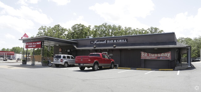
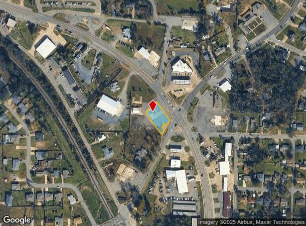
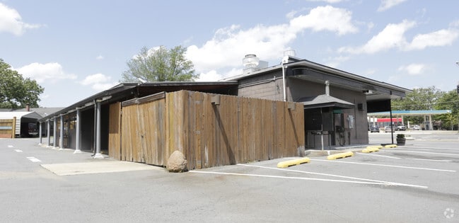
Property Detail
5501 Mac Arthur Dr
33N-080-00-018-00
PT E1/2 SW NE BEG 199 1'E OF SW COR ON W R/W OF RIFLE RANGE RD TH NE ALONG SAID RD 100' TO A PT ON W'RLY R/W OF NEW LR-CONWAY HWY 65-60' FROM CENTER LINE TH NW'RLY ALONG HWY 150' TH SW'RLY 94.5'TO PT 131' N & 95.1'E OF SW COR SE'RLY 166' TO BEG. 16 2
Commercialnec
Pulaski
X
Arkansas
05119C0341G
0.89 AC
2025
North Little Rock
2025
Little Rock/N Little Rock
003207
Little Rock-North Little Rock-Conway, AR
2,044 SF
NEARBY LISTINGS FOR SALE OR LEASE
DEMOGRAPHICS near 5501 Mac Arthur Dr
1 mile
3 mile
5 mile
2024 Total Population
5,968
40,449
106,142
2029 Population
5,959
40,499
106,443
Pop Growth 2024-2029
(0.15%)
+ 0.12%
+ 0.28%
Average Age
37
39
40
2024 Total Households
2,526
18,241
49,730
HH Growth 2024-2029
(0.20%)
+ 0.03%
+ 0.33%
Median Household Inc
$40,581
$46,048
$55,231
Avg Household Size
2.30
2.10
2.00
2024 Avg HH Vehicles
2.00
2.00
2.00
Median Home Value
$78,978
$146,271
$184,838
Median Year Built
1967
1970
1970
Nearby Places
Map Layers
Map Styles
 Street
 Aerial
Transit
 Traffic
 Biking
Places
Listings with unknown addresses are not visible on the map
- Restaurants
- Banks
- Shops
- Fitness
- Groceries
PUBLIC TRANSPORTATION
COMMUTER RAIL
Drive
Walk
Distance
9 min
5.3 mi
AIRPORT
Bill and Hillary Clinton Ntl/Adams Field
Drive
Walk
Distance
Bill and Hillary Clinton Ntl/Adams Field
16 min
9.8 mi
SALE & LEASE HISTORY
LISTING DATE
SALE/LEASE

Sep 23, 2016
For Sale
Dec 12, 2016
For Sale
Nearby Properties
Address
Land Use
TOTAL SIZE
Lot Size
Zoning
Address
Land Use
TOTAL SIZE
Lot Size
Zoning
305,882 SF
7.82 AC
Address
Land Use
TOTAL SIZE
Lot Size
Zoning
7,859 SF
175.11 AC
Address
Land Use
TOTAL SIZE
Lot Size
Zoning
65.57 AC
Address
Land Use
TOTAL SIZE
Lot Size
Zoning
195,404 SF
25.19 AC
Address
Land Use
TOTAL SIZE
Lot Size
Zoning
199,466 SF
38.24 AC
Address
Land Use
TOTAL SIZE
Lot Size
Zoning
35,964 SF
10.59 AC
Address
Land Use
TOTAL SIZE
Lot Size
Zoning
456,896 SF
18.54 AC
Address
Land Use
TOTAL SIZE
Lot Size
Zoning
40,758 SF
6.43 AC
Address
Land Use
TOTAL SIZE
Lot Size
Zoning
94,824 SF
19.51 AC
Address
Land Use
TOTAL SIZE
Lot Size
Zoning
153,981 SF
10.95 AC
Address
Land Use
TOTAL SIZE
Lot Size
Zoning
303,355 SF
17.47 AC
Address
Land Use
TOTAL SIZE
Lot Size
Zoning
105,316 SF
5.53 AC
Address
Land Use
TOTAL SIZE
Lot Size
Zoning
34,159 SF
12.34 AC
Address
Land Use
TOTAL SIZE
Lot Size
Zoning
51,361 SF
6.14 AC
Address
Land Use
TOTAL SIZE
Lot Size
Zoning
108,922 SF
13.70 AC
Address
Land Use
TOTAL SIZE
Lot Size
Zoning
174,878 SF
7.55 AC
Address
Land Use
TOTAL SIZE
Lot Size
Zoning
228,599 SF
7.14 AC
Address
Land Use
TOTAL SIZE
Lot Size
Zoning
135,844 SF
3.11 AC
Address
Land Use
TOTAL SIZE
Lot Size
Zoning
23,934.60 AC
Address
Land Use
TOTAL SIZE
Lot Size
Zoning
21,168 SF
8.30 AC
Address
Land Use
TOTAL SIZE
Lot Size
Zoning
94,248 SF
23.30 AC
Address
Land Use
TOTAL SIZE
Lot Size
Zoning
32,408 SF
9.36 AC
Address
Land Use
TOTAL SIZE
Lot Size
Zoning
167,408 SF
2.61 AC
Address
Land Use
TOTAL SIZE
Lot Size
Zoning
2,335 SF
3.39 AC
Address
Land Use
TOTAL SIZE
Lot Size
Zoning
7,340 SF
2.24 AC
Address
Land Use
TOTAL SIZE
Lot Size
Zoning
54,445 SF
157.11 AC
Address
Land Use
TOTAL SIZE
Lot Size
Zoning
16,030 SF
6.18 AC
Address
Land Use
TOTAL SIZE
Lot Size
Zoning
24,951 SF
143.50 AC
Address
Land Use
TOTAL SIZE
Lot Size
Zoning
69,609 SF
4.15 AC
Address
Land Use
TOTAL SIZE
Lot Size
Zoning
48,142 SF
10.99 AC
The World's #1 Commercial Real Estate Marketplace
Connect with us
© 2026 CoStar Group
The information above has been obtained from sources believed reliable. While we do not doubt its accuracy we have not verified it and make no guarantee, warranty or representation about it. It is your responsibility to independently confirm its accuracy and completeness. Any projections, opinions, assumptions, or estimates used are for example only and do not represent the current or future performance of the property. The value of this transaction to you depends on tax and other factors which should be evaluated by your tax, financial, and legal advisors. You and your advisors should conduct a careful, independent investigation of the property to determine to your satisfaction the suitability of the property for your needs.