Property Record
2801 N 3Rd St, Harrisburg, PA 17110
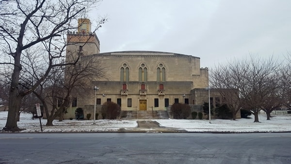


Property Detail
2801 N 3Rd St
10-041-001
Dauphin
Industrialgeneral
Pennsylvania
C and X Area of minimal flood hazard, usually depicted on FIRMs as above the 500-year flood level.
4.33 AC
2025
Harrisburg Area East
2025
Philadelphia
020900
Harrisburg-Carlisle, PA
62,621 SF
NEARBY LISTINGS FOR SALE OR LEASE
-
-
View all Harrisburg listings for sale on LoopNet.com
DEMOGRAPHICS near 2801 N 3Rd St
1 mile
3 mile
5 mile
2025 Total Population
11,854
81,814
187,233
2030 Population
12,199
84,558
192,776
Pop Growth 2025-2030
+ 2.91%
+ 3.35%
+ 2.96%
Average Age
37
39
40
2025 Total Households
4,760
35,200
78,943
HH Growth 2025-2030
+ 2.88%
+ 3.48%
+ 3.09%
Median Household Inc
$56,633
$64,674
$71,145
Avg Household Size
2.40
2.20
2.30
2025 Avg HH Vehicles
1.00
1.00
2.00
Median Home Value
$126,815
$195,391
$242,415
Median Year Built
1947
1959
1963
Nearby Places
Map Layers
Map Styles
 Street
 Aerial
Transit
 Traffic
 Biking
Places
Listings with unknown addresses are not visible on the map
- Restaurants
- Banks
- Shops
- Fitness
- Groceries
PUBLIC TRANSPORTATION
COMMUTER RAIL
Drive
Walk
Distance
8 min
3.2 mi
AIRPORT
Harrisburg International
Drive
Walk
Distance
Harrisburg International
25 min
13.3 mi
SALE & LEASE HISTORY
LISTING DATE
SALE/LEASE

Feb 06, 2017
For Sale
Nearby Properties
Address
Land Use
TOTAL SIZE
Lot Size
Zoning
Address
Land Use
TOTAL SIZE
Lot Size
Zoning
474,282 SF
4.71 AC
Address
Land Use
TOTAL SIZE
Lot Size
Zoning
22.15 AC
Address
Land Use
TOTAL SIZE
Lot Size
Zoning
615,797 SF
59.70 AC
Address
Land Use
TOTAL SIZE
Lot Size
Zoning
72.78 AC
Address
Land Use
TOTAL SIZE
Lot Size
Zoning
3,025 SF
274.13 AC
Address
Land Use
TOTAL SIZE
Lot Size
Zoning
725,856 SF
2.15 AC
Address
Land Use
TOTAL SIZE
Lot Size
Zoning
372,234 SF
1.01 AC
Address
Land Use
TOTAL SIZE
Lot Size
Zoning
482,564 SF
5 AC
Address
Land Use
TOTAL SIZE
Lot Size
Zoning
35.15 AC
Address
Land Use
TOTAL SIZE
Lot Size
Zoning
577,075 SF
39.55 AC
Address
Land Use
TOTAL SIZE
Lot Size
Zoning
0.67 AC
Address
Land Use
TOTAL SIZE
Lot Size
Zoning
1,155,340 SF
3.94 AC
Address
Land Use
TOTAL SIZE
Lot Size
Zoning
638,721 SF
47.78 AC
Address
Land Use
TOTAL SIZE
Lot Size
Zoning
349,587 SF
0.53 AC
Address
Land Use
TOTAL SIZE
Lot Size
Zoning
307,080 SF
25 AC
Address
Land Use
TOTAL SIZE
Lot Size
Zoning
329,377 SF
1.66 AC
Address
Land Use
TOTAL SIZE
Lot Size
Zoning
30.87 AC
Address
Land Use
TOTAL SIZE
Lot Size
Zoning
725 SF
19.33 AC
Address
Land Use
TOTAL SIZE
Lot Size
Zoning
352,350 SF
2.90 AC
Address
Land Use
TOTAL SIZE
Lot Size
Zoning
125,255 SF
26.65 AC
Address
Land Use
TOTAL SIZE
Lot Size
Zoning
79.43 AC
Address
Land Use
TOTAL SIZE
Lot Size
Zoning
215,800 SF
16 AC
Address
Land Use
TOTAL SIZE
Lot Size
Zoning
192,390 SF
43.19 AC
Address
Land Use
TOTAL SIZE
Lot Size
Zoning
358,680 SF
3.79 AC
Address
Land Use
TOTAL SIZE
Lot Size
Zoning
186,900 SF
Address
Land Use
TOTAL SIZE
Lot Size
Zoning
167,935 SF
0.57 AC
Address
Land Use
TOTAL SIZE
Lot Size
Zoning
218,468 SF
0.76 AC
Address
Land Use
TOTAL SIZE
Lot Size
Zoning
13.57 AC
Address
Land Use
TOTAL SIZE
Lot Size
Zoning
Address
Land Use
TOTAL SIZE
Lot Size
Zoning
13.05 AC
The World's #1 Commercial Real Estate Marketplace
Connect with us
© 2026 CoStar Group
The information above has been obtained from sources believed reliable. While we do not doubt its accuracy we have not verified it and make no guarantee, warranty or representation about it. It is your responsibility to independently confirm its accuracy and completeness. Any projections, opinions, assumptions, or estimates used are for example only and do not represent the current or future performance of the property. The value of this transaction to you depends on tax and other factors which should be evaluated by your tax, financial, and legal advisors. You and your advisors should conduct a careful, independent investigation of the property to determine to your satisfaction the suitability of the property for your needs.