Property Record
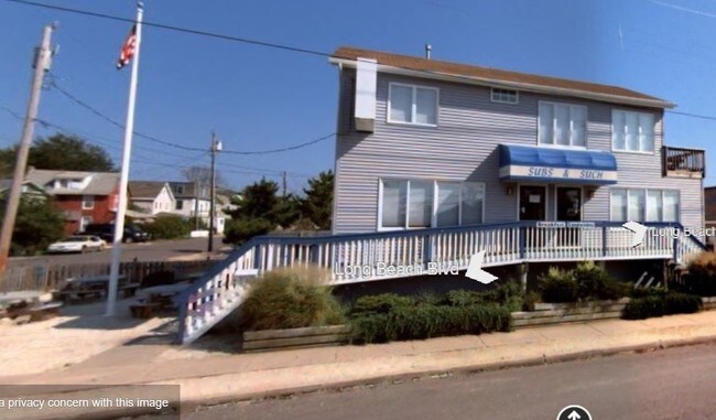
1211 Long Beach Blvd, Ship Bottom, NJ 08008

Property Detail
1211 Long Beach Blvd
18-00004-02-00002-01
80X97
Commercialnec
OCEAN
C
New Jersey
AE The base floodplain where base flood elevations are provided. AE Zones are now used on new format FIRMs instead of A1-A30 Zones.
2.1
2025
0.18 AC
2025
Ocean County
738001
Northern New Jersey
1,950 SF
Lakewood-New Brunswick, NJ
NEARBY LISTINGS FOR SALE OR LEASE
DEMOGRAPHICS near 1211 Long Beach Blvd
1 mile
3 mile
5 mile
2024 Total Population
4,332
11,749
15,368
2029 Population
5,135
13,950
18,214
Pop Growth 2024-2029
+ 18.54%
+ 18.73%
+ 18.52%
Average Age
52
53
53
2024 Total Households
2,052
5,607
7,328
HH Growth 2024-2029
+ 18.32%
+ 18.57%
+ 18.41%
Median Household Inc
$96,509
$103,944
$111,361
Avg Household Size
2.10
2.00
2.10
2024 Avg HH Vehicles
2.00
2.00
2.00
Median Home Value
$1,028,503
$980,088
$981,351
Median Year Built
1974
1978
1979
Nearby Places
Map Layers
Map Styles
 Street
 Aerial
Transit
 Traffic
 Biking
Places
Listings with unknown addresses are not visible on the map
- Restaurants
- Banks
- Shops
- Fitness
- Groceries
PUBLIC TRANSPORTATION
AIRPORT
Atlantic City International
Drive
Walk
Distance
Atlantic City International
80 min
43.2 mi
SALE & LEASE HISTORY
LISTING DATE
SALE/LEASE

Feb 17, 2017
For Sale
Nearby Properties
Address
Land Use
TOTAL SIZE
Lot Size
Zoning
Address
Land Use
TOTAL SIZE
Lot Size
Zoning
Address
Land Use
TOTAL SIZE
Lot Size
Zoning
1.76 AC
R-C
Address
Land Use
TOTAL SIZE
Lot Size
Zoning
1.96 AC
R-C
Address
Land Use
TOTAL SIZE
Lot Size
Zoning
0.10 AC
B-D
Address
Land Use
TOTAL SIZE
Lot Size
Zoning
0.95 AC
R-50
Address
Land Use
TOTAL SIZE
Lot Size
Zoning
2,369 SF
2.07 AC
R-A
Address
Land Use
TOTAL SIZE
Lot Size
Zoning
1.06 AC
R-50
Address
Land Use
TOTAL SIZE
Lot Size
Zoning
0.82 AC
R-C
Address
Land Use
TOTAL SIZE
Lot Size
Zoning
2.26 AC
P-U
Address
Land Use
TOTAL SIZE
Lot Size
Zoning
1.39 AC
RSA
Address
Land Use
TOTAL SIZE
Lot Size
Zoning
1.94 AC
B-D
Address
Land Use
TOTAL SIZE
Lot Size
Zoning
1.75 AC
R-B
Address
Land Use
TOTAL SIZE
Lot Size
Zoning
4.86 AC
P-U
Address
Land Use
TOTAL SIZE
Lot Size
Zoning
2.29 AC
P-U
Address
Land Use
TOTAL SIZE
Lot Size
Zoning
1.86 AC
B-D
Address
Land Use
TOTAL SIZE
Lot Size
Zoning
1.70 AC
B-D
Address
Land Use
TOTAL SIZE
Lot Size
Zoning
1.30 AC
R-B
Address
Land Use
TOTAL SIZE
Lot Size
Zoning
Address
Land Use
TOTAL SIZE
Lot Size
Zoning
1.82 AC
M-C
Address
Land Use
TOTAL SIZE
Lot Size
Zoning
6.86 AC
M-C
Address
Land Use
TOTAL SIZE
Lot Size
Zoning
9,329 SF
0.28 AC
R-50
Address
Land Use
TOTAL SIZE
Lot Size
Zoning
960 SF
3 AC
M-C
Address
Land Use
TOTAL SIZE
Lot Size
Zoning
4,376 SF
1.04 AC
RNA
Address
Land Use
TOTAL SIZE
Lot Size
Zoning
8,797 SF
0.82 AC
C
Address
Land Use
TOTAL SIZE
Lot Size
Zoning
0.76 AC
M-C
Address
Land Use
TOTAL SIZE
Lot Size
Zoning
1.52 AC
RSA
Address
Land Use
TOTAL SIZE
Lot Size
Zoning
0.65 AC
B-D
Address
Land Use
TOTAL SIZE
Lot Size
Zoning
Address
Land Use
TOTAL SIZE
Lot Size
Zoning
1,728 SF
4.36 AC
C
Address
Land Use
TOTAL SIZE
Lot Size
Zoning
1,499 SF
1.84 AC
P-U
The World's #1 Commercial Real Estate Marketplace
Connect with us
© 2026 CoStar Group
The information above has been obtained from sources believed reliable. While we do not doubt its accuracy we have not verified it and make no guarantee, warranty or representation about it. It is your responsibility to independently confirm its accuracy and completeness. Any projections, opinions, assumptions, or estimates used are for example only and do not represent the current or future performance of the property. The value of this transaction to you depends on tax and other factors which should be evaluated by your tax, financial, and legal advisors. You and your advisors should conduct a careful, independent investigation of the property to determine to your satisfaction the suitability of the property for your needs.