Property Record
201 S Main St, New Carlisle, OH 45344
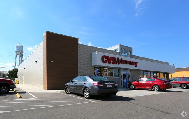


Property Detail
201 S Main St
Springfield, OH
OLD PLAT PTS EACH 7-13, 18 & 79-81
03-00500-02810-3012
Clark
Storebuilding
Ohio
B and X Area of moderate flood hazard, usually the area between the limits of the 100-year and 500-year floods.
12
2024
1.40 AC
2025
Northeast Dayton
002702
Cincinnati/Dayton
9,140 SF
NEARBY LISTINGS FOR SALE OR LEASE
DEMOGRAPHICS near 201 S Main St
1 mile
3 mile
5 mile
2025 Total Population
4,490
9,494
21,310
2030 Population
4,478
9,476
21,261
Pop Growth 2025-2030
(0.27%)
(0.19%)
(0.23%)
Average Age
40
42
42
2025 Total Households
1,818
3,759
8,434
HH Growth 2025-2030
(0.33%)
(0.21%)
(0.26%)
Median Household Inc
$60,600
$68,596
$72,100
Avg Household Size
2.40
2.50
2.50
2025 Avg HH Vehicles
2.00
2.00
2.00
Median Home Value
$138,158
$175,901
$183,011
Median Year Built
1962
1965
1965
Nearby Places
Map Layers
Map Styles
 Street
 Aerial
Transit
 Traffic
 Biking
Places
Listings with unknown addresses are not visible on the map
- Restaurants
- Banks
- Shops
- Fitness
- Groceries
PUBLIC TRANSPORTATION
AIRPORT
James M Cox Dayton International
Drive
Walk
Distance
James M Cox Dayton International
25 min
17.3 mi
Freight Ports
Port of Toledo
Drive
Walk
Distance
Port of Toledo
174 min
147.9 mi
SALE & LEASE HISTORY
LISTING DATE
SALE/LEASE

Sep 24, 2016
For Sale
Mar 30, 2017
For Sale
Dec 13, 2016
For Sale
Nearby Properties
Address
Land Use
TOTAL SIZE
Lot Size
Zoning
Address
Land Use
TOTAL SIZE
Lot Size
Zoning
2,736 SF
29.87 AC
A-1
Address
Land Use
TOTAL SIZE
Lot Size
Zoning
Address
Land Use
TOTAL SIZE
Lot Size
Zoning
25.14 AC
A-1
Address
Land Use
TOTAL SIZE
Lot Size
Zoning
Address
Land Use
TOTAL SIZE
Lot Size
Zoning
515.72 AC
A-1
Address
Land Use
TOTAL SIZE
Lot Size
Zoning
12,928 SF
4.22 AC
Address
Land Use
TOTAL SIZE
Lot Size
Zoning
5,198 SF
163.30 AC
A-1
Address
Land Use
TOTAL SIZE
Lot Size
Zoning
2,016 SF
91.09 AC
A-1
Address
Land Use
TOTAL SIZE
Lot Size
Zoning
45,780 SF
19.81 AC
Address
Land Use
TOTAL SIZE
Lot Size
Zoning
1,120 SF
181.24 AC
Address
Land Use
TOTAL SIZE
Lot Size
Zoning
3,882 SF
119.51 AC
Address
Land Use
TOTAL SIZE
Lot Size
Zoning
3,904 SF
57.22 AC
A1
Address
Land Use
TOTAL SIZE
Lot Size
Zoning
56,752 SF
32.24 AC
A-1
Address
Land Use
TOTAL SIZE
Lot Size
Zoning
12,262 SF
97.58 AC
A-1
Address
Land Use
TOTAL SIZE
Lot Size
Zoning
48,157 SF
5.93 AC
Address
Land Use
TOTAL SIZE
Lot Size
Zoning
3,960 SF
149.58 AC
A-1
Address
Land Use
TOTAL SIZE
Lot Size
Zoning
31,221 SF
4.25 AC
Address
Land Use
TOTAL SIZE
Lot Size
Zoning
6,448 SF
2 AC
Address
Land Use
TOTAL SIZE
Lot Size
Zoning
144.75 AC
Address
Land Use
TOTAL SIZE
Lot Size
Zoning
4,042 SF
1.36 AC
Address
Land Use
TOTAL SIZE
Lot Size
Zoning
24,140 SF
4.62 AC
Address
Land Use
TOTAL SIZE
Lot Size
Zoning
11,676 SF
5.09 AC
Address
Land Use
TOTAL SIZE
Lot Size
Zoning
1.59 AC
Address
Land Use
TOTAL SIZE
Lot Size
Zoning
Address
Land Use
TOTAL SIZE
Lot Size
Zoning
2,902 SF
114.17 AC
A-1
Address
Land Use
TOTAL SIZE
Lot Size
Zoning
7,316 SF
35.17 AC
A-1
Address
Land Use
TOTAL SIZE
Lot Size
Zoning
5,943 SF
2 AC
Address
Land Use
TOTAL SIZE
Lot Size
Zoning
10,533 SF
83.09 AC
B-3
Address
Land Use
TOTAL SIZE
Lot Size
Zoning
Address
Land Use
TOTAL SIZE
Lot Size
Zoning
1,982 SF
112.70 AC
A-1
The World's #1 Commercial Real Estate Marketplace
Connect with us
© 2026 CoStar Group
The information above has been obtained from sources believed reliable. While we do not doubt its accuracy we have not verified it and make no guarantee, warranty or representation about it. It is your responsibility to independently confirm its accuracy and completeness. Any projections, opinions, assumptions, or estimates used are for example only and do not represent the current or future performance of the property. The value of this transaction to you depends on tax and other factors which should be evaluated by your tax, financial, and legal advisors. You and your advisors should conduct a careful, independent investigation of the property to determine to your satisfaction the suitability of the property for your needs.