Property Record
1301 Marietta Hwy, Canton, GA 30114


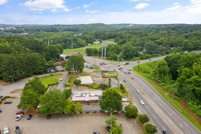
Property Detail
1301 Marietta Hwy
091N27-00000-013-000-0000
LL 160 14TH D TR 1
Storebuilding
CHEROKEE
GC
Georgia
B and X Area of moderate flood hazard, usually the area between the limits of the 100-year and 500-year floods.
0.69 AC
2025
Cherokee/Woodstock
2025
Atlanta
090605
Atlanta-Sandy Springs-Roswell, GA
4,570 SF
NEARBY LISTINGS FOR SALE OR LEASE
DEMOGRAPHICS near 1301 Marietta Hwy
1 mile
3 mile
5 mile
2025 Total Population
4,923
40,216
85,231
2030 Population
5,274
43,386
92,344
Pop Growth 2025-2030
+ 7.13%
+ 7.88%
+ 8.35%
Average Age
35
38
39
2025 Total Households
1,460
14,240
30,043
HH Growth 2025-2030
+ 7.19%
+ 8.08%
+ 8.48%
Median Household Inc
$81,105
$90,197
$104,351
Avg Household Size
3.20
2.70
2.80
2025 Avg HH Vehicles
2.00
2.00
2.00
Median Home Value
$331,318
$425,904
$453,321
Median Year Built
1994
2002
2003
Nearby Places
Map Layers
Map Styles
 Street
 Aerial
Transit
 Traffic
 Biking
Places
Listings with unknown addresses are not visible on the map
- Restaurants
- Banks
- Shops
- Fitness
- Groceries
SALE & LEASE HISTORY
LISTING DATE
SALE/LEASE

Sep 20, 2018
For Sale
May 16, 2017
For Sale
Jun 02, 2017
For Sale
Jul 06, 2020
For Sale
Jul 05, 2017
For Sale
Jul 02, 2019
For Sale
Aug 07, 2018
For Sale
Apr 28, 2017
For Sale
Nearby Properties
Address
Land Use
TOTAL SIZE
Lot Size
Zoning
Address
Land Use
TOTAL SIZE
Lot Size
Zoning
242,502 SF
41.65 AC
PD
Address
Land Use
TOTAL SIZE
Lot Size
Zoning
244,451 SF
20.55 AC
PSC
Address
Land Use
TOTAL SIZE
Lot Size
Zoning
255,483 SF
138.30 AC
LI
Address
Land Use
TOTAL SIZE
Lot Size
Zoning
443,973 SF
70.02 AC
GC
Address
Land Use
TOTAL SIZE
Lot Size
Zoning
353,395 SF
29.15 AC
GC
Address
Land Use
TOTAL SIZE
Lot Size
Zoning
162,243 SF
29.44 AC
R-5
Address
Land Use
TOTAL SIZE
Lot Size
Zoning
369,520 SF
4.50 AC
ERC
Address
Land Use
TOTAL SIZE
Lot Size
Zoning
79,162 SF
8.54 AC
RM16
Address
Land Use
TOTAL SIZE
Lot Size
Zoning
103,620 SF
19.78 AC
R-5
Address
Land Use
TOTAL SIZE
Lot Size
Zoning
313,906 SF
28.96 AC
PD
Address
Land Use
TOTAL SIZE
Lot Size
Zoning
302,757 SF
62.80 AC
PUD
Address
Land Use
TOTAL SIZE
Lot Size
Zoning
155,341 SF
14.54 AC
R-5
Address
Land Use
TOTAL SIZE
Lot Size
Zoning
133,711 SF
22.23 AC
R-3
Address
Land Use
TOTAL SIZE
Lot Size
Zoning
239,139 SF
88 AC
PD-MU
Address
Land Use
TOTAL SIZE
Lot Size
Zoning
238,343 SF
38.77 AC
PSC
Address
Land Use
TOTAL SIZE
Lot Size
Zoning
204,826 SF
4.91 AC
PD
Address
Land Use
TOTAL SIZE
Lot Size
Zoning
241,482 SF
31.65 AC
PD
Address
Land Use
TOTAL SIZE
Lot Size
Zoning
270,248 SF
29.05 AC
PD-MU
Address
Land Use
TOTAL SIZE
Lot Size
Zoning
279,274 SF
23.46 AC
R-5
Address
Land Use
TOTAL SIZE
Lot Size
Zoning
489,988 SF
20.20 AC
LI
Address
Land Use
TOTAL SIZE
Lot Size
Zoning
43,897 SF
8.45 AC
PUD
Address
Land Use
TOTAL SIZE
Lot Size
Zoning
24,586 SF
PD
Address
Land Use
TOTAL SIZE
Lot Size
Zoning
62,308 SF
7.57 AC
ERC
Address
Land Use
TOTAL SIZE
Lot Size
Zoning
79,672 SF
4.28 AC
PSC
Address
Land Use
TOTAL SIZE
Lot Size
Zoning
31,428 SF
10.21 AC
R-3
Address
Land Use
TOTAL SIZE
Lot Size
Zoning
149,713 SF
36.97 AC
R-80
Address
Land Use
TOTAL SIZE
Lot Size
Zoning
138,048 SF
21.40 AC
R-40
Address
Land Use
TOTAL SIZE
Lot Size
Zoning
182,067 SF
23.83 AC
GC
Address
Land Use
TOTAL SIZE
Lot Size
Zoning
111,630 SF
38.45 AC
LI
Address
Land Use
TOTAL SIZE
Lot Size
Zoning
159,645 SF
14.05 AC
RM-15
The World's #1 Commercial Real Estate Marketplace
Connect with us
© 2026 CoStar Group
The information above has been obtained from sources believed reliable. While we do not doubt its accuracy we have not verified it and make no guarantee, warranty or representation about it. It is your responsibility to independently confirm its accuracy and completeness. Any projections, opinions, assumptions, or estimates used are for example only and do not represent the current or future performance of the property. The value of this transaction to you depends on tax and other factors which should be evaluated by your tax, financial, and legal advisors. You and your advisors should conduct a careful, independent investigation of the property to determine to your satisfaction the suitability of the property for your needs.