Property Record
115 W City Ave, Bala Cynwyd, PA 19004


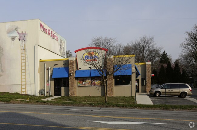
Property Detail
115 W City Ave
40-00-11036-003
ASSESSOR BLOCK-UNIT NUMBER 1G-261
Restaurantbuilding
MONTGOMERY
C1
Pennsylvania
B and X Area of moderate flood hazard, usually the area between the limits of the 100-year and 500-year floods.
36
2024
0.51 AC
2025
Bala Cynwyd/Narberth
204300
Philadelphia
3,000 SF
Philadelphia-Camden-Wilmington, PA-NJ-DE-MD
NEARBY LISTINGS FOR SALE OR LEASE
DEMOGRAPHICS near 115 W City Ave
1 mile
3 mile
5 mile
2024 Total Population
26,615
236,291
817,427
2029 Population
27,139
238,038
824,724
Pop Growth 2024-2029
+ 1.97%
+ 0.74%
+ 0.89%
Average Age
40
39
38
2024 Total Households
9,797
98,391
340,729
HH Growth 2024-2029
+ 1.36%
+ 0.47%
+ 0.69%
Median Household Inc
$75,726
$62,742
$62,556
Avg Household Size
2.30
2.30
2.20
2024 Avg HH Vehicles
1.00
1.00
1.00
Median Home Value
$367,711
$268,973
$279,105
Median Year Built
1949
1948
1949
Nearby Places
Map Layers
Map Styles
 Street
 Aerial
Transit
 Traffic
 Biking
Places
Listings with unknown addresses are not visible on the map
- Restaurants
- Banks
- Shops
- Fitness
- Groceries
PUBLIC TRANSPORTATION
TRANSIT/SUBWAY
Bala (R6 - Southeastern Pennsylvania Transportation Authority Regional Rail (SEPTA Regional Rail))
Drive
Walk
Distance
Bala (R6 - Southeastern Pennsylvania Transportation Authority Regional Rail (SEPTA Regional Rail))
2 min
7 min
0.4 mi
Cynwyd (R6 - Southeastern Pennsylvania Transportation Authority Regional Rail (SEPTA Regional Rail))
Drive
Walk
Distance
Cynwyd (R6 - Southeastern Pennsylvania Transportation Authority Regional Rail (SEPTA Regional Rail))
2 min
14 min
0.7 mi
Wynnefield Avenue (R6 - Southeastern Pennsylvania Transportation Authority Regional Rail (SEPTA Regional Rail))
Drive
Walk
Distance
Wynnefield Avenue (R6 - Southeastern Pennsylvania Transportation Authority Regional Rail (SEPTA Regional Rail))
3 min
16 min
0.8 mi
COMMUTER RAIL
Bala (R6 - Southeastern Pennsylvania Transportation Authority Regional Rail (SEPTA Regional Rail))
Drive
Walk
Distance
Bala (R6 - Southeastern Pennsylvania Transportation Authority Regional Rail (SEPTA Regional Rail))
1 min
7 min
0.4 mi
Cynwyd (R6 - Southeastern Pennsylvania Transportation Authority Regional Rail (SEPTA Regional Rail))
Drive
Walk
Distance
Cynwyd (R6 - Southeastern Pennsylvania Transportation Authority Regional Rail (SEPTA Regional Rail))
2 min
14 min
0.7 mi
AIRPORT
Philadelphia International
Drive
Walk
Distance
Philadelphia International
27 min
13.9 mi
Trenton Mercer
Drive
Walk
Distance
Trenton Mercer
58 min
33.7 mi
Freight Ports
South Jersey Port
Drive
Walk
Distance
South Jersey Port
19 min
9.3 mi
SALE & LEASE HISTORY
LISTING DATE
SALE/LEASE

Oct 04, 2017
For Lease
Jul 07, 2017
For Sale
Jan 03, 2018
For Lease
Apr 04, 2018
For Sale
Nearby Properties
Address
Land Use
TOTAL SIZE
Lot Size
Zoning
Address
Land Use
TOTAL SIZE
Lot Size
Zoning
391,885 SF
7.15 AC
RM4
Address
Land Use
TOTAL SIZE
Lot Size
Zoning
2,178,860 SF
48.65 AC
R3
Address
Land Use
TOTAL SIZE
Lot Size
Zoning
1,455,130 SF
6.80 AC
RSD3
Address
Land Use
TOTAL SIZE
Lot Size
Zoning
451,857 SF
3.57 AC
CMX2
Address
Land Use
TOTAL SIZE
Lot Size
Zoning
162,000 SF
8.16 AC
SPPOA
Address
Land Use
TOTAL SIZE
Lot Size
Zoning
1,600 SF
177.07 AC
SPPOA
Address
Land Use
TOTAL SIZE
Lot Size
Zoning
253,400 SF
10.90 AC
RM2
Address
Land Use
TOTAL SIZE
Lot Size
Zoning
368,612 SF
20.06 AC
CMX2
Address
Land Use
TOTAL SIZE
Lot Size
Zoning
511,806 SF
1.70 AC
RM4
Address
Land Use
TOTAL SIZE
Lot Size
Zoning
418,017 SF
19.10 AC
CO
Address
Land Use
TOTAL SIZE
Lot Size
Zoning
374,105 SF
5.63 AC
CMX3
Address
Land Use
TOTAL SIZE
Lot Size
Zoning
495,017 SF
9.65 AC
CMX3
Address
Land Use
TOTAL SIZE
Lot Size
Zoning
343,158 SF
12 AC
CMX4
Address
Land Use
TOTAL SIZE
Lot Size
Zoning
194,304 SF
9.33 AC
RM2
Address
Land Use
TOTAL SIZE
Lot Size
Zoning
1,935,584 SF
11.11 AC
ICMX
Address
Land Use
TOTAL SIZE
Lot Size
Zoning
409,386 SF
33.36 AC
R2
Address
Land Use
TOTAL SIZE
Lot Size
Zoning
479,520 SF
21.26 AC
R1
Address
Land Use
TOTAL SIZE
Lot Size
Zoning
210,738 SF
8.73 AC
RM4
Address
Land Use
TOTAL SIZE
Lot Size
Zoning
281,508 SF
18.93 AC
SPINS
Address
Land Use
TOTAL SIZE
Lot Size
Zoning
180,750 SF
1.60 AC
CMX3
Address
Land Use
TOTAL SIZE
Lot Size
Zoning
299,678 SF
14.06 AC
R4
Address
Land Use
TOTAL SIZE
Lot Size
Zoning
178,738 SF
6.11 AC
CMX3
Address
Land Use
TOTAL SIZE
Lot Size
Zoning
530,525 SF
36.29 AC
R3
Address
Land Use
TOTAL SIZE
Lot Size
Zoning
293,734 SF
4.42 AC
ICMX
Address
Land Use
TOTAL SIZE
Lot Size
Zoning
258,000 SF
1.90 AC
CMX2
Address
Land Use
TOTAL SIZE
Lot Size
Zoning
305,100 SF
5.28 AC
RM4
Address
Land Use
TOTAL SIZE
Lot Size
Zoning
394,649 SF
27.93 AC
C0
Address
Land Use
TOTAL SIZE
Lot Size
Zoning
197,925 SF
1.96 AC
RM4
Address
Land Use
TOTAL SIZE
Lot Size
Zoning
475,984 SF
5.74 AC
ICMX
Address
Land Use
TOTAL SIZE
Lot Size
Zoning
1.65 AC
CMX3
The World's #1 Commercial Real Estate Marketplace
Connect with us
© 2026 CoStar Group
The information above has been obtained from sources believed reliable. While we do not doubt its accuracy we have not verified it and make no guarantee, warranty or representation about it. It is your responsibility to independently confirm its accuracy and completeness. Any projections, opinions, assumptions, or estimates used are for example only and do not represent the current or future performance of the property. The value of this transaction to you depends on tax and other factors which should be evaluated by your tax, financial, and legal advisors. You and your advisors should conduct a careful, independent investigation of the property to determine to your satisfaction the suitability of the property for your needs.