Your email has been sent.

400 W US Hwy 82 1.63 Acres of Commercial Land Offered at $1,500,000 in Sherman, TX 75092

Investment Highlights
- Easy access to U.S. Hwy 82.
- Positioned between two major residential subdivisions under construction.
- Frontage along W. Canyon Grove Rd with bidirectional traffic flow.
- Located within a federally designated Opportunity Zone.
- Approximately 0.5 miles from the intersection of Hwy 82 and U.S. Hwy 75.
- High-visibility corridor ideal for future commercial or mixed-use development.
Executive Summary
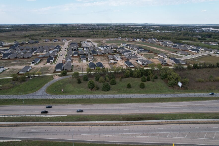
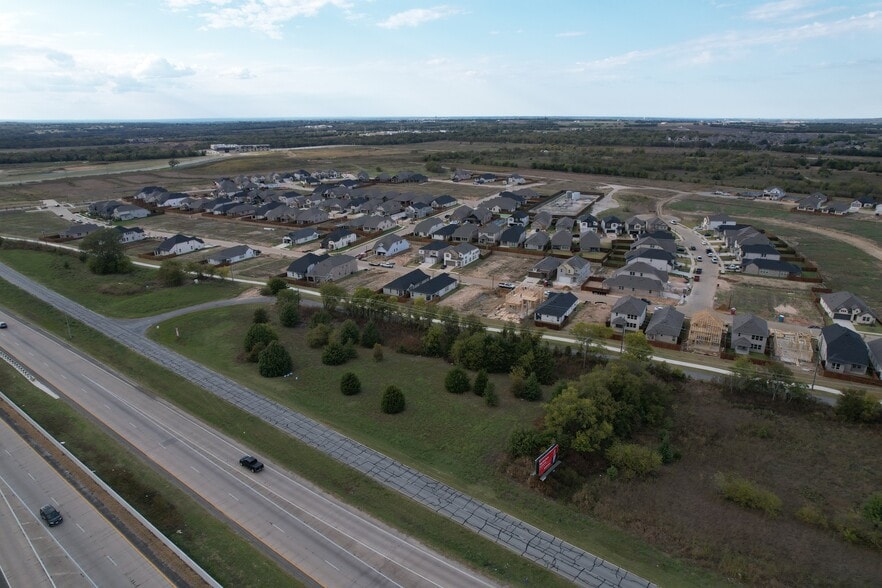
This 1.63-acre parcel along westbound Hwy 82 is only 0.5 miles from the Hwy 82 and U.S. Hwy 75 intersection. The site fronts W. Canyon Grove Rd and is positioned between two major residential subdivisions currently under construction, creating strong future demand for commercial or mixed-use development.
Property Facts
| Price | $1,500,000 | Property Subtype | Commercial |
| Sale Type | Investment | Proposed Use | |
| No. Lots | 1 | Total Lot Size | 1.63 AC |
| Property Type | Land | Opportunity Zone |
Yes
|
| Zoning | D1 - Commercial AG | ||
| Price | $1,500,000 |
| Sale Type | Investment |
| No. Lots | 1 |
| Property Type | Land |
| Property Subtype | Commercial |
| Proposed Use | |
| Total Lot Size | 1.63 AC |
| Opportunity Zone |
Yes |
| Zoning | D1 - Commercial AG |
1 Lot Available
Lot
| Price | $1,500,000 | Lot Size | 1.63 AC |
| Price Per AC | $920,243.14 |
| Price | $1,500,000 |
| Price Per AC | $920,243.14 |
| Lot Size | 1.63 AC |
1.63 acres (71,003 sq. ft.) in Sherman, TX, along westbound Hwy 82, just 0.5 miles west of Hwy 82 & U.S. Hwy 75. Fronts W. Canyon Grove Rd and sits between two major subdivisions under construction. This location lies in an Opportunity Zone.
Description
1.63-acre site located on westbound Hwy 82, approximately 0.5 miles west of its intersection with U.S. Hwy 75 in Sherman, Texas. The property fronts W. Canyon Grove Rd, a two-way roadway forming the northern boundary, and lies between two major subdivisions under development. Situated in an Opportunity Zone, the site offers tax advantages and excellent visibility for future development.


Property Taxes
| Parcel Number | 121088 | Improvements Assessment | $0 |
| Land Assessment | $2,612 | Total Assessment | $2,612 |
Property Taxes

Presented by
400 W US Hwy 82
Hmm, there seems to have been an error sending your message. Please try again.
Thanks! Your message was sent.