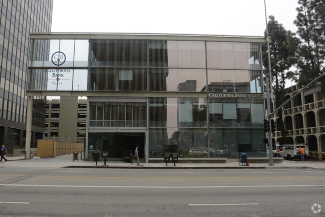
Property Record
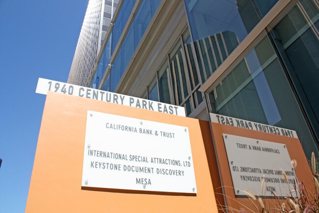
1940 Century Park E, Los Angeles, CA 90067


Property Detail
1940 Century Park E
4319-001-905
TR=26196 LAND DESC IN DOC 1279522, 112119 POR OF LOT 4
Officebuilding
LOS ANGELES
LAC2
California
B and X Area of moderate flood hazard, usually the area between the limits of the 100-year and 500-year floods.
4
0
0.69 AC
2025
Century City
267901
Los Angeles
50,889 SF
Los Angeles-Long Beach-Glendale, CA
NEARBY LISTINGS FOR SALE OR LEASE
DEMOGRAPHICS near 1940 Century Park E
1 mile
3 mile
5 mile
2025 Total Population
26,445
302,119
695,819
2030 Population
26,506
304,363
698,425
Pop Growth 2025-2030
+ 0.23%
+ 0.74%
+ 0.37%
Average Age
46
40
41
2025 Total Households
12,776
133,253
311,378
HH Growth 2025-2030
+ 0.02%
+ 0.68%
+ 0.20%
Median Household Inc
$138,736
$111,423
$107,677
Avg Household Size
2.00
2.00
2.10
2025 Avg HH Vehicles
1.00
1.00
1.00
Median Home Value
$1,127,985
$1,106,880
$1,105,845
Median Year Built
1967
1970
1965
Nearby Places
Map Layers
Map Styles
 Street
 Aerial
Transit
 Traffic
 Biking
Places
Listings with unknown addresses are not visible on the map
- Restaurants
- Banks
- Shops
- Fitness
- Groceries
PUBLIC TRANSPORTATION
AIRPORT
Los Angeles International
Drive
Walk
Distance
Los Angeles International
20 min
11.4 mi
Bob Hope
Drive
Walk
Distance
Bob Hope
28 min
14.5 mi
Long Beach (Daugherty Field)
Drive
Walk
Distance
Long Beach (Daugherty Field)
39 min
28.9 mi
Freight Ports
Port of Los Angeles
Drive
Walk
Distance
Port of Los Angeles
46 min
32.0 mi
Nearby Properties
Address
Land Use
TOTAL SIZE
Lot Size
Zoning
Address
Land Use
TOTAL SIZE
Lot Size
Zoning
1,436,724 SF
21.11 AC
LAC2
Address
Land Use
TOTAL SIZE
Lot Size
Zoning
2,529,036 SF
8.48 AC
LAC2
Address
Land Use
TOTAL SIZE
Lot Size
Zoning
1,447,077 SF
10.63 AC
LAC2
Address
Land Use
TOTAL SIZE
Lot Size
Zoning
436,774 SF
1.49 AC
LAC2
Address
Land Use
TOTAL SIZE
Lot Size
Zoning
597,158 SF
2.15 AC
LAC2
Address
Land Use
TOTAL SIZE
Lot Size
Zoning
1,353,044 SF
6.18 AC
LAC2
Address
Land Use
TOTAL SIZE
Lot Size
Zoning
227,227 SF
7.62 AC
BHC3*
Address
Land Use
TOTAL SIZE
Lot Size
Zoning
5.57 AC
LAC2
Address
Land Use
TOTAL SIZE
Lot Size
Zoning
33,373 SF
52.98 AC
LACCS
Address
Land Use
TOTAL SIZE
Lot Size
Zoning
1,029,337 SF
3.34 AC
LAC4
Address
Land Use
TOTAL SIZE
Lot Size
Zoning
618,301 SF
1.99 AC
LAC4
Address
Land Use
TOTAL SIZE
Lot Size
Zoning
346,856 SF
3.67 AC
CCC3*
Address
Land Use
TOTAL SIZE
Lot Size
Zoning
840,124 SF
2.77 AC
LAC2
Address
Land Use
TOTAL SIZE
Lot Size
Zoning
636,436 SF
6.62 AC
LAC2
Address
Land Use
TOTAL SIZE
Lot Size
Zoning
500,629 SF
1.60 AC
LAC4
Address
Land Use
TOTAL SIZE
Lot Size
Zoning
597,713 SF
11.18 AC
CCS1YY
Address
Land Use
TOTAL SIZE
Lot Size
Zoning
366,614 SF
4.25 AC
LAC4
Address
Land Use
TOTAL SIZE
Lot Size
Zoning
803,989 SF
LAC2
Address
Land Use
TOTAL SIZE
Lot Size
Zoning
1,232,625 SF
2.40 AC
LAC2
Address
Land Use
TOTAL SIZE
Lot Size
Zoning
1,226,598 SF
2.30 AC
LAC2
Address
Land Use
TOTAL SIZE
Lot Size
Zoning
32,180 SF
BHC3*
Address
Land Use
TOTAL SIZE
Lot Size
Zoning
824,156 SF
2.15 AC
LAC2
Address
Land Use
TOTAL SIZE
Lot Size
Zoning
767,078 SF
9.30 AC
LAC2
Address
Land Use
TOTAL SIZE
Lot Size
Zoning
871,235 SF
14.56 AC
LAC2
Address
Land Use
TOTAL SIZE
Lot Size
Zoning
476,779 SF
1.57 AC
LAC4
Address
Land Use
TOTAL SIZE
Lot Size
Zoning
133,959 SF
1.23 AC
BHC3*
Address
Land Use
TOTAL SIZE
Lot Size
Zoning
754,581 SF
3.75 AC
LAC1
Address
Land Use
TOTAL SIZE
Lot Size
Zoning
605,678 SF
LAC2
Address
Land Use
TOTAL SIZE
Lot Size
Zoning
808,626 SF
1.88 AC
LAC2
Address
Land Use
TOTAL SIZE
Lot Size
Zoning
35,635 SF
2.81 AC
LAC2
The World's #1 Commercial Real Estate Marketplace
Connect with us
© 2026 CoStar Group
The information above has been obtained from sources believed reliable. While we do not doubt its accuracy we have not verified it and make no guarantee, warranty or representation about it. It is your responsibility to independently confirm its accuracy and completeness. Any projections, opinions, assumptions, or estimates used are for example only and do not represent the current or future performance of the property. The value of this transaction to you depends on tax and other factors which should be evaluated by your tax, financial, and legal advisors. You and your advisors should conduct a careful, independent investigation of the property to determine to your satisfaction the suitability of the property for your needs.