Property Record
2904 228Th Ave Se, Sammamish, WA 98075


NEARBY LISTINGS FOR SALE OR LEASE
Property Detail
2904 228Th Ave Se
102406-9024
LOT 4 OF REVISED K C SHORT PLAT #674172 REC #8602251081 LESS POR DAF - BEG AT NE COR OF SD LOT 4 TH N 88-10-06 W ALG N LN THOF 85 FT TH S 01-31-46 W 15 FT TH S 88-10-06 E 85 FT TO E LN OF SD LOT 4 TH N 01-31-46 E ALG SD E LN 15 FT TO POB - SD SHORT P
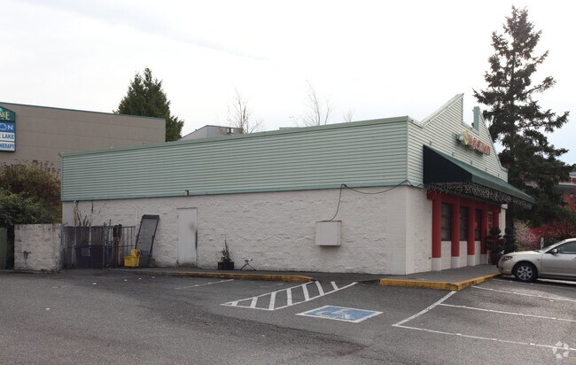
Restaurantbuilding
King
X
Washington
53033C0685G
4
2025
0.96 AC
2024
Coal Creek/Issaquah
032211
Seattle/Puget Sound
2,500 SF
Seattle-Tacoma-Bellevue, WA
DEMOGRAPHICS near 2904 228Th Ave Se
1 Mile
3 Mile
5 Mile
2024 Total Population
9,880
70,510
148,847
2029 Population
9,934
70,782
149,416
Pop Growth 2024-2029
+ 0.55%
+ 0.39%
+ 0.38%
Average Age
40
38
39
2024 Total Households
3,406
24,455
52,245
HH Growth 2024-2029
+ 0.47%
+ 0.26%
+ 0.22%
Median Household Inc
$207,353
$191,703
$183,772
Avg Household Size
2.80
2.80
2.80
2024 Avg HH Vehicles
2.00
2.00
2.00
Median Home Value
$1,055,859
$1,024,270
$1,026,627
Median Year Built
1993
1996
1991
Nearby Places
Map Layers
Map Styles
 Street
 Aerial
- Restaurants
- Banks
- Shops
- Fitness
- Groceries
PUBLIC TRANSPORTATION
AIRPORT
Seattle-Tacoma International
DRIVE
WALK
Distance
Seattle-Tacoma International
40 min
25.0 mi
Seattle Paine Field International
DRIVE
WALK
Distance
Seattle Paine Field International
49 min
30.5 mi
Freight Ports
Port of Seattle
DRIVE
WALK
Distance
Port of Seattle
35 min
21.6 mi
Nearby Properties
Address
Land Use
TOTAL SIZE
Lot Size
Zoning
Address
Land Use
TOTAL SIZE
Lot Size
Zoning
165,676 SF
21 AC
UC
Address
Land Use
TOTAL SIZE
Lot Size
Zoning
378,896 SF
15.55 AC
VR
Address
Land Use
TOTAL SIZE
Lot Size
Zoning
293,232 SF
13.31 AC
UV-L
Address
Land Use
TOTAL SIZE
Lot Size
Zoning
411,348 SF
11.65 AC
R18
Address
Land Use
TOTAL SIZE
Lot Size
Zoning
286,224 SF
11.32 AC
UV-MF
Address
Land Use
TOTAL SIZE
Lot Size
Zoning
249,508 SF
14.79 AC
R18
Address
Land Use
TOTAL SIZE
Lot Size
Zoning
277,585 SF
15.51 AC
MU-CI
Address
Land Use
TOTAL SIZE
Lot Size
Zoning
229,670 SF
8.05 AC
MF-M
Address
Land Use
TOTAL SIZE
Lot Size
Zoning
190,900 SF
15.71 AC
R12
Address
Land Use
TOTAL SIZE
Lot Size
Zoning
192,096 SF
8.11 AC
MF-M
Address
Land Use
TOTAL SIZE
Lot Size
Zoning
141,895 SF
4.01 AC
MU-CI
Address
Land Use
TOTAL SIZE
Lot Size
Zoning
145,000 SF
34.09 AC
R4
Address
Land Use
TOTAL SIZE
Lot Size
Zoning
103,682 SF
39.46 AC
R1
Address
Land Use
TOTAL SIZE
Lot Size
Zoning
42,340 SF
15.64 AC
UC
Address
Land Use
TOTAL SIZE
Lot Size
Zoning
82,863 SF
4.23 AC
CB
Address
Land Use
TOTAL SIZE
Lot Size
Zoning
161,566 SF
20.76 AC
R6
Address
Land Use
TOTAL SIZE
Lot Size
Zoning
531,355 SF
7.44 AC
UC
Address
Land Use
TOTAL SIZE
Lot Size
Zoning
3,910 SF
175.15 AC
CF-F
Address
Land Use
TOTAL SIZE
Lot Size
Zoning
16,407 SF
13.37 AC
MU-CI
Address
Land Use
TOTAL SIZE
Lot Size
Zoning
118,552 SF
6.10 AC
VR
Address
Land Use
TOTAL SIZE
Lot Size
Zoning
103,192 SF
2.38 AC
UV-R
Address
Land Use
TOTAL SIZE
Lot Size
Zoning
78,384 SF
2.34 AC
TC A2
Address
Land Use
TOTAL SIZE
Lot Size
Zoning
230,636 SF
5.79 AC
MU-CI
Address
Land Use
TOTAL SIZE
Lot Size
Zoning
53,500 SF
32.68 AC
R6
Address
Land Use
TOTAL SIZE
Lot Size
Zoning
87,600 SF
5.56 AC
SF-SL
Address
Land Use
TOTAL SIZE
Lot Size
Zoning
72,764 SF
11.70 AC
CF-F
Address
Land Use
TOTAL SIZE
Lot Size
Zoning
105,240 SF
43.38 AC
RA5P
Address
Land Use
TOTAL SIZE
Lot Size
Zoning
28,106 SF
28.86 AC
CF-F
Address
Land Use
TOTAL SIZE
Lot Size
Zoning
143.99 AC
CF-F
Address
Land Use
TOTAL SIZE
Lot Size
Zoning
69,352 SF
1.79 AC
UV-R
The World's #1 Commercial Real Estate Marketplace
Connect with us
© 2026 CoStar Group
The information above has been obtained from sources believed reliable. While we do not doubt its accuracy we have not verified it and make no guarantee, warranty or representation about it. It is your responsibility to independently confirm its accuracy and completeness. Any projections, opinions, assumptions, or estimates used are for example only and do not represent the current or future performance of the property. The value of this transaction to you depends on tax and other factors which should be evaluated by your tax, financial, and legal advisors. You and your advisors should conduct a careful, independent investigation of the property to determine to your satisfaction the suitability of the property for your needs.