Property Record
6830 Ne Bothell Way, Kenmore, WA 98028
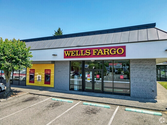
Property Detail
6830 Ne Bothell Way
011410-0690
LAKE TOP CONDOMINIUM PCT UND INT 57.00
Storebuilding
King
DC
Washington
B and X Area of moderate flood hazard, usually the area between the limits of the 100-year and 500-year floods.
0.82 AC
2025
Bothell/Kenmore
2024
Seattle/Puget Sound
021600
Seattle-Tacoma-Bellevue, WA
8,700 SF
NEARBY LISTINGS FOR SALE OR LEASE
DEMOGRAPHICS near 6830 Ne Bothell Way
1 mile
3 mile
5 mile
2025 Total Population
12,981
108,450
357,805
2030 Population
13,554
112,664
373,897
Pop Growth 2025-2030
+ 4.41%
+ 3.89%
+ 4.50%
Average Age
41
41
40
2025 Total Households
5,459
42,969
143,102
HH Growth 2025-2030
+ 4.40%
+ 3.92%
+ 4.62%
Median Household Inc
$117,640
$137,841
$122,140
Avg Household Size
2.40
2.50
2.40
2025 Avg HH Vehicles
2.00
2.00
2.00
Median Home Value
$836,502
$877,783
$838,766
Median Year Built
1985
1982
1982
Nearby Places
Map Layers
Map Styles
 Street
 Aerial
Transit
 Traffic
 Biking
Places
Listings with unknown addresses are not visible on the map
- Restaurants
- Banks
- Shops
- Fitness
- Groceries
PUBLIC TRANSPORTATION
COMMUTER RAIL
Edmonds Station (Sounder South Line - Central Puget Sound Regional Transit Authority Rail (Link Light Rail/Sounder))
Drive
Walk
Distance
Edmonds Station (Sounder South Line - Central Puget Sound Regional Transit Authority Rail (Link Light Rail/Sounder))
19 min
8.8 mi
AIRPORT
Seattle Paine Field International
Drive
Walk
Distance
Seattle Paine Field International
25 min
13.1 mi
Seattle-Tacoma International
Drive
Walk
Distance
Seattle-Tacoma International
43 min
27.8 mi
Freight Ports
Port of Seattle
Drive
Walk
Distance
Port of Seattle
31 min
18.3 mi
SALE & LEASE HISTORY
LISTING DATE
SALE/LEASE

May 07, 2020
For Lease
Nearby Properties
Address
Land Use
TOTAL SIZE
Lot Size
Zoning
Address
Land Use
TOTAL SIZE
Lot Size
Zoning
50,400 SF
123.66 AC
C
Address
Land Use
TOTAL SIZE
Lot Size
Zoning
444,231 SF
31.50 AC
SDD/R
Address
Land Use
TOTAL SIZE
Lot Size
Zoning
2.60 AC
DN
Address
Land Use
TOTAL SIZE
Lot Size
Zoning
194,388 SF
1.65 AC
DC
Address
Land Use
TOTAL SIZE
Lot Size
Zoning
170,520 SF
1.92 AC
DN
Address
Land Use
TOTAL SIZE
Lot Size
Zoning
217,877 SF
17.03 AC
R 2,800
Address
Land Use
TOTAL SIZE
Lot Size
Zoning
75,661 SF
30.54 AC
R 8400
Address
Land Use
TOTAL SIZE
Lot Size
Zoning
131,236 SF
19.14 AC
R6
Address
Land Use
TOTAL SIZE
Lot Size
Zoning
184,576 SF
9.56 AC
RMA 1.8
Address
Land Use
TOTAL SIZE
Lot Size
Zoning
122,766 SF
2 AC
GDC
Address
Land Use
TOTAL SIZE
Lot Size
Zoning
182,875 SF
16.47 AC
R-AC, OP,
Address
Land Use
TOTAL SIZE
Lot Size
Zoning
204,428 SF
34.65 AC
R 9600
Address
Land Use
TOTAL SIZE
Lot Size
Zoning
119,470 SF
1.56 AC
DN
Address
Land Use
TOTAL SIZE
Lot Size
Zoning
114,513 SF
2.35 AC
GDC
Address
Land Use
TOTAL SIZE
Lot Size
Zoning
113,880 SF
1.56 AC
GDC
Address
Land Use
TOTAL SIZE
Lot Size
Zoning
177,990 SF
50.72 AC
PUBLIC/SEM
Address
Land Use
TOTAL SIZE
Lot Size
Zoning
194,954 SF
49.73 AC
PUBLIC/SEM
Address
Land Use
TOTAL SIZE
Lot Size
Zoning
120,420 SF
0.94 AC
DN
Address
Land Use
TOTAL SIZE
Lot Size
Zoning
220,968 SF
16.46 AC
TC
Address
Land Use
TOTAL SIZE
Lot Size
Zoning
236,309 SF
43.88 AC
R6
Address
Land Use
TOTAL SIZE
Lot Size
Zoning
95,892 SF
1.05 AC
DT
Address
Land Use
TOTAL SIZE
Lot Size
Zoning
141,044 SF
5.46 AC
R 9600, SS
Address
Land Use
TOTAL SIZE
Lot Size
Zoning
187,806 SF
8.13 AC
R-AC, OP,
Address
Land Use
TOTAL SIZE
Lot Size
Zoning
308.56 AC
P
Address
Land Use
TOTAL SIZE
Lot Size
Zoning
158,688 SF
5.78 AC
RM 900
Address
Land Use
TOTAL SIZE
Lot Size
Zoning
134,964 SF
8.87 AC
R18
Address
Land Use
TOTAL SIZE
Lot Size
Zoning
41.24 AC
R 9,600
Address
Land Use
TOTAL SIZE
Lot Size
Zoning
75,644 SF
5.50 AC
P
Address
Land Use
TOTAL SIZE
Lot Size
Zoning
85,522 SF
0.53 AC
DC
Address
Land Use
TOTAL SIZE
Lot Size
Zoning
142,992 SF
3.16 AC
R 2800, OP
The World's #1 Commercial Real Estate Marketplace
Connect with us
© 2026 CoStar Group
The information above has been obtained from sources believed reliable. While we do not doubt its accuracy we have not verified it and make no guarantee, warranty or representation about it. It is your responsibility to independently confirm its accuracy and completeness. Any projections, opinions, assumptions, or estimates used are for example only and do not represent the current or future performance of the property. The value of this transaction to you depends on tax and other factors which should be evaluated by your tax, financial, and legal advisors. You and your advisors should conduct a careful, independent investigation of the property to determine to your satisfaction the suitability of the property for your needs.