Log In/Sign Up
Your email has been sent.
Calle del Greco, 10 2.51 Acres of Residential Land in Segovia, Segovia 40006
Some information has been automatically translated.
Investment Highlights
- Area with planning for residential development and private facilities.
Executive Summary
Ref.: SBRE-0039342
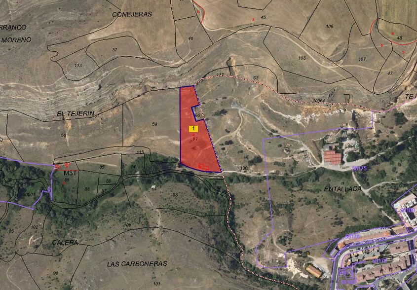
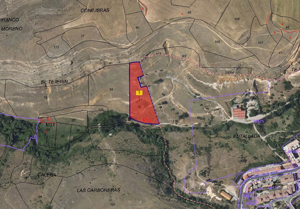
Developable land located in the municipality of Segovia, on Calle del Greco, within the area known as El Cerro - Carretera de San Rafael, next to the expanding residential environment of Zamarramala and just 5 kilometers from the urban center of Segovia. The plot has an approximate area of 10,173 m2, according to cadastral data (Cadastral Ref.: 40900A008000610000HQ).
Buildability of the total Partial Urban Plan:
Free collective housing: 138,350 m2 - 1,194 homes.
Collective housing with some protection regime: 133 homes.
Grouped single-family house: 55,312 - 266 homes.
Detached Single Family Home: 21,020 - 65 homes.
Private Equipment: 10,435, 17 m2.
Cadastral reference: 40900A00 0HQ.
Urban planning assigns significant buildability to the area as a whole, aimed at residential development and private use, which makes this land a strategic opportunity for real estate development. The types provided for in the Partial Plan include free and protected collective housing, grouped and isolated single-family housing, as well as private equipment, which provides great flexibility for development.
The environment is growing, with consolidated residential areas undergoing progressive development, access to nearby facilities and good connection to Segovia through interurban roads. The tenure of this land implies urban rights and obligations in accordance with current regulations, and coordination with the Administration is recommended for its development and participation in future urbanization plans.
Property Facts
| Sale Type | Investment | Property Subtype | Residential |
| No. Lots | 1 | Proposed Use | Multifamily |
| Property Type | Land | Total Lot Size | 2.51 AC |
| Sale Type | Investment |
| No. Lots | 1 |
| Property Type | Land |
| Property Subtype | Residential |
| Proposed Use | Multifamily |
| Total Lot Size | 2.51 AC |
1 Lot Available
Lot
| Lot Size | 2.51 AC |
| Lot Size | 2.51 AC |
Buildable land located in Segovia within the area known as El Cerro – Carretera de San Rafael, near the expanding residential area of Zamarramala and just 5 kilometers from the urban center of Segovia.
Description
Developable land located in Segovia within the area known as El Cerro – Carretera de San Rafael, near the expanding residential area of Zamarramala and just 5 kilometers from the urban center of Segovia. The plot has an approximate surface area of 10,173 m², according to cadastral data.
1 1

1 of 2
Videos
Matterport 3D Exterior
Matterport 3D Tour
Photos
Street View
Street
Map
1 of 1
Presented by

Calle del Greco, 10
Already a member? Log In
Hmm, there seems to have been an error sending your message. Please try again.
Thanks! Your message was sent.