
Main part of property 7.5 ac net (8.0 ac gross) is annexed into city and zoned B2. Additional tract is 1.03 acres , zoned NR and is in Missoula County. Development will require annexation of that lot. Excellent development property allowing 14-21 units per acre and neighborhood businesses. Development agreement in place and available for review. City services to site. Parkland agreement in place. This is part of the historic Flynn Ranch. See associated docs for more info or call listing Brokers. Land is open and easy to show with maps. Home will be moved and is not included.
| Parcel Number | 04-2200-18-2-08-03-0000 | Improvements Assessment | $0 |
| Land Assessment | $282,600 | Total Assessment | $282,600 |
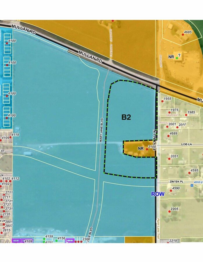 Zoning map
The LoopNet service and information provided therein, while believed to be accurate, are provided "as is". LoopNet disclaims any and all representations, warranties, or guarantees of any kind.