Your email has been sent.
State Route 15
Carey, OH 43316
State Route 15 · Land For Sale
·
5.80 AC
EXECUTIVE SUMMARY
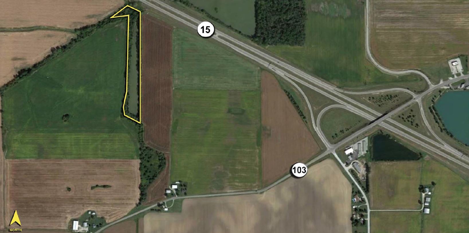
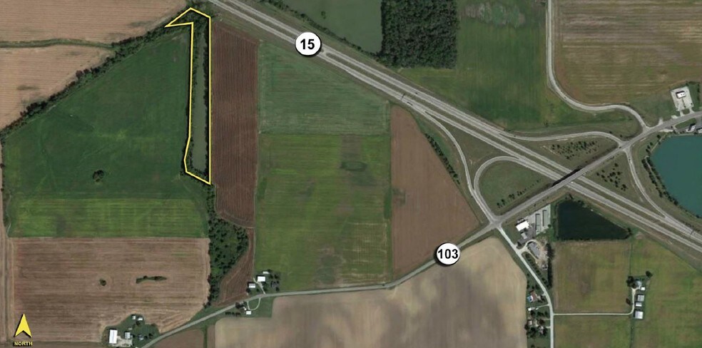
- Deep, but narrow property with 50’± frontage on State Route 15 that lies parallel and follows Spring Run Creek.
- Depth of the parcel is 1,400’± with the width of the site varying from 100’ – 200’.
- The rear boundary line forms a point that terminates at a bend in the creek.
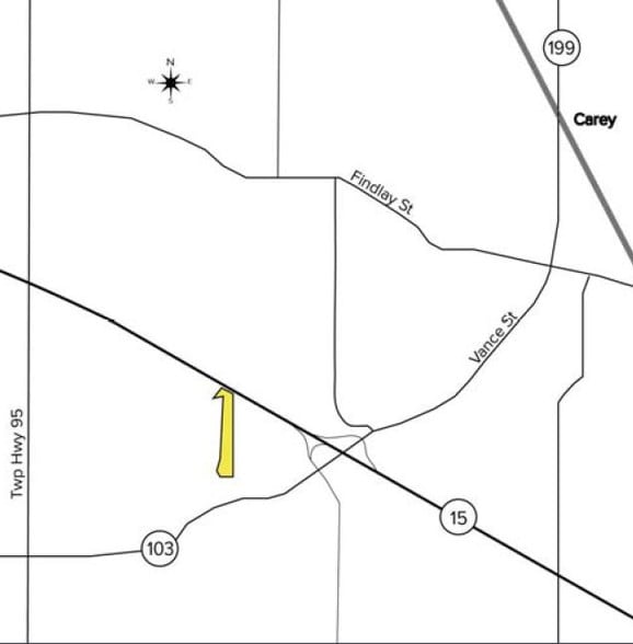
- Village of Carey is located to the north. City of Findlay is located to the northwest.
- Site is located in a flood plain (Flood Zone A), per Wyandot County, Ohio Community Panel #3907870025C, dated 9/18/87.
PROPERTY FACTS
| Sale Type | Investment | Property Subtype | Commercial |
| No. Lots | 1 | Proposed Use | Commercial |
| Property Type | Land | Total Lot Size | 5.80 AC |
| Zoning | Agricultural | ||
| Sale Type | Investment |
| No. Lots | 1 |
| Property Type | Land |
| Property Subtype | Commercial |
| Proposed Use | Commercial |
| Total Lot Size | 5.80 AC |
| Zoning | Agricultural |
1 LOT AVAILABLE
Lot
| Price | $9,300 | Lot Size | 5.80 AC |
| Price Per AC | $1,603.45 |
| Price | $9,300 |
| Price Per AC | $1,603.45 |
| Lot Size | 5.80 AC |
- Located on the south side of State Route 15/US-23, ½ mile west of intersection with State Route 103. - Deep, but narrow property with 50’± frontage on State Route 15 that lies parallel and follows Spring Run Creek. - Depth of the parcel is 1,400’±
DESCRIPTION
? Located on the south side of State Route 15/US-23, ½ mile west of intersection with State Route 103. ? Deep, but narrow property with 50’± frontage on State Route 15 that lies parallel and follows Spring Run Creek. ? Depth of the parcel is 1,400’± with the width of the site varying from 100’ – 200’. ? The rear boundary line forms a point that terminates at a bend in the creek. ? Village of Carey is located to the north. City of Findlay is located to the northwest. ? Site is located in a flood plain (Flood Zone A), per Wyandot County, Ohio Community Panel #3907870025C, dated 9/18/87.
AMENITIES
- Utilities