Property Record
18108 Point Lookout Dr, Houston, TX 77058
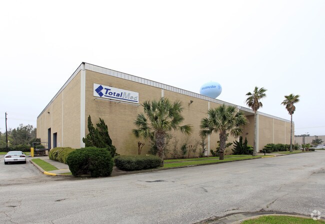

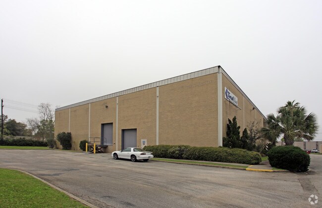
Property Detail
18108 Point Lookout Dr
0402110010028
TR 28 ABST 13 S DEEL
Warehouse
HARRIS
AE The base floodplain where base flood elevations are provided. AE Zones are now used on new format FIRMs instead of A1-A30 Zones.
Texas
2024
3.39 AC
2025
East-Southeast Far
341203
Houston
27,724 SF
Houston-Pasadena-The Woodlands, TX
NEARBY LISTINGS FOR SALE OR LEASE
DEMOGRAPHICS near 18108 Point Lookout Dr
1 mile
3 mile
5 mile
2025 Total Population
11,959
73,699
199,789
2030 Population
12,758
77,671
209,380
Pop Growth 2025-2030
+ 6.68%
+ 5.39%
+ 4.80%
Average Age
37
39
40
2025 Total Households
5,671
32,275
80,315
HH Growth 2025-2030
+ 6.84%
+ 5.55%
+ 5.02%
Median Household Inc
$67,931
$74,437
$96,019
Avg Household Size
2.10
2.20
2.40
2025 Avg HH Vehicles
1.00
2.00
2.00
Median Home Value
$353,688
$317,604
$333,412
Median Year Built
1979
1984
1989
Nearby Places
Map Layers
Map Styles
 Street
 Aerial
Layers
 Traffic
 Biking
Places
Listings with unknown addresses are not visible on the map
- Restaurants
- Banks
- Shops
- Fitness
- Groceries
PUBLIC TRANSPORTATION
AIRPORT
William P Hobby
Drive
Walk
Distance
William P Hobby
28 min
15.9 mi
Freight Ports
Port of Houston
Drive
Walk
Distance
Port of Houston
33 min
22.3 mi
Nearby Properties
Address
Land Use
TOTAL SIZE
Lot Size
Zoning
Address
Land Use
TOTAL SIZE
Lot Size
Zoning
544,605 SF
27.49 AC
Address
Land Use
TOTAL SIZE
Lot Size
Zoning
538,570 SF
16.15 AC
Address
Land Use
TOTAL SIZE
Lot Size
Zoning
645,535 SF
4.40 AC
Address
Land Use
TOTAL SIZE
Lot Size
Zoning
585,632 SF
7.24 AC
Address
Land Use
TOTAL SIZE
Lot Size
Zoning
614,377 SF
26.06 AC
Address
Land Use
TOTAL SIZE
Lot Size
Zoning
780,870 SF
22.72 AC
Address
Land Use
TOTAL SIZE
Lot Size
Zoning
363,876 SF
11.74 AC
Address
Land Use
TOTAL SIZE
Lot Size
Zoning
335,717 SF
21.15 AC
Address
Land Use
TOTAL SIZE
Lot Size
Zoning
502,791 SF
123.05 AC
Address
Land Use
TOTAL SIZE
Lot Size
Zoning
218,198 SF
7.27 AC
Address
Land Use
TOTAL SIZE
Lot Size
Zoning
452,269 SF
29.63 AC
Address
Land Use
TOTAL SIZE
Lot Size
Zoning
323,638 SF
25.17 AC
Address
Land Use
TOTAL SIZE
Lot Size
Zoning
530,696 SF
8.57 AC
Address
Land Use
TOTAL SIZE
Lot Size
Zoning
366,202 SF
32.55 AC
Address
Land Use
TOTAL SIZE
Lot Size
Zoning
485,863 SF
4.81 AC
Address
Land Use
TOTAL SIZE
Lot Size
Zoning
372,183 SF
11.16 AC
Address
Land Use
TOTAL SIZE
Lot Size
Zoning
437,909 SF
27.06 AC
Address
Land Use
TOTAL SIZE
Lot Size
Zoning
166,816 SF
18.55 AC
Address
Land Use
TOTAL SIZE
Lot Size
Zoning
372,831 SF
20 AC
Address
Land Use
TOTAL SIZE
Lot Size
Zoning
441,889 SF
17.88 AC
Address
Land Use
TOTAL SIZE
Lot Size
Zoning
282,246 SF
19.56 AC
Address
Land Use
TOTAL SIZE
Lot Size
Zoning
335,315 SF
20 AC
Address
Land Use
TOTAL SIZE
Lot Size
Zoning
334,876 SF
0.86 AC
Address
Land Use
TOTAL SIZE
Lot Size
Zoning
879,410 SF
93.36 AC
Address
Land Use
TOTAL SIZE
Lot Size
Zoning
364,008 SF
21.78 AC
Address
Land Use
TOTAL SIZE
Lot Size
Zoning
126,874 SF
3.92 AC
Address
Land Use
TOTAL SIZE
Lot Size
Zoning
470,930 SF
16.55 AC
Address
Land Use
TOTAL SIZE
Lot Size
Zoning
273,648 SF
11.48 AC
Address
Land Use
TOTAL SIZE
Lot Size
Zoning
349,698 SF
20.46 AC
Address
Land Use
TOTAL SIZE
Lot Size
Zoning
376,153 SF
40.01 AC
The World's #1 Commercial Real Estate Marketplace
Connect with us
© 2026 CoStar Group
The information above has been obtained from sources believed reliable. While we do not doubt its accuracy we have not verified it and make no guarantee, warranty or representation about it. It is your responsibility to independently confirm its accuracy and completeness. Any projections, opinions, assumptions, or estimates used are for example only and do not represent the current or future performance of the property. The value of this transaction to you depends on tax and other factors which should be evaluated by your tax, financial, and legal advisors. You and your advisors should conduct a careful, independent investigation of the property to determine to your satisfaction the suitability of the property for your needs.