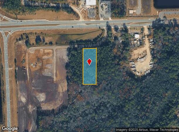
Property Record
0 103Rd St, Jacksonville, FL 32222
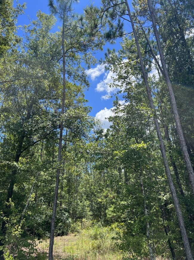
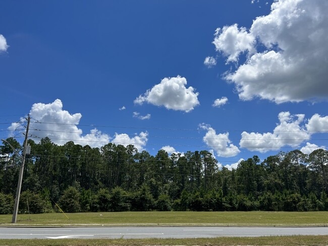
This Property Is For Sale
NEARBY LISTINGS FOR SALE OR LEASE
Property Detail
0 103Rd St
Jacksonville, FL
Jax Heights Sec
015402-0000
5-93 18-3S-25E 1.346 JACKSONVILLE HEIGHTS PT TRACT 1 RECD O/R 17580-1960 BLK 2
Commercialacreage
Duval
X
Florida
12019C0055E
1.47 AC
2025
Riverside
2026
Jacksonville (Florida)
013723
DEMOGRAPHICS near 0 103Rd St
1 Mile
3 Mile
5 Mile
2024 Total Population
2,138
29,952
115,045
2029 Population
2,250
32,016
122,001
Pop Growth 2024-2029
+ 5.24%
+ 6.89%
+ 6.05%
Average Age
38
37
37
2024 Total Households
771
10,726
40,639
HH Growth 2024-2029
+ 5.45%
+ 7.02%
+ 6.10%
Median Household Inc
$72,272
$68,293
$67,574
Avg Household Size
2.70
2.70
2.80
2024 Avg HH Vehicles
2.00
2.00
2.00
Median Home Value
$238,685
$246,233
$223,531
Median Year Built
2002
2005
1999
Nearby Places
Map Layers
Map Styles
 Street
 Aerial
- Restaurants
- Banks
- Shops
- Fitness
- Groceries
PUBLIC TRANSPORTATION
AIRPORT
Jacksonville International
DRIVE
WALK
Distance
Jacksonville International
39 min
25.5 mi
Freight Ports
Jacksonville Port
DRIVE
WALK
Distance
Jacksonville Port
32 min
18.1 mi
Nearby Properties
Address
Land Use
TOTAL SIZE
Lot Size
Zoning
Address
Land Use
TOTAL SIZE
Lot Size
Zoning
1,871,524 SF
5,837.66 AC
PUD
Address
Land Use
TOTAL SIZE
Lot Size
Zoning
1,020,863 SF
85.89 AC
PUD
Address
Land Use
TOTAL SIZE
Lot Size
Zoning
1,014,416 SF
80.58 AC
PUD
Address
Land Use
TOTAL SIZE
Lot Size
Zoning
557,137 SF
40.70 AC
PUD
Address
Land Use
TOTAL SIZE
Lot Size
Zoning
284,061 SF
19.48 AC
PUD
Address
Land Use
TOTAL SIZE
Lot Size
Zoning
239,891 SF
21.95 AC
CRO
Address
Land Use
TOTAL SIZE
Lot Size
Zoning
307,960 SF
18.52 AC
PUD
Address
Land Use
TOTAL SIZE
Lot Size
Zoning
375,127 SF
18.65 AC
PUD
Address
Land Use
TOTAL SIZE
Lot Size
Zoning
245,626 SF
202.62 AC
PUD
Address
Land Use
TOTAL SIZE
Lot Size
Zoning
88,000 SF
11.28 AC
CCG-1
Address
Land Use
TOTAL SIZE
Lot Size
Zoning
136,599 SF
47.95 AC
PBF-2
Address
Land Use
TOTAL SIZE
Lot Size
Zoning
65,052 SF
15.97 AC
PUD
Address
Land Use
TOTAL SIZE
Lot Size
Zoning
108,217 SF
178.52 AC
PBF-1
Address
Land Use
TOTAL SIZE
Lot Size
Zoning
292,154 SF
18.68 AC
PUD
Address
Land Use
TOTAL SIZE
Lot Size
Zoning
6,792 SF
53.56 AC
PUD
Address
Land Use
TOTAL SIZE
Lot Size
Zoning
80,512 SF
4.05 AC
PUD
Address
Land Use
TOTAL SIZE
Lot Size
Zoning
66,892 SF
9.62 AC
PUD
Address
Land Use
TOTAL SIZE
Lot Size
Zoning
198,713 SF
26.59 AC
PUD
Address
Land Use
TOTAL SIZE
Lot Size
Zoning
61,580 SF
15.40 AC
RMD-MH
Address
Land Use
TOTAL SIZE
Lot Size
Zoning
9,554 SF
2.85 AC
PUD
Address
Land Use
TOTAL SIZE
Lot Size
Zoning
404.50 AC
PUD
Address
Land Use
TOTAL SIZE
Lot Size
Zoning
13.29 AC
PUD
Address
Land Use
TOTAL SIZE
Lot Size
Zoning
15,025 SF
5.72 AC
CCG-2
Address
Land Use
TOTAL SIZE
Lot Size
Zoning
32,321 SF
8.05 AC
RMD-B
Address
Land Use
TOTAL SIZE
Lot Size
Zoning
25.88 AC
CCG-1
Address
Land Use
TOTAL SIZE
Lot Size
Zoning
45,252 SF
16.91 AC
CCG-1
Address
Land Use
TOTAL SIZE
Lot Size
Zoning
50,225 SF
3.08 AC
CCG-2
Address
Land Use
TOTAL SIZE
Lot Size
Zoning
78,192 SF
6.36 AC
RMD-D
Address
Land Use
TOTAL SIZE
Lot Size
Zoning
92,735 SF
43.97 AC
PBF-2
Address
Land Use
TOTAL SIZE
Lot Size
Zoning
40,210 SF
6.61 AC
RLD-60
The World's #1 Commercial Real Estate Marketplace
Connect with us
© 2026 CoStar Group
The information above has been obtained from sources believed reliable. While we do not doubt its accuracy we have not verified it and make no guarantee, warranty or representation about it. It is your responsibility to independently confirm its accuracy and completeness. Any projections, opinions, assumptions, or estimates used are for example only and do not represent the current or future performance of the property. The value of this transaction to you depends on tax and other factors which should be evaluated by your tax, financial, and legal advisors. You and your advisors should conduct a careful, independent investigation of the property to determine to your satisfaction the suitability of the property for your needs.