Property Record
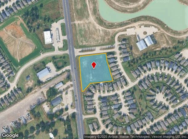
0 Aldine Westfield Rd, Humble, TX 77338


NEARBY LISTINGS FOR SALE OR LEASE
Property Detail
0 Aldine Westfield Rd
Houston-The Woodlands-Sugar Land, TX
Abst 543 A Mays
0432090051303
TR 7 Q ABST 543 A MAYS
Commercialacreage
Harris
X
Texas
48339C0700F
2.36 AC
2024
Kingwood/Humble
2025
Houston
240904
DEMOGRAPHICS near 0 Aldine Westfield Rd
1 Mile
3 Mile
5 Mile
2024 Total Population
10,657
77,003
197,674
2029 Population
10,847
78,519
205,523
Pop Growth 2024-2029
+ 1.78%
+ 1.97%
+ 3.97%
Average Age
33
34
34
2024 Total Households
3,352
24,968
66,032
HH Growth 2024-2029
+ 1.70%
+ 1.99%
+ 3.90%
Median Household Inc
$58,233
$64,084
$66,472
Avg Household Size
3.10
3.00
2.90
2024 Avg HH Vehicles
2.00
2.00
2.00
Median Home Value
$154,589
$166,314
$193,002
Median Year Built
1991
1991
1999
Nearby Places
Map Layers
Map Styles
 Street
 Aerial
- Restaurants
- Banks
- Shops
- Fitness
- Groceries
PUBLIC TRANSPORTATION
AIRPORT
George Bush Intcntl/Houston
DRIVE
WALK
Distance
George Bush Intcntl/Houston
17 min
10.0 mi
William P Hobby
DRIVE
WALK
Distance
William P Hobby
53 min
33.9 mi
Freight Ports
Port of Houston
DRIVE
WALK
Distance
Port of Houston
41 min
27.9 mi
SALE & LEASE HISTORY
LISTING DATE
SALE/LEASE

Oct 30, 2017
For Sale
Jun 26, 2019
For Sale
Nearby Properties
Address
Land Use
TOTAL SIZE
Lot Size
Zoning
Address
Land Use
TOTAL SIZE
Lot Size
Zoning
409,480 SF
27.32 AC
Address
Land Use
TOTAL SIZE
Lot Size
Zoning
288,721 SF
Address
Land Use
TOTAL SIZE
Lot Size
Zoning
350,423 SF
122.83 AC
Address
Land Use
TOTAL SIZE
Lot Size
Zoning
280,283 SF
16.56 AC
Address
Land Use
TOTAL SIZE
Lot Size
Zoning
271,432 SF
35.81 AC
Address
Land Use
TOTAL SIZE
Lot Size
Zoning
287,251 SF
18.12 AC
Address
Land Use
TOTAL SIZE
Lot Size
Zoning
259,000 SF
15.73 AC
Address
Land Use
TOTAL SIZE
Lot Size
Zoning
259,000 SF
14.73 AC
Address
Land Use
TOTAL SIZE
Lot Size
Zoning
204,870 SF
13.40 AC
Address
Land Use
TOTAL SIZE
Lot Size
Zoning
203,013 SF
12.28 AC
Address
Land Use
TOTAL SIZE
Lot Size
Zoning
238,835 SF
9.98 AC
Address
Land Use
TOTAL SIZE
Lot Size
Zoning
249,296 SF
10.10 AC
Address
Land Use
TOTAL SIZE
Lot Size
Zoning
175,495 SF
8.92 AC
Address
Land Use
TOTAL SIZE
Lot Size
Zoning
267,250 SF
11.83 AC
Address
Land Use
TOTAL SIZE
Lot Size
Zoning
127,260 SF
14 AC
Address
Land Use
TOTAL SIZE
Lot Size
Zoning
59,589 SF
9.74 AC
Address
Land Use
TOTAL SIZE
Lot Size
Zoning
222,382 SF
10.44 AC
Address
Land Use
TOTAL SIZE
Lot Size
Zoning
110,597 SF
9.06 AC
Address
Land Use
TOTAL SIZE
Lot Size
Zoning
132,102 SF
14.93 AC
Address
Land Use
TOTAL SIZE
Lot Size
Zoning
101,399 SF
17.11 AC
Address
Land Use
TOTAL SIZE
Lot Size
Zoning
216,390 SF
8.42 AC
Address
Land Use
TOTAL SIZE
Lot Size
Zoning
281,563 SF
19.98 AC
Address
Land Use
TOTAL SIZE
Lot Size
Zoning
186,971 SF
7.58 AC
Address
Land Use
TOTAL SIZE
Lot Size
Zoning
152,440 SF
24.67 AC
Address
Land Use
TOTAL SIZE
Lot Size
Zoning
89,044 SF
13.17 AC
Address
Land Use
TOTAL SIZE
Lot Size
Zoning
64,010 SF
5.90 AC
Address
Land Use
TOTAL SIZE
Lot Size
Zoning
171,018 SF
6.35 AC
Address
Land Use
TOTAL SIZE
Lot Size
Zoning
210,430 SF
8 AC
Address
Land Use
TOTAL SIZE
Lot Size
Zoning
115,000 SF
7.83 AC
Address
Land Use
TOTAL SIZE
Lot Size
Zoning
126,320 SF
12.11 AC
The World's #1 Commercial Real Estate Marketplace
Connect with us
© 2025 CoStar Group
The information above has been obtained from sources believed reliable. While we do not doubt its accuracy we have not verified it and make no guarantee, warranty or representation about it. It is your responsibility to independently confirm its accuracy and completeness. Any projections, opinions, assumptions, or estimates used are for example only and do not represent the current or future performance of the property. The value of this transaction to you depends on tax and other factors which should be evaluated by your tax, financial, and legal advisors. You and your advisors should conduct a careful, independent investigation of the property to determine to your satisfaction the suitability of the property for your needs.