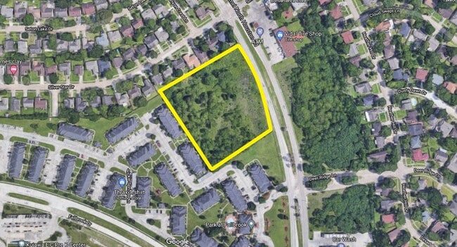
Property Record
0 Bammel North Houston Rd, Houston, TX 77086


NEARBY LISTINGS FOR SALE OR LEASE
Property Detail
0 Bammel North Houston Rd
Houston-The Woodlands-Sugar Land, TX
Abst 918 Wcrr Co Sec 25
0460180000061
TR 1 (NM) ABST 918 WCRR CO SEC 25 BLK 4
Vacantlandnec
Harris
X
Texas
48201C0465M
0.20 AC
0
West Belt
2025
Houston
533903
DEMOGRAPHICS near 0 Bammel North Houston Rd
1 Mile
3 Mile
5 Mile
2024 Total Population
18,027
101,736
304,709
2029 Population
18,022
102,502
308,561
Pop Growth 2024-2029
(0.03%)
+ 0.75%
+ 1.26%
Average Age
35
36
36
2024 Total Households
5,485
29,377
100,171
HH Growth 2024-2029
(0.22%)
+ 0.67%
+ 1.28%
Median Household Inc
$44,512
$59,275
$54,917
Avg Household Size
3.20
3.40
3.00
2024 Avg HH Vehicles
2.00
2.00
2.00
Median Home Value
$157,196
$165,440
$182,267
Median Year Built
1983
1985
1987
Nearby Places
Map Layers
Map Styles
 Street
 Aerial
- Restaurants
- Banks
- Shops
- Fitness
- Groceries
PUBLIC TRANSPORTATION
AIRPORT
George Bush Intcntl/Houston
DRIVE
WALK
Distance
George Bush Intcntl/Houston
19 min
14.4 mi
William P Hobby
DRIVE
WALK
Distance
William P Hobby
44 min
27.7 mi
Freight Ports
Port of Houston
DRIVE
WALK
Distance
Port of Houston
36 min
23.2 mi
SALE & LEASE HISTORY
LISTING DATE
SALE/LEASE

May 24, 2021
For Sale
Aug 02, 2022
For Sale
Nearby Properties
Address
Land Use
TOTAL SIZE
Lot Size
Zoning
Address
Land Use
TOTAL SIZE
Lot Size
Zoning
778,140 SF
40.25 AC
Address
Land Use
TOTAL SIZE
Lot Size
Zoning
552,757 SF
32.95 AC
Address
Land Use
TOTAL SIZE
Lot Size
Zoning
546,420 SF
40.07 AC
Address
Land Use
TOTAL SIZE
Lot Size
Zoning
527,744 SF
35.46 AC
Address
Land Use
TOTAL SIZE
Lot Size
Zoning
397,248 SF
26.37 AC
Address
Land Use
TOTAL SIZE
Lot Size
Zoning
365,380 SF
19.17 AC
Address
Land Use
TOTAL SIZE
Lot Size
Zoning
495,024 SF
23.96 AC
Address
Land Use
TOTAL SIZE
Lot Size
Zoning
502,860 SF
40.99 AC
Address
Land Use
TOTAL SIZE
Lot Size
Zoning
399,828 SF
20.32 AC
Address
Land Use
TOTAL SIZE
Lot Size
Zoning
424,122 SF
21.06 AC
Address
Land Use
TOTAL SIZE
Lot Size
Zoning
361,800 SF
18.20 AC
Address
Land Use
TOTAL SIZE
Lot Size
Zoning
351,235 SF
20.73 AC
Address
Land Use
TOTAL SIZE
Lot Size
Zoning
357,300 SF
23.38 AC
Address
Land Use
TOTAL SIZE
Lot Size
Zoning
215,968 SF
17.23 AC
Address
Land Use
TOTAL SIZE
Lot Size
Zoning
356,656 SF
23.54 AC
Address
Land Use
TOTAL SIZE
Lot Size
Zoning
299,280 SF
15.71 AC
Address
Land Use
TOTAL SIZE
Lot Size
Zoning
292,112 SF
4.41 AC
Address
Land Use
TOTAL SIZE
Lot Size
Zoning
272,600 SF
23.27 AC
Address
Land Use
TOTAL SIZE
Lot Size
Zoning
200,123 SF
14.94 AC
Address
Land Use
TOTAL SIZE
Lot Size
Zoning
293,280 SF
16.24 AC
Address
Land Use
TOTAL SIZE
Lot Size
Zoning
614,712 SF
7.93 AC
Address
Land Use
TOTAL SIZE
Lot Size
Zoning
352,680 SF
28.21 AC
Address
Land Use
TOTAL SIZE
Lot Size
Zoning
240,905 SF
19.98 AC
Address
Land Use
TOTAL SIZE
Lot Size
Zoning
287,510 SF
19.43 AC
Address
Land Use
TOTAL SIZE
Lot Size
Zoning
241,946 SF
14.02 AC
Address
Land Use
TOTAL SIZE
Lot Size
Zoning
220,000 SF
12.07 AC
Address
Land Use
TOTAL SIZE
Lot Size
Zoning
253,369 SF
16.81 AC
Address
Land Use
TOTAL SIZE
Lot Size
Zoning
211,036 SF
11.62 AC
Address
Land Use
TOTAL SIZE
Lot Size
Zoning
172,500 SF
13.15 AC
Address
Land Use
TOTAL SIZE
Lot Size
Zoning
209,825 SF
11.97 AC
The World's #1 Commercial Real Estate Marketplace
Connect with us
© 2026 CoStar Group
The information above has been obtained from sources believed reliable. While we do not doubt its accuracy we have not verified it and make no guarantee, warranty or representation about it. It is your responsibility to independently confirm its accuracy and completeness. Any projections, opinions, assumptions, or estimates used are for example only and do not represent the current or future performance of the property. The value of this transaction to you depends on tax and other factors which should be evaluated by your tax, financial, and legal advisors. You and your advisors should conduct a careful, independent investigation of the property to determine to your satisfaction the suitability of the property for your needs.