Property Record
0 Bissonnet St, Houston, TX 77099
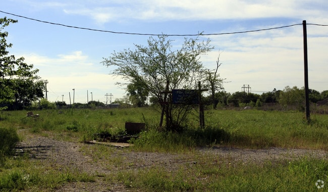

Property Detail
0 Bissonnet St
Houston-Pasadena-The Woodlands, TX
TR 1A-6 ABST 593 G MORRIS
0440170000006
HARRIS
Recreationalentertainmentgeneral
Texas
AE The base floodplain where base flood elevations are provided. AE Zones are now used on new format FIRMs instead of A1-A30 Zones.
24.70 AC
0
Southwest Beltway 8
2025
Houston
453403
NEARBY LISTINGS FOR SALE OR LEASE
DEMOGRAPHICS near 0 Bissonnet St
1 mile
3 mile
5 mile
2024 Total Population
24,745
198,641
482,605
2029 Population
26,254
213,788
520,884
Pop Growth 2024-2029
+ 6.10%
+ 7.63%
+ 7.93%
Average Age
37
38
37
2024 Total Households
7,550
64,971
170,601
HH Growth 2024-2029
+ 6.49%
+ 7.95%
+ 8.13%
Median Household Inc
$53,734
$57,858
$59,062
Avg Household Size
3.10
3.00
2.80
2024 Avg HH Vehicles
2.00
2.00
2.00
Median Home Value
$196,065
$240,418
$265,896
Median Year Built
1979
1984
1986
Nearby Places
Map Layers
Map Styles
 Street
 Aerial
Transit
 Traffic
 Biking
Places
Listings with unknown addresses are not visible on the map
- Restaurants
- Banks
- Shops
- Fitness
- Groceries
PUBLIC TRANSPORTATION
AIRPORT
William P Hobby
Drive
Walk
Distance
William P Hobby
41 min
25.5 mi
George Bush Intcntl/Houston
Drive
Walk
Distance
George Bush Intcntl/Houston
48 min
37.8 mi
Freight Ports
Port of Houston
Drive
Walk
Distance
Port of Houston
42 min
24.8 mi
Nearby Properties
Address
Land Use
TOTAL SIZE
Lot Size
Zoning
Address
Land Use
TOTAL SIZE
Lot Size
Zoning
94,547 SF
13.59 AC
Address
Land Use
TOTAL SIZE
Lot Size
Zoning
422,123 SF
39.85 AC
Address
Land Use
TOTAL SIZE
Lot Size
Zoning
126,308 SF
16.95 AC
Address
Land Use
TOTAL SIZE
Lot Size
Zoning
76,385 SF
17.48 AC
Address
Land Use
TOTAL SIZE
Lot Size
Zoning
526,945 SF
23.05 AC
Address
Land Use
TOTAL SIZE
Lot Size
Zoning
76,306 SF
15.84 AC
Address
Land Use
TOTAL SIZE
Lot Size
Zoning
61,006 SF
13.16 AC
X
Address
Land Use
TOTAL SIZE
Lot Size
Zoning
183,015 SF
9.91 AC
Address
Land Use
TOTAL SIZE
Lot Size
Zoning
286,285 SF
11.78 AC
Address
Land Use
TOTAL SIZE
Lot Size
Zoning
291,196 SF
30.06 AC
SXY
Address
Land Use
TOTAL SIZE
Lot Size
Zoning
322,894 SF
17.51 AC
Address
Land Use
TOTAL SIZE
Lot Size
Zoning
84,509 SF
13.06 AC
Y
Address
Land Use
TOTAL SIZE
Lot Size
Zoning
355,887 SF
13.89 AC
Address
Land Use
TOTAL SIZE
Lot Size
Zoning
75,978 SF
10.13 AC
Address
Land Use
TOTAL SIZE
Lot Size
Zoning
226,700 SF
19.14 AC
M
Address
Land Use
TOTAL SIZE
Lot Size
Zoning
329,954 SF
15.55 AC
SH
Address
Land Use
TOTAL SIZE
Lot Size
Zoning
719,540 SF
33.47 AC
YQX
Address
Land Use
TOTAL SIZE
Lot Size
Zoning
364,674 SF
13.79 AC
Address
Land Use
TOTAL SIZE
Lot Size
Zoning
396,100 SF
18.02 AC
Address
Land Use
TOTAL SIZE
Lot Size
Zoning
459,199 SF
15.74 AC
Address
Land Use
TOTAL SIZE
Lot Size
Zoning
314,657 SF
17.77 AC
S
Address
Land Use
TOTAL SIZE
Lot Size
Zoning
45,216 SF
11.92 AC
SY
Address
Land Use
TOTAL SIZE
Lot Size
Zoning
307,488 SF
11 AC
Address
Land Use
TOTAL SIZE
Lot Size
Zoning
274,158 SF
10.51 AC
Address
Land Use
TOTAL SIZE
Lot Size
Zoning
299,622 SF
17.66 AC
MSY
Address
Land Use
TOTAL SIZE
Lot Size
Zoning
280,309 SF
9.98 AC
Address
Land Use
TOTAL SIZE
Lot Size
Zoning
20.82 AC
Address
Land Use
TOTAL SIZE
Lot Size
Zoning
185,541 SF
10.51 AC
Address
Land Use
TOTAL SIZE
Lot Size
Zoning
280,253 SF
12.54 AC
Address
Land Use
TOTAL SIZE
Lot Size
Zoning
365,218 SF
25.48 AC
The World's #1 Commercial Real Estate Marketplace
Connect with us
© 2026 CoStar Group
The information above has been obtained from sources believed reliable. While we do not doubt its accuracy we have not verified it and make no guarantee, warranty or representation about it. It is your responsibility to independently confirm its accuracy and completeness. Any projections, opinions, assumptions, or estimates used are for example only and do not represent the current or future performance of the property. The value of this transaction to you depends on tax and other factors which should be evaluated by your tax, financial, and legal advisors. You and your advisors should conduct a careful, independent investigation of the property to determine to your satisfaction the suitability of the property for your needs.