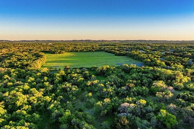
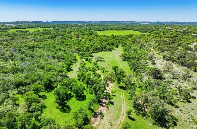
Property Record
0 Bulverde Rd, Bulverde, TX 78163

Property Detail
0 Bulverde Rd
San Antonio-New Braunfels, TX
A-493 SUR-410 W REAGER, ACRES 75.414
74-0493-0001-01
COMAL
Agriculturalland
Texas
A Areas with a 1% annual chance of flooding and a 26% chance of flooding over the life of a 30-year mortgage.
75.41 AC
2024
Comal County
2025
San Antonio
310705
NEARBY LISTINGS FOR SALE OR LEASE
DEMOGRAPHICS near 0 Bulverde Rd
1 mile
3 mile
5 mile
2025 Total Population
1,179
9,409
31,246
2030 Population
1,379
11,206
36,625
Pop Growth 2025-2030
+ 16.96%
+ 19.10%
+ 17.22%
Average Age
42
42
41
2025 Total Households
396
3,334
10,908
HH Growth 2025-2030
+ 16.92%
+ 19.14%
+ 17.43%
Median Household Inc
$113,392
$129,505
$141,023
Avg Household Size
2.80
2.80
2.80
2025 Avg HH Vehicles
3.00
3.00
3.00
Median Home Value
$624,407
$506,439
$508,110
Median Year Built
1999
2008
2010
Nearby Places
Map Layers
Map Styles
 Street
 Aerial
Transit
 Traffic
 Biking
Places
Listings with unknown addresses are not visible on the map
- Restaurants
- Banks
- Shops
- Fitness
- Groceries
PUBLIC TRANSPORTATION
AIRPORT
San Antonio International
Drive
Walk
Distance
San Antonio International
32 min
20.6 mi
Freight Ports
Calhoun Port
Drive
Walk
Distance
Calhoun Port
210 min
169.4 mi
SALE & LEASE HISTORY
LISTING DATE
SALE/LEASE

Aug 01, 2024
For Sale
Nearby Properties
Address
Land Use
TOTAL SIZE
Lot Size
Zoning
Address
Land Use
TOTAL SIZE
Lot Size
Zoning
128,094 SF
26.63 AC
Address
Land Use
TOTAL SIZE
Lot Size
Zoning
Address
Land Use
TOTAL SIZE
Lot Size
Zoning
66,166 SF
85.74 AC
Address
Land Use
TOTAL SIZE
Lot Size
Zoning
101,914 SF
19.55 AC
Address
Land Use
TOTAL SIZE
Lot Size
Zoning
50,318 SF
19.62 AC
Address
Land Use
TOTAL SIZE
Lot Size
Zoning
103,535 SF
14.40 AC
Address
Land Use
TOTAL SIZE
Lot Size
Zoning
32,964 SF
6.98 AC
Address
Land Use
TOTAL SIZE
Lot Size
Zoning
39,230 SF
22.05 AC
Address
Land Use
TOTAL SIZE
Lot Size
Zoning
69,435 SF
12.74 AC
Address
Land Use
TOTAL SIZE
Lot Size
Zoning
63,236 SF
15.29 AC
Address
Land Use
TOTAL SIZE
Lot Size
Zoning
Address
Land Use
TOTAL SIZE
Lot Size
Zoning
5,508 SF
3.50 AC
Address
Land Use
TOTAL SIZE
Lot Size
Zoning
37,551 SF
42.01 AC
Address
Land Use
TOTAL SIZE
Lot Size
Zoning
24,762 SF
3.98 AC
Address
Land Use
TOTAL SIZE
Lot Size
Zoning
23,088 SF
2.88 AC
Address
Land Use
TOTAL SIZE
Lot Size
Zoning
13,969 SF
10.03 AC
Address
Land Use
TOTAL SIZE
Lot Size
Zoning
16,248 SF
2.66 AC
Address
Land Use
TOTAL SIZE
Lot Size
Zoning
9,280 SF
3.93 AC
Address
Land Use
TOTAL SIZE
Lot Size
Zoning
20,125 SF
3.54 AC
Address
Land Use
TOTAL SIZE
Lot Size
Zoning
7,190 SF
18.37 AC
Address
Land Use
TOTAL SIZE
Lot Size
Zoning
17,531 SF
1.45 AC
Address
Land Use
TOTAL SIZE
Lot Size
Zoning
13,172 SF
1.98 AC
Address
Land Use
TOTAL SIZE
Lot Size
Zoning
13,552 SF
4.48 AC
Address
Land Use
TOTAL SIZE
Lot Size
Zoning
23,314 SF
3 AC
Address
Land Use
TOTAL SIZE
Lot Size
Zoning
13,700 SF
2.33 AC
Address
Land Use
TOTAL SIZE
Lot Size
Zoning
3,120 SF
10.02 AC
Address
Land Use
TOTAL SIZE
Lot Size
Zoning
70.39 AC
Address
Land Use
TOTAL SIZE
Lot Size
Zoning
Address
Land Use
TOTAL SIZE
Lot Size
Zoning
9,960 SF
7.45 AC
Address
Land Use
TOTAL SIZE
Lot Size
Zoning
9,372 SF
12.10 AC
The World's #1 Commercial Real Estate Marketplace
Connect with us
© 2026 CoStar Group
The information above has been obtained from sources believed reliable. While we do not doubt its accuracy we have not verified it and make no guarantee, warranty or representation about it. It is your responsibility to independently confirm its accuracy and completeness. Any projections, opinions, assumptions, or estimates used are for example only and do not represent the current or future performance of the property. The value of this transaction to you depends on tax and other factors which should be evaluated by your tax, financial, and legal advisors. You and your advisors should conduct a careful, independent investigation of the property to determine to your satisfaction the suitability of the property for your needs.