Property Record
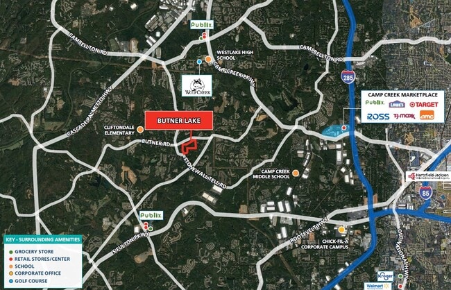
Butner Rd, South Fulton, GA 30349


NEARBY LISTINGS FOR SALE OR LEASE
Property Detail
Butner Rd
Atlanta-Sandy Springs-Roswell, GA
WORKFLOW 2022-0045 (MERGE COMPLETE
14F-0125-LL-022-0
Fulton
Residentialacreage
Georgia
X
125
13121C0339F
57.30 AC
2024
North Clayton/Airport
2025
Atlanta
010529
DEMOGRAPHICS near Butner Rd
1 Mile
3 Mile
5 Mile
2024 Total Population
3,616
34,425
78,854
2029 Population
3,684
35,558
81,496
Pop Growth 2024-2029
+ 1.88%
+ 3.29%
+ 3.35%
Average Age
39
38
38
2024 Total Households
1,227
12,082
28,512
HH Growth 2024-2029
+ 1.96%
+ 3.27%
+ 3.37%
Median Household Inc
$91,440
$97,701
$88,295
Avg Household Size
2.80
2.80
2.70
2024 Avg HH Vehicles
2.00
2.00
2.00
Median Home Value
$258,071
$290,335
$266,138
Median Year Built
2002
2004
2003
Nearby Places
Map Layers
Map Styles
 Street
 Aerial
- Restaurants
- Banks
- Shops
- Fitness
- Groceries
PUBLIC TRANSPORTATION
AIRPORT
Hartsfield - Jackson Atlanta International
DRIVE
WALK
Distance
Hartsfield - Jackson Atlanta International
25 min
14.9 mi
Freight Ports
Georgia Ports - Savannah
DRIVE
WALK
Distance
Georgia Ports - Savannah
287 min
252.2 mi
SALE & LEASE HISTORY
LISTING DATE
SALE/LEASE

Oct 02, 2017
For Sale
Jun 24, 2019
For Sale
Jul 23, 2024
For Sale
Apr 21, 2022
For Sale
Nearby Properties
Address
Land Use
TOTAL SIZE
Lot Size
Zoning
Address
Land Use
TOTAL SIZE
Lot Size
Zoning
14.13 AC
TCMU
Address
Land Use
TOTAL SIZE
Lot Size
Zoning
11.10 AC
SUBC
Address
Land Use
TOTAL SIZE
Lot Size
Zoning
1,325,500 SF
101.81 AC
AG1
Address
Land Use
TOTAL SIZE
Lot Size
Zoning
78.33 AC
Address
Land Use
TOTAL SIZE
Lot Size
Zoning
1,052,500 SF
184.50 AC
AG1
Address
Land Use
TOTAL SIZE
Lot Size
Zoning
364,391 SF
25.33 AC
R4
Address
Land Use
TOTAL SIZE
Lot Size
Zoning
274,956 SF
74.20 AC
AG1
Address
Land Use
TOTAL SIZE
Lot Size
Zoning
39.08 AC
SUBC
Address
Land Use
TOTAL SIZE
Lot Size
Zoning
14.83 AC
AG1
Address
Land Use
TOTAL SIZE
Lot Size
Zoning
42.90 AC
R4
Address
Land Use
TOTAL SIZE
Lot Size
Zoning
499,950 SF
63.40 AC
AG1
Address
Land Use
TOTAL SIZE
Lot Size
Zoning
1,320,344 SF
0.35 AC
MIX
Address
Land Use
TOTAL SIZE
Lot Size
Zoning
24.53 AC
Address
Land Use
TOTAL SIZE
Lot Size
Zoning
102,976 SF
38.97 AC
AG1
Address
Land Use
TOTAL SIZE
Lot Size
Zoning
25.40 AC
AG1
Address
Land Use
TOTAL SIZE
Lot Size
Zoning
327,822 SF
0.16 AC
MIX
Address
Land Use
TOTAL SIZE
Lot Size
Zoning
169,212 SF
0.20 AC
MIX
Address
Land Use
TOTAL SIZE
Lot Size
Zoning
31.25 AC
Address
Land Use
TOTAL SIZE
Lot Size
Zoning
83,102 SF
10.75 AC
MIX
Address
Land Use
TOTAL SIZE
Lot Size
Zoning
45.90 AC
AG1
Address
Land Use
TOTAL SIZE
Lot Size
Zoning
123,645 SF
20.50 AC
R4
Address
Land Use
TOTAL SIZE
Lot Size
Zoning
11,117 SF
163.44 AC
AG1
Address
Land Use
TOTAL SIZE
Lot Size
Zoning
29,612 SF
6.67 AC
MIX
Address
Land Use
TOTAL SIZE
Lot Size
Zoning
24,927 SF
14.59 AC
R4
Address
Land Use
TOTAL SIZE
Lot Size
Zoning
Address
Land Use
TOTAL SIZE
Lot Size
Zoning
2,615 SF
0.78 AC
Address
Land Use
TOTAL SIZE
Lot Size
Zoning
29,764 SF
7.20 AC
AG1
Address
Land Use
TOTAL SIZE
Lot Size
Zoning
20.08 AC
R4
Address
Land Use
TOTAL SIZE
Lot Size
Zoning
13.69 AC
AG1
Address
Land Use
TOTAL SIZE
Lot Size
Zoning
9.99 AC
MIX
The World's #1 Commercial Real Estate Marketplace
Connect with us
© 2026 CoStar Group
The information above has been obtained from sources believed reliable. While we do not doubt its accuracy we have not verified it and make no guarantee, warranty or representation about it. It is your responsibility to independently confirm its accuracy and completeness. Any projections, opinions, assumptions, or estimates used are for example only and do not represent the current or future performance of the property. The value of this transaction to you depends on tax and other factors which should be evaluated by your tax, financial, and legal advisors. You and your advisors should conduct a careful, independent investigation of the property to determine to your satisfaction the suitability of the property for your needs.