Property Record
0 Chalk Rd, Rolesville, NC 27571


NEARBY LISTINGS FOR SALE OR LEASE
Property Detail
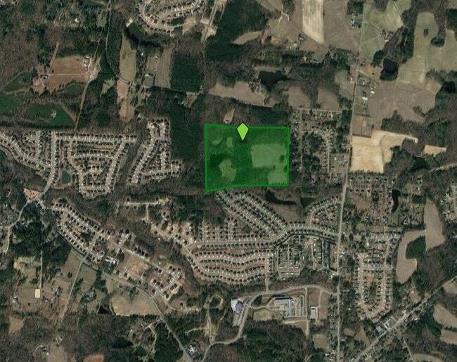
0 Chalk Rd
Raleigh-Cary, NC
Nathan Dunn Lands 01
1759.02-86-6170-000
MONTAGUE LD
Farms
Wake
X
North Carolina
3720175900K
50 AC
2025
Route 1
2025
Raleigh/Durham
054222
DEMOGRAPHICS near 0 Chalk Rd
1 Mile
3 Mile
5 Mile
2024 Total Population
4,826
33,377
84,535
2029 Population
5,340
36,650
92,922
Pop Growth 2024-2029
+ 10.65%
+ 9.81%
+ 9.92%
Average Age
38
39
39
2024 Total Households
1,509
11,107
30,351
HH Growth 2024-2029
+ 10.67%
+ 9.84%
+ 9.96%
Median Household Inc
$159,271
$126,534
$103,741
Avg Household Size
3.20
3.00
2.70
2024 Avg HH Vehicles
2.00
2.00
2.00
Median Home Value
$434,683
$410,056
$363,351
Median Year Built
2010
2009
2006
Nearby Places
Map Layers
Map Styles
 Street
 Aerial
- Restaurants
- Banks
- Shops
- Fitness
- Groceries
PUBLIC TRANSPORTATION
AIRPORT
Raleigh-Durham International
DRIVE
WALK
Distance
Raleigh-Durham International
36 min
25.0 mi
Freight Ports
Virginia Port Authority - Richmond
DRIVE
WALK
Distance
Virginia Port Authority - Richmond
169 min
137.9 mi
Nearby Properties
Address
Land Use
TOTAL SIZE
Lot Size
Zoning
Address
Land Use
TOTAL SIZE
Lot Size
Zoning
340,702 SF
121.26 AC
RM-CZ
Address
Land Use
TOTAL SIZE
Lot Size
Zoning
378,421 SF
19.06 AC
RMX
Address
Land Use
TOTAL SIZE
Lot Size
Zoning
283,870 SF
11.39 AC
RMX
Address
Land Use
TOTAL SIZE
Lot Size
Zoning
263,777 SF
93.84 AC
GR3
Address
Land Use
TOTAL SIZE
Lot Size
Zoning
232,734 SF
57.28 AC
GR3
Address
Land Use
TOTAL SIZE
Lot Size
Zoning
243,797 SF
22.57 AC
GR10
Address
Land Use
TOTAL SIZE
Lot Size
Zoning
225,390 SF
14.95 AC
GR10
Address
Land Use
TOTAL SIZE
Lot Size
Zoning
227,653 SF
10.84 AC
TC
Address
Land Use
TOTAL SIZE
Lot Size
Zoning
162,909 SF
9.84 AC
RMX
Address
Land Use
TOTAL SIZE
Lot Size
Zoning
196,091 SF
37.21 AC
RL
Address
Land Use
TOTAL SIZE
Lot Size
Zoning
100,625 SF
16.39 AC
RL
Address
Land Use
TOTAL SIZE
Lot Size
Zoning
88,053 SF
12.16 AC
GR10
Address
Land Use
TOTAL SIZE
Lot Size
Zoning
101,307 SF
21 AC
HB
Address
Land Use
TOTAL SIZE
Lot Size
Zoning
71,351 SF
9.83 AC
NB
Address
Land Use
TOTAL SIZE
Lot Size
Zoning
74,000 SF
20 AC
R-30
Address
Land Use
TOTAL SIZE
Lot Size
Zoning
47,984 SF
4.44 AC
NB
Address
Land Use
TOTAL SIZE
Lot Size
Zoning
53,707 SF
17.07 AC
RL
Address
Land Use
TOTAL SIZE
Lot Size
Zoning
68,489 SF
7.26 AC
NB
Address
Land Use
TOTAL SIZE
Lot Size
Zoning
45,723 SF
8.96 AC
GC
Address
Land Use
TOTAL SIZE
Lot Size
Zoning
47,262 SF
12.36 AC
GR5
Address
Land Use
TOTAL SIZE
Lot Size
Zoning
75,210 SF
1.78 AC
HB
Address
Land Use
TOTAL SIZE
Lot Size
Zoning
66,801 SF
11.01 AC
RL
Address
Land Use
TOTAL SIZE
Lot Size
Zoning
44,966 SF
7.16 AC
HB
Address
Land Use
TOTAL SIZE
Lot Size
Zoning
58,813 SF
5.46 AC
RMX
Address
Land Use
TOTAL SIZE
Lot Size
Zoning
61,720 SF
7.76 AC
HB
Address
Land Use
TOTAL SIZE
Lot Size
Zoning
43,044 SF
6.78 AC
GC-CZ
Address
Land Use
TOTAL SIZE
Lot Size
Zoning
36,295 SF
5.71 AC
GC
Address
Land Use
TOTAL SIZE
Lot Size
Zoning
46,203 SF
4.68 AC
GC-CZ
Address
Land Use
TOTAL SIZE
Lot Size
Zoning
25,045 SF
4.57 AC
NB
Address
Land Use
TOTAL SIZE
Lot Size
Zoning
18,962 SF
52.06 AC
RL
The World's #1 Commercial Real Estate Marketplace
Connect with us
© 2026 CoStar Group
The information above has been obtained from sources believed reliable. While we do not doubt its accuracy we have not verified it and make no guarantee, warranty or representation about it. It is your responsibility to independently confirm its accuracy and completeness. Any projections, opinions, assumptions, or estimates used are for example only and do not represent the current or future performance of the property. The value of this transaction to you depends on tax and other factors which should be evaluated by your tax, financial, and legal advisors. You and your advisors should conduct a careful, independent investigation of the property to determine to your satisfaction the suitability of the property for your needs.