Property Record
0 Chart Dr, Crosby, TX 77532
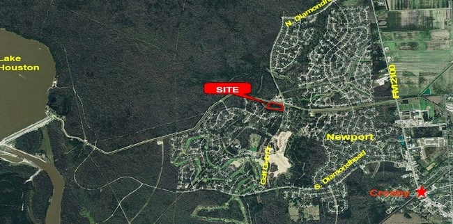

Property Detail
0 Chart Dr
Houston-Pasadena-The Woodlands, TX
TR 1D-1 ABST 838 W WILSON
0451420000139
HARRIS
Vacantlandnec
Texas
B and X Area of moderate flood hazard, usually the area between the limits of the 100-year and 500-year floods.
0.08 AC
2024
Northeast Outlier
2025
Houston
251800
NEARBY LISTINGS FOR SALE OR LEASE
DEMOGRAPHICS near 0 Chart Dr
1 mile
3 mile
5 mile
2025 Total Population
9,574
21,726
44,619
2030 Population
10,359
23,518
48,201
Pop Growth 2025-2030
+ 8.20%
+ 8.25%
+ 8.03%
Average Age
37
36
37
2025 Total Households
3,207
7,386
14,841
HH Growth 2025-2030
+ 8.26%
+ 8.37%
+ 8.18%
Median Household Inc
$108,897
$95,504
$95,515
Avg Household Size
2.90
2.90
3.00
2025 Avg HH Vehicles
3.00
2.00
2.00
Median Home Value
$265,358
$266,677
$286,829
Median Year Built
2004
2001
2003
Nearby Places
Map Layers
Map Styles
 Street
 Aerial
Transit
 Traffic
 Biking
Places
Listings with unknown addresses are not visible on the map
- Restaurants
- Banks
- Shops
- Fitness
- Groceries
PUBLIC TRANSPORTATION
AIRPORT
George Bush Intcntl/Houston
Drive
Walk
Distance
George Bush Intcntl/Houston
43 min
30.3 mi
William P Hobby
Drive
Walk
Distance
William P Hobby
51 min
30.8 mi
Freight Ports
Port of Houston
Drive
Walk
Distance
Port of Houston
38 min
22.8 mi
SALE & LEASE HISTORY
LISTING DATE
SALE/LEASE

Sep 24, 2016
For Sale
Nearby Properties
Address
Land Use
TOTAL SIZE
Lot Size
Zoning
Address
Land Use
TOTAL SIZE
Lot Size
Zoning
160,714 SF
19.36 AC
Address
Land Use
TOTAL SIZE
Lot Size
Zoning
15,697 SF
14.02 AC
Address
Land Use
TOTAL SIZE
Lot Size
Zoning
75,784 SF
2.57 AC
Address
Land Use
TOTAL SIZE
Lot Size
Zoning
58,521 SF
4.42 AC
Address
Land Use
TOTAL SIZE
Lot Size
Zoning
83,709 SF
2.67 AC
Address
Land Use
TOTAL SIZE
Lot Size
Zoning
82,611 SF
5.06 AC
Address
Land Use
TOTAL SIZE
Lot Size
Zoning
10,672 SF
1.10 AC
Address
Land Use
TOTAL SIZE
Lot Size
Zoning
28,050 SF
3.08 AC
Address
Land Use
TOTAL SIZE
Lot Size
Zoning
59,125 SF
6.72 AC
Address
Land Use
TOTAL SIZE
Lot Size
Zoning
82,060 SF
108.44 AC
Address
Land Use
TOTAL SIZE
Lot Size
Zoning
88,896 SF
17.69 AC
Address
Land Use
TOTAL SIZE
Lot Size
Zoning
65,124 SF
1.50 AC
Address
Land Use
TOTAL SIZE
Lot Size
Zoning
26,564 SF
4.20 AC
Address
Land Use
TOTAL SIZE
Lot Size
Zoning
77,278 SF
3.89 AC
Address
Land Use
TOTAL SIZE
Lot Size
Zoning
34,004 SF
3.04 AC
Address
Land Use
TOTAL SIZE
Lot Size
Zoning
131,390 SF
9.79 AC
Address
Land Use
TOTAL SIZE
Lot Size
Zoning
55,142 SF
3.94 AC
Address
Land Use
TOTAL SIZE
Lot Size
Zoning
9,840 SF
7.99 AC
Address
Land Use
TOTAL SIZE
Lot Size
Zoning
49,048 SF
5.91 AC
Address
Land Use
TOTAL SIZE
Lot Size
Zoning
1,879.93 AC
Address
Land Use
TOTAL SIZE
Lot Size
Zoning
19,807 SF
3.91 AC
Address
Land Use
TOTAL SIZE
Lot Size
Zoning
17,034 SF
2.88 AC
Address
Land Use
TOTAL SIZE
Lot Size
Zoning
46,774 SF
6.73 AC
Address
Land Use
TOTAL SIZE
Lot Size
Zoning
14,290 SF
2.86 AC
Address
Land Use
TOTAL SIZE
Lot Size
Zoning
26,950 SF
6.07 AC
Address
Land Use
TOTAL SIZE
Lot Size
Zoning
88,057 SF
10 AC
Address
Land Use
TOTAL SIZE
Lot Size
Zoning
31,725 SF
4.81 AC
Address
Land Use
TOTAL SIZE
Lot Size
Zoning
28,100 SF
0.86 AC
Address
Land Use
TOTAL SIZE
Lot Size
Zoning
19,152 SF
1.59 AC
Address
Land Use
TOTAL SIZE
Lot Size
Zoning
5,268 SF
1.69 AC
The World's #1 Commercial Real Estate Marketplace
Connect with us
© 2026 CoStar Group
The information above has been obtained from sources believed reliable. While we do not doubt its accuracy we have not verified it and make no guarantee, warranty or representation about it. It is your responsibility to independently confirm its accuracy and completeness. Any projections, opinions, assumptions, or estimates used are for example only and do not represent the current or future performance of the property. The value of this transaction to you depends on tax and other factors which should be evaluated by your tax, financial, and legal advisors. You and your advisors should conduct a careful, independent investigation of the property to determine to your satisfaction the suitability of the property for your needs.