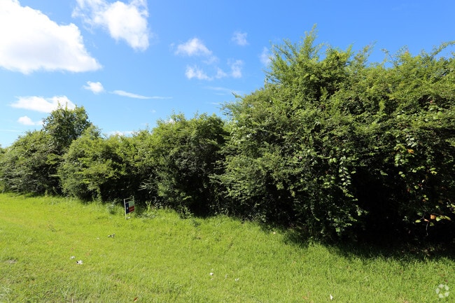
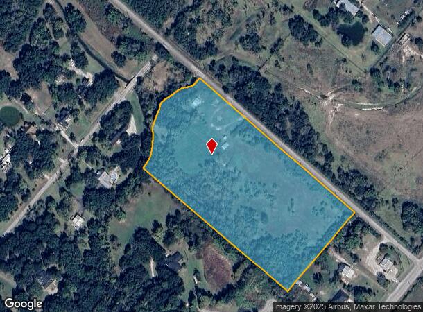
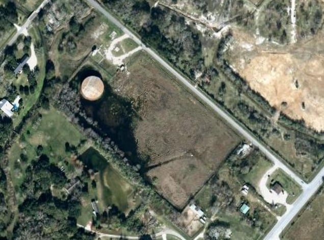
Property Record
Chocolate Bayou Rd, Manvel, TX 77578
NEARBY LISTINGS FOR SALE OR LEASE
Property Detail
Chocolate Bayou Rd
0319-0093-000
H N Little
Farms
A0319 H N LITTLE BLOCK E TRACT 43-44 ACRES 12.096
AE
Brazoria
48039C0040K
Texas
2024
12.10 AC
2025
South
660708
Houston
875 SF
Houston-The Woodlands-Sugar Land, TX
DEMOGRAPHICS near Chocolate Bayou Rd
1 Mile
3 Mile
5 Mile
2024 Total Population
501
22,870
94,443
2029 Population
568
25,595
105,226
Pop Growth 2024-2029
+ 13.37%
+ 11.92%
+ 11.42%
Average Age
38
37
36
2024 Total Households
171
7,531
30,557
HH Growth 2024-2029
+ 13.45%
+ 12.16%
+ 11.51%
Median Household Inc
$106,818
$112,134
$106,964
Avg Household Size
2.90
3.00
3.00
2024 Avg HH Vehicles
2.00
2.00
2.00
Median Home Value
$337,301
$320,189
$312,639
Median Year Built
2010
2003
2003
Nearby Places
Map Layers
Map Styles
 Street
 Aerial
- Restaurants
- Banks
- Shops
- Fitness
- Groceries
PUBLIC TRANSPORTATION
AIRPORT
William P Hobby
DRIVE
WALK
Distance
William P Hobby
26 min
13.3 mi
Freight Ports
Port of Houston
DRIVE
WALK
Distance
Port of Houston
37 min
21.5 mi
SALE & LEASE HISTORY
LISTING DATE
SALE/LEASE

Jul 27, 2017
For Sale
Aug 01, 2017
For Sale
Nearby Properties
Address
Land Use
TOTAL SIZE
Lot Size
Zoning
Address
Land Use
TOTAL SIZE
Lot Size
Zoning
114.04 AC
Address
Land Use
TOTAL SIZE
Lot Size
Zoning
120,380 SF
15.56 AC
Address
Land Use
TOTAL SIZE
Lot Size
Zoning
93,990 SF
15.73 AC
Address
Land Use
TOTAL SIZE
Lot Size
Zoning
21.99 AC
0258
Address
Land Use
TOTAL SIZE
Lot Size
Zoning
70,033 SF
17.97 AC
Address
Land Use
TOTAL SIZE
Lot Size
Zoning
17.17 AC
Address
Land Use
TOTAL SIZE
Lot Size
Zoning
46,732 SF
8.64 AC
0752
Address
Land Use
TOTAL SIZE
Lot Size
Zoning
44,735 SF
120.87 AC
0010
Address
Land Use
TOTAL SIZE
Lot Size
Zoning
28,143 SF
13.08 AC
Address
Land Use
TOTAL SIZE
Lot Size
Zoning
125,723 SF
2.63 AC
Address
Land Use
TOTAL SIZE
Lot Size
Zoning
3,159 SF
64.95 AC
0227
Address
Land Use
TOTAL SIZE
Lot Size
Zoning
15,762 SF
1.66 AC
Address
Land Use
TOTAL SIZE
Lot Size
Zoning
4,290 SF
38.48 AC
Address
Land Use
TOTAL SIZE
Lot Size
Zoning
11,302 SF
1.69 AC
Address
Land Use
TOTAL SIZE
Lot Size
Zoning
21,300 SF
12.92 AC
Address
Land Use
TOTAL SIZE
Lot Size
Zoning
48,750 SF
2.82 AC
Address
Land Use
TOTAL SIZE
Lot Size
Zoning
11,628 SF
1.86 AC
0009
Address
Land Use
TOTAL SIZE
Lot Size
Zoning
14,500 SF
2.39 AC
Address
Land Use
TOTAL SIZE
Lot Size
Zoning
14,885 SF
2.10 AC
Address
Land Use
TOTAL SIZE
Lot Size
Zoning
50,400 SF
8.40 AC
0013
Address
Land Use
TOTAL SIZE
Lot Size
Zoning
34,250 SF
6.67 AC
Address
Land Use
TOTAL SIZE
Lot Size
Zoning
14,768 SF
1.30 AC
Address
Land Use
TOTAL SIZE
Lot Size
Zoning
12,240 SF
1.46 AC
0240
Address
Land Use
TOTAL SIZE
Lot Size
Zoning
136.01 AC
0003
Address
Land Use
TOTAL SIZE
Lot Size
Zoning
14,808 SF
1.64 AC
Address
Land Use
TOTAL SIZE
Lot Size
Zoning
128.92 AC
0028
Address
Land Use
TOTAL SIZE
Lot Size
Zoning
9,020 SF
3.12 AC
Address
Land Use
TOTAL SIZE
Lot Size
Zoning
25,200 SF
5.08 AC
Address
Land Use
TOTAL SIZE
Lot Size
Zoning
54.73 AC
0008
Address
Land Use
TOTAL SIZE
Lot Size
Zoning
36,684 SF
1.47 AC
The World's #1 Commercial Real Estate Marketplace
Connect with us
© 2025 CoStar Group
The information above has been obtained from sources believed reliable. While we do not doubt its accuracy we have not verified it and make no guarantee, warranty or representation about it. It is your responsibility to independently confirm its accuracy and completeness. Any projections, opinions, assumptions, or estimates used are for example only and do not represent the current or future performance of the property. The value of this transaction to you depends on tax and other factors which should be evaluated by your tax, financial, and legal advisors. You and your advisors should conduct a careful, independent investigation of the property to determine to your satisfaction the suitability of the property for your needs.