Property Record
0 Cole Rd, Bryan, OH 43506
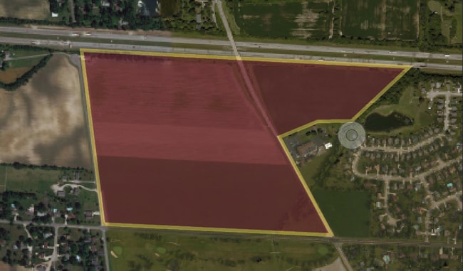
This Property Is For Sale
Property Detail
0 Cole Rd
Columbus, OH
00000 COLE ROAD 34. ACRES O Q 2000 ENTRY 3445
120-000146
FRANKLIN
Agriculturalland
Ohio
AE The base floodplain where base flood elevations are provided. AE Zones are now used on new format FIRMs instead of A1-A30 Zones.
10 AC
2024
Southwest
2025
Columbus
008001
NEARBY LISTINGS FOR SALE OR LEASE
DEMOGRAPHICS near 0 Cole Rd
1 mile
3 mile
5 mile
2025 Total Population
4,468
56,754
141,304
2030 Population
4,627
57,924
144,814
Pop Growth 2025-2030
+ 3.56%
+ 2.06%
+ 2.48%
Average Age
37
36
36
2025 Total Households
1,742
22,080
54,788
HH Growth 2025-2030
+ 3.62%
+ 2.16%
+ 2.58%
Median Household Inc
$106,392
$90,607
$81,573
Avg Household Size
2.50
2.50
2.50
2025 Avg HH Vehicles
2.00
2.00
2.00
Median Home Value
$346,505
$303,929
$288,491
Median Year Built
1994
1995
1991
Nearby Places
Map Layers
Map Styles
 Street
 Aerial
Transit
 Traffic
 Biking
Places
Listings with unknown addresses are not visible on the map
- Restaurants
- Banks
- Shops
- Fitness
- Groceries
PUBLIC TRANSPORTATION
AIRPORT
John Glenn Columbus International
Drive
Walk
Distance
John Glenn Columbus International
24 min
17.1 mi
Rickenbacker International
Drive
Walk
Distance
Rickenbacker International
30 min
21.8 mi
Freight Ports
Port of Toledo
Drive
Walk
Distance
Port of Toledo
184 min
133.0 mi
Nearby Properties
Address
Land Use
TOTAL SIZE
Lot Size
Zoning
Address
Land Use
TOTAL SIZE
Lot Size
Zoning
417,762 SF
119.53 AC
Address
Land Use
TOTAL SIZE
Lot Size
Zoning
269,165 SF
7 AC
Address
Land Use
TOTAL SIZE
Lot Size
Zoning
538,680 SF
32.49 AC
Address
Land Use
TOTAL SIZE
Lot Size
Zoning
155,280 SF
0.23 AC
Address
Land Use
TOTAL SIZE
Lot Size
Zoning
566,334 SF
58.62 AC
Address
Land Use
TOTAL SIZE
Lot Size
Zoning
25,368 SF
27.23 AC
Address
Land Use
TOTAL SIZE
Lot Size
Zoning
96,602 SF
0.21 AC
Address
Land Use
TOTAL SIZE
Lot Size
Zoning
293,744 SF
20.12 AC
Address
Land Use
TOTAL SIZE
Lot Size
Zoning
157,875 SF
0.19 AC
Address
Land Use
TOTAL SIZE
Lot Size
Zoning
62,400 SF
9.02 AC
Address
Land Use
TOTAL SIZE
Lot Size
Zoning
40,500 SF
20.91 AC
Address
Land Use
TOTAL SIZE
Lot Size
Zoning
131,116 SF
15.30 AC
Address
Land Use
TOTAL SIZE
Lot Size
Zoning
149,424 SF
39.15 AC
Address
Land Use
TOTAL SIZE
Lot Size
Zoning
72,320 SF
2.52 AC
Address
Land Use
TOTAL SIZE
Lot Size
Zoning
67,133 SF
16.67 AC
Address
Land Use
TOTAL SIZE
Lot Size
Zoning
249,644 SF
7.15 AC
Address
Land Use
TOTAL SIZE
Lot Size
Zoning
55,758 SF
7.83 AC
Address
Land Use
TOTAL SIZE
Lot Size
Zoning
121,403 SF
50.93 AC
Address
Land Use
TOTAL SIZE
Lot Size
Zoning
204,787 SF
11.88 AC
Address
Land Use
TOTAL SIZE
Lot Size
Zoning
199,790 SF
25.99 AC
Address
Land Use
TOTAL SIZE
Lot Size
Zoning
107,468 SF
16.05 AC
Address
Land Use
TOTAL SIZE
Lot Size
Zoning
125.87 AC
Address
Land Use
TOTAL SIZE
Lot Size
Zoning
81,516 SF
15.16 AC
Address
Land Use
TOTAL SIZE
Lot Size
Zoning
465,256 SF
21.58 AC
Address
Land Use
TOTAL SIZE
Lot Size
Zoning
75,856 SF
274.12 AC
Address
Land Use
TOTAL SIZE
Lot Size
Zoning
78,657 SF
19.41 AC
Address
Land Use
TOTAL SIZE
Lot Size
Zoning
114,040 SF
16.32 AC
Address
Land Use
TOTAL SIZE
Lot Size
Zoning
210,584 SF
24.58 AC
Address
Land Use
TOTAL SIZE
Lot Size
Zoning
117,722 SF
13.71 AC
Address
Land Use
TOTAL SIZE
Lot Size
Zoning
85,047 SF
17.34 AC
The World's #1 Commercial Real Estate Marketplace
Connect with us
© 2026 CoStar Group
The information above has been obtained from sources believed reliable. While we do not doubt its accuracy we have not verified it and make no guarantee, warranty or representation about it. It is your responsibility to independently confirm its accuracy and completeness. Any projections, opinions, assumptions, or estimates used are for example only and do not represent the current or future performance of the property. The value of this transaction to you depends on tax and other factors which should be evaluated by your tax, financial, and legal advisors. You and your advisors should conduct a careful, independent investigation of the property to determine to your satisfaction the suitability of the property for your needs.