Property Record
0 Dames Point Crossing Blvd, Jacksonville, FL 32277

Property Detail
0 Dames Point Crossing Blvd
Jacksonville, FL
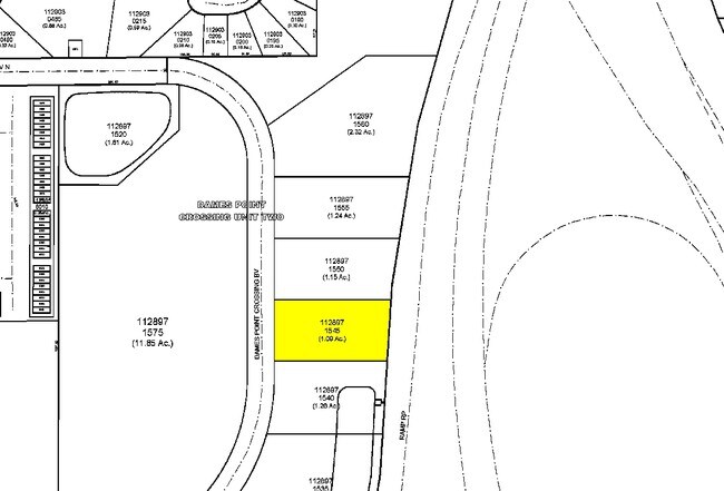
57-15 1-2S-27E .519 DAMES POINT CROSSING UNIT 02 LOT 4(EX PT RECD O/RS 12104-831, 13971-52)
112897-1545
DUVAL
Commercialacreage
Florida
PUD
4
B and X Area of moderate flood hazard, usually the area between the limits of the 100-year and 500-year floods.
0.52 AC
2025
Arlington
2026
Jacksonville (Florida)
014901
NEARBY LISTINGS FOR SALE OR LEASE
DEMOGRAPHICS near 0 Dames Point Crossing Blvd
1 mile
3 mile
5 mile
2025 Total Population
10,892
77,933
171,192
2030 Population
11,499
82,299
180,545
Pop Growth 2025-2030
+ 5.57%
+ 5.60%
+ 5.46%
Average Age
38
37
38
2025 Total Households
4,167
30,409
67,219
HH Growth 2025-2030
+ 5.83%
+ 5.92%
+ 5.77%
Median Household Inc
$75,201
$58,405
$65,114
Avg Household Size
2.50
2.40
2.50
2025 Avg HH Vehicles
2.00
2.00
2.00
Median Home Value
$293,993
$268,113
$293,237
Median Year Built
1993
1978
1982
Nearby Places
Map Layers
Map Styles
 Street
 Aerial
Layers
 Traffic
 Biking
Places
Listings with unknown addresses are not visible on the map
- Restaurants
- Banks
- Shops
- Fitness
- Groceries
PUBLIC TRANSPORTATION
AIRPORT
Jacksonville International
Drive
Walk
Distance
Jacksonville International
26 min
16.1 mi
Freight Ports
Jacksonville Port
Drive
Walk
Distance
Jacksonville Port
19 min
10.4 mi
Nearby Properties
Address
Land Use
TOTAL SIZE
Lot Size
Zoning
Address
Land Use
TOTAL SIZE
Lot Size
Zoning
181,827 SF
269.11 AC
IW
Address
Land Use
TOTAL SIZE
Lot Size
Zoning
327,165 SF
25 AC
RMD-D
Address
Land Use
TOTAL SIZE
Lot Size
Zoning
557,032 SF
40.06 AC
PUD
Address
Land Use
TOTAL SIZE
Lot Size
Zoning
471,372 SF
1,067.68 AC
PUD
Address
Land Use
TOTAL SIZE
Lot Size
Zoning
308,517 SF
19.55 AC
PUD
Address
Land Use
TOTAL SIZE
Lot Size
Zoning
323,318 SF
19.24 AC
PUD
Address
Land Use
TOTAL SIZE
Lot Size
Zoning
321,335 SF
19.83 AC
RMD-D
Address
Land Use
TOTAL SIZE
Lot Size
Zoning
394,122 SF
17.19 AC
RMD-D
Address
Land Use
TOTAL SIZE
Lot Size
Zoning
300,360 SF
14.44 AC
RMD-C
Address
Land Use
TOTAL SIZE
Lot Size
Zoning
232,520 SF
12.37 AC
RMD-D
Address
Land Use
TOTAL SIZE
Lot Size
Zoning
328,457 SF
23.99 AC
RMD-D
Address
Land Use
TOTAL SIZE
Lot Size
Zoning
184,221 SF
12.05 AC
PUD
Address
Land Use
TOTAL SIZE
Lot Size
Zoning
210,913 SF
10.32 AC
PUD
Address
Land Use
TOTAL SIZE
Lot Size
Zoning
210,829 SF
11.84 AC
RMD-D
Address
Land Use
TOTAL SIZE
Lot Size
Zoning
154,382 SF
8.67 AC
RMD-D
Address
Land Use
TOTAL SIZE
Lot Size
Zoning
166,588 SF
10.40 AC
RMD-D
Address
Land Use
TOTAL SIZE
Lot Size
Zoning
164,330 SF
9.04 AC
PUD
Address
Land Use
TOTAL SIZE
Lot Size
Zoning
222,235 SF
14.58 AC
RMD-D
Address
Land Use
TOTAL SIZE
Lot Size
Zoning
125,088 SF
6.62 AC
RMD-D
Address
Land Use
TOTAL SIZE
Lot Size
Zoning
245,531 SF
17.37 AC
CCG-1
Address
Land Use
TOTAL SIZE
Lot Size
Zoning
229,298 SF
11.74 AC
RMD-D
Address
Land Use
TOTAL SIZE
Lot Size
Zoning
252,229 SF
10.74 AC
RMD-D
Address
Land Use
TOTAL SIZE
Lot Size
Zoning
180,180 SF
11.06 AC
CRO
Address
Land Use
TOTAL SIZE
Lot Size
Zoning
116,814 SF
11.77 AC
RMD-D
Address
Land Use
TOTAL SIZE
Lot Size
Zoning
180,528 SF
10.57 AC
RMD-D
Address
Land Use
TOTAL SIZE
Lot Size
Zoning
104,472 SF
62.78 AC
IW
Address
Land Use
TOTAL SIZE
Lot Size
Zoning
98,760 SF
5.66 AC
RMD-D
Address
Land Use
TOTAL SIZE
Lot Size
Zoning
156,969 SF
15.27 AC
RMD-D
Address
Land Use
TOTAL SIZE
Lot Size
Zoning
382,055 SF
28.81 AC
CCG-1
Address
Land Use
TOTAL SIZE
Lot Size
Zoning
222,904 SF
17.32 AC
PUD
The World's #1 Commercial Real Estate Marketplace
Connect with us
© 2026 CoStar Group
The information above has been obtained from sources believed reliable. While we do not doubt its accuracy we have not verified it and make no guarantee, warranty or representation about it. It is your responsibility to independently confirm its accuracy and completeness. Any projections, opinions, assumptions, or estimates used are for example only and do not represent the current or future performance of the property. The value of this transaction to you depends on tax and other factors which should be evaluated by your tax, financial, and legal advisors. You and your advisors should conduct a careful, independent investigation of the property to determine to your satisfaction the suitability of the property for your needs.