Property Record
0 Dixie Dr, Houston, TX 77087

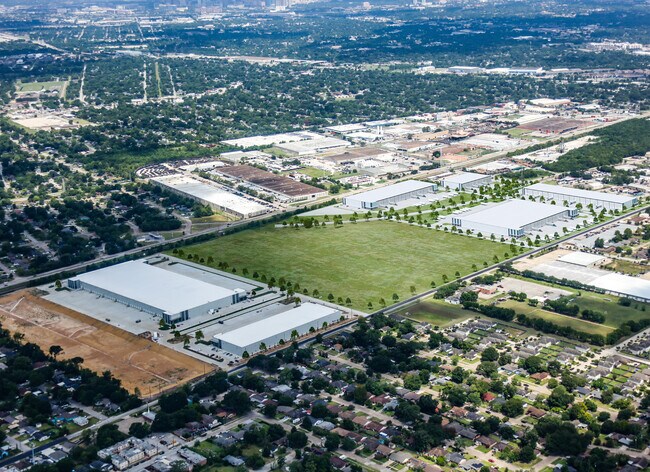
Property Detail
0 Dixie Dr
Houston-Pasadena-The Woodlands, TX
RES A BLK 1 MYKAWA BUSINESS PARK SEC 2
1452380010001
HARRIS
Agriculturalland
Texas
2024
13.75 AC
2025
South
332800
Houston
NEARBY LISTINGS FOR SALE OR LEASE
DEMOGRAPHICS near 0 Dixie Dr
1 mile
3 mile
5 mile
2025 Total Population
13,491
141,248
350,005
2030 Population
14,299
151,777
376,759
Pop Growth 2025-2030
+ 5.99%
+ 7.45%
+ 7.64%
Average Age
39
37
37
2025 Total Households
4,263
48,737
126,167
HH Growth 2025-2030
+ 6.15%
+ 7.79%
+ 8.11%
Median Household Inc
$44,885
$44,605
$50,314
Avg Household Size
3.10
2.80
2.60
2025 Avg HH Vehicles
2.00
2.00
2.00
Median Home Value
$152,475
$183,905
$213,184
Median Year Built
1958
1965
1970
Nearby Places
Map Layers
Map Styles
 Street
 Aerial
Transit
 Traffic
 Biking
Places
Listings with unknown addresses are not visible on the map
- Restaurants
- Banks
- Shops
- Fitness
- Groceries
PUBLIC TRANSPORTATION
COMMUTER RAIL
Houston (Sunset Limited - Amtrak)
Drive
Walk
Distance
Houston (Sunset Limited - Amtrak)
14 min
8.5 mi
AIRPORT
William P Hobby
Drive
Walk
Distance
William P Hobby
15 min
6.5 mi
George Bush Intcntl/Houston
Drive
Walk
Distance
George Bush Intcntl/Houston
37 min
25.6 mi
Freight Ports
Port of Houston
Drive
Walk
Distance
Port of Houston
15 min
8.0 mi
SALE & LEASE HISTORY
LISTING DATE
SALE/LEASE

Oct 31, 2019
For Sale
Feb 26, 2021
For Sale
Nearby Properties
Address
Land Use
TOTAL SIZE
Lot Size
Zoning
Address
Land Use
TOTAL SIZE
Lot Size
Zoning
453,987 SF
4.33 AC
Address
Land Use
TOTAL SIZE
Lot Size
Zoning
403,242 SF
46.18 AC
Address
Land Use
TOTAL SIZE
Lot Size
Zoning
1,171,276 SF
44.19 AC
Address
Land Use
TOTAL SIZE
Lot Size
Zoning
159,235 SF
1.49 AC
Address
Land Use
TOTAL SIZE
Lot Size
Zoning
310,171 SF
2.35 AC
Address
Land Use
TOTAL SIZE
Lot Size
Zoning
389,108 SF
37.39 AC
Address
Land Use
TOTAL SIZE
Lot Size
Zoning
198,023 SF
17.87 AC
Address
Land Use
TOTAL SIZE
Lot Size
Zoning
419,760 SF
15.27 AC
Address
Land Use
TOTAL SIZE
Lot Size
Zoning
556,568 SF
20 AC
Address
Land Use
TOTAL SIZE
Lot Size
Zoning
232,915 SF
7.89 AC
Address
Land Use
TOTAL SIZE
Lot Size
Zoning
228,886 SF
1.85 AC
Address
Land Use
TOTAL SIZE
Lot Size
Zoning
267,844 SF
10.98 AC
Address
Land Use
TOTAL SIZE
Lot Size
Zoning
194,296 SF
15.13 AC
Address
Land Use
TOTAL SIZE
Lot Size
Zoning
196,000 SF
29.42 AC
Address
Land Use
TOTAL SIZE
Lot Size
Zoning
239,458 SF
15.57 AC
Address
Land Use
TOTAL SIZE
Lot Size
Zoning
210,476 SF
9.60 AC
Address
Land Use
TOTAL SIZE
Lot Size
Zoning
353,676 SF
19.86 AC
Address
Land Use
TOTAL SIZE
Lot Size
Zoning
284,290 SF
20 AC
Address
Land Use
TOTAL SIZE
Lot Size
Zoning
433,760 SF
52.70 AC
Address
Land Use
TOTAL SIZE
Lot Size
Zoning
113,688 SF
4 AC
Address
Land Use
TOTAL SIZE
Lot Size
Zoning
257,481 SF
9.28 AC
Address
Land Use
TOTAL SIZE
Lot Size
Zoning
244,134 SF
9.44 AC
Address
Land Use
TOTAL SIZE
Lot Size
Zoning
100,458 SF
8.54 AC
Address
Land Use
TOTAL SIZE
Lot Size
Zoning
54,077 SF
5.06 AC
Address
Land Use
TOTAL SIZE
Lot Size
Zoning
44,327 SF
5.40 AC
Address
Land Use
TOTAL SIZE
Lot Size
Zoning
126,000 SF
1.51 AC
Address
Land Use
TOTAL SIZE
Lot Size
Zoning
445,535 SF
36.94 AC
Address
Land Use
TOTAL SIZE
Lot Size
Zoning
241,219 SF
8.92 AC
Address
Land Use
TOTAL SIZE
Lot Size
Zoning
177,406 SF
10.86 AC
Address
Land Use
TOTAL SIZE
Lot Size
Zoning
215,004 SF
7.76 AC
The World's #1 Commercial Real Estate Marketplace
Connect with us
© 2026 CoStar Group
The information above has been obtained from sources believed reliable. While we do not doubt its accuracy we have not verified it and make no guarantee, warranty or representation about it. It is your responsibility to independently confirm its accuracy and completeness. Any projections, opinions, assumptions, or estimates used are for example only and do not represent the current or future performance of the property. The value of this transaction to you depends on tax and other factors which should be evaluated by your tax, financial, and legal advisors. You and your advisors should conduct a careful, independent investigation of the property to determine to your satisfaction the suitability of the property for your needs.