Property Record
Heideke St, , TX

Property Detail
Heideke St
San Antonio-New Braunfels, TX
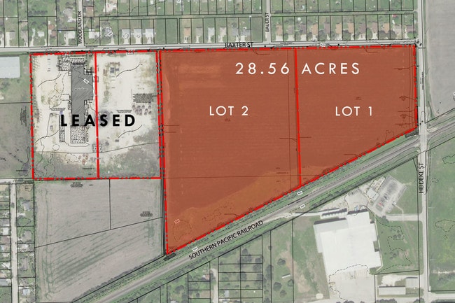
LOT: 1 BLK: ADDN: VITA FOAM SUB 8.5190 AC.
1G3412-0000-00100-0-00
GUADALUPE
Commercialnec
Texas
B and X Area of moderate flood hazard, usually the area between the limits of the 100-year and 500-year floods.
1
2024
8.52 AC
2025
Guadalupe County
000021
San Antonio
22,750 SF
NEARBY LISTINGS FOR SALE OR LEASE
DEMOGRAPHICS near Heideke St
1 mile
3 mile
5 mile
2025 Total Population
6,961
31,802
47,769
2030 Population
7,835
35,964
54,151
Pop Growth 2025-2030
+ 12.56%
+ 13.09%
+ 13.36%
Average Age
38
40
40
2025 Total Households
2,389
11,476
17,540
HH Growth 2025-2030
+ 13.14%
+ 13.72%
+ 13.99%
Median Household Inc
$60,557
$67,805
$73,357
Avg Household Size
2.80
2.60
2.60
2025 Avg HH Vehicles
2.00
2.00
2.00
Median Home Value
$186,059
$253,483
$285,602
Median Year Built
1976
1990
1994
Nearby Places
Map Layers
Map Styles
 Street
 Aerial
Transit
 Traffic
 Biking
Places
Listings with unknown addresses are not visible on the map
- Restaurants
- Banks
- Shops
- Fitness
- Groceries
SALE & LEASE HISTORY
LISTING DATE
SALE/LEASE

May 02, 2018
For Lease
May 02, 2018
For Sale
Nearby Properties
Address
Land Use
TOTAL SIZE
Lot Size
Zoning
Address
Land Use
TOTAL SIZE
Lot Size
Zoning
Address
Land Use
TOTAL SIZE
Lot Size
Zoning
470,871 SF
32 AC
Address
Land Use
TOTAL SIZE
Lot Size
Zoning
383,395 SF
19.68 AC
Address
Land Use
TOTAL SIZE
Lot Size
Zoning
Address
Land Use
TOTAL SIZE
Lot Size
Zoning
274,059 SF
40.33 AC
Address
Land Use
TOTAL SIZE
Lot Size
Zoning
556,920 SF
Address
Land Use
TOTAL SIZE
Lot Size
Zoning
Address
Land Use
TOTAL SIZE
Lot Size
Zoning
Address
Land Use
TOTAL SIZE
Lot Size
Zoning
Address
Land Use
TOTAL SIZE
Lot Size
Zoning
Address
Land Use
TOTAL SIZE
Lot Size
Zoning
128,297 SF
27.46 AC
Address
Land Use
TOTAL SIZE
Lot Size
Zoning
165,226 SF
6.18 AC
Address
Land Use
TOTAL SIZE
Lot Size
Zoning
1,120 SF
126 AC
Address
Land Use
TOTAL SIZE
Lot Size
Zoning
Address
Land Use
TOTAL SIZE
Lot Size
Zoning
58,255 SF
3.99 AC
Address
Land Use
TOTAL SIZE
Lot Size
Zoning
224,300 SF
15.42 AC
Address
Land Use
TOTAL SIZE
Lot Size
Zoning
44,883 SF
2.62 AC
Address
Land Use
TOTAL SIZE
Lot Size
Zoning
58,250 SF
15 AC
Address
Land Use
TOTAL SIZE
Lot Size
Zoning
55,300 SF
0.92 AC
Address
Land Use
TOTAL SIZE
Lot Size
Zoning
79,756 SF
11 AC
Address
Land Use
TOTAL SIZE
Lot Size
Zoning
152,124 SF
27.50 AC
Address
Land Use
TOTAL SIZE
Lot Size
Zoning
52,867 SF
16.49 AC
Address
Land Use
TOTAL SIZE
Lot Size
Zoning
61,375 SF
15 AC
Address
Land Use
TOTAL SIZE
Lot Size
Zoning
531 AC
Address
Land Use
TOTAL SIZE
Lot Size
Zoning
97,744 SF
20.08 AC
Address
Land Use
TOTAL SIZE
Lot Size
Zoning
225,660 SF
28.55 AC
Address
Land Use
TOTAL SIZE
Lot Size
Zoning
Address
Land Use
TOTAL SIZE
Lot Size
Zoning
88,244 SF
99.07 AC
Address
Land Use
TOTAL SIZE
Lot Size
Zoning
116,197 SF
12.70 AC
Address
Land Use
TOTAL SIZE
Lot Size
Zoning
100,960 SF
7.61 AC
The World's #1 Commercial Real Estate Marketplace
Connect with us
© 2026 CoStar Group
The information above has been obtained from sources believed reliable. While we do not doubt its accuracy we have not verified it and make no guarantee, warranty or representation about it. It is your responsibility to independently confirm its accuracy and completeness. Any projections, opinions, assumptions, or estimates used are for example only and do not represent the current or future performance of the property. The value of this transaction to you depends on tax and other factors which should be evaluated by your tax, financial, and legal advisors. You and your advisors should conduct a careful, independent investigation of the property to determine to your satisfaction the suitability of the property for your needs.