Property Record
E Of Freeport St, Saxonburg, PA 16056
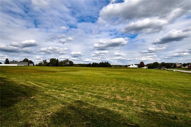
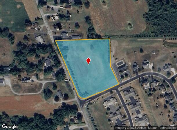
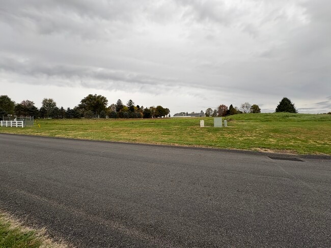
This Property Is For Sale
Current Lease Availabilities
NEARBY LISTINGS FOR SALE OR LEASE
Property Detail
E Of Freeport St
Pittsburgh, PA
Plantation Saxonburg
100-S6-AA-0000
6.512 ACS
Vacantlandnec
Butler
X
Pennsylvania
42019C0560D
6.51 AC
2025
Butler County
2025
Pittsburgh
911502
DEMOGRAPHICS near E Of Freeport St
1 Mile
3 Mile
5 Mile
2024 Total Population
1,343
8,427
17,643
2029 Population
1,350
8,570
18,013
Pop Growth 2024-2029
+ 0.52%
+ 1.70%
+ 2.10%
Average Age
47
46
45
2024 Total Households
598
3,468
7,043
HH Growth 2024-2029
0.00%
+ 1.53%
+ 2.07%
Median Household Inc
$58,888
$67,965
$73,380
Avg Household Size
2.20
2.30
2.40
2024 Avg HH Vehicles
2.00
2.00
2.00
Median Home Value
$227,778
$239,088
$252,003
Median Year Built
1978
1981
1979
Nearby Places
- Restaurants
- Banks
- Shops
- Fitness
- Groceries
PUBLIC TRANSPORTATION
AIRPORT
Pittsburgh International
DRIVE
WALK
Distance
Pittsburgh International
69 min
38.9 mi
Freight Ports
Port of Baltimore
DRIVE
WALK
Distance
Port of Baltimore
312 min
263.6 mi
Nearby Properties
Address
Land Use
TOTAL SIZE
Lot Size
Zoning
Address
Land Use
TOTAL SIZE
Lot Size
Zoning
99.35 AC
Address
Land Use
TOTAL SIZE
Lot Size
Zoning
70.60 AC
Address
Land Use
TOTAL SIZE
Lot Size
Zoning
56.87 AC
Address
Land Use
TOTAL SIZE
Lot Size
Zoning
40.67 AC
Address
Land Use
TOTAL SIZE
Lot Size
Zoning
110.70 AC
Address
Land Use
TOTAL SIZE
Lot Size
Zoning
Address
Land Use
TOTAL SIZE
Lot Size
Zoning
40.57 AC
Address
Land Use
TOTAL SIZE
Lot Size
Zoning
Address
Land Use
TOTAL SIZE
Lot Size
Zoning
Address
Land Use
TOTAL SIZE
Lot Size
Zoning
Address
Land Use
TOTAL SIZE
Lot Size
Zoning
6.07 AC
Address
Land Use
TOTAL SIZE
Lot Size
Zoning
11.57 AC
Address
Land Use
TOTAL SIZE
Lot Size
Zoning
10.17 AC
Address
Land Use
TOTAL SIZE
Lot Size
Zoning
19.90 AC
Address
Land Use
TOTAL SIZE
Lot Size
Zoning
12.51 AC
Address
Land Use
TOTAL SIZE
Lot Size
Zoning
11.11 AC
Address
Land Use
TOTAL SIZE
Lot Size
Zoning
10.87 AC
Address
Land Use
TOTAL SIZE
Lot Size
Zoning
22.60 AC
Address
Land Use
TOTAL SIZE
Lot Size
Zoning
Address
Land Use
TOTAL SIZE
Lot Size
Zoning
33.06 AC
Address
Land Use
TOTAL SIZE
Lot Size
Zoning
6.05 AC
Address
Land Use
TOTAL SIZE
Lot Size
Zoning
Address
Land Use
TOTAL SIZE
Lot Size
Zoning
1.64 AC
Address
Land Use
TOTAL SIZE
Lot Size
Zoning
111.44 AC
Address
Land Use
TOTAL SIZE
Lot Size
Zoning
4.42 AC
Address
Land Use
TOTAL SIZE
Lot Size
Zoning
2.25 AC
Address
Land Use
TOTAL SIZE
Lot Size
Zoning
6.98 AC
Address
Land Use
TOTAL SIZE
Lot Size
Zoning
3.15 AC
Address
Land Use
TOTAL SIZE
Lot Size
Zoning
Address
Land Use
TOTAL SIZE
Lot Size
Zoning
5.36 AC
The World's #1 Commercial Real Estate Marketplace
Connect with us
© 2025 CoStar Group
The information above has been obtained from sources believed reliable. While we do not doubt its accuracy we have not verified it and make no guarantee, warranty or representation about it. It is your responsibility to independently confirm its accuracy and completeness. Any projections, opinions, assumptions, or estimates used are for example only and do not represent the current or future performance of the property. The value of this transaction to you depends on tax and other factors which should be evaluated by your tax, financial, and legal advisors. You and your advisors should conduct a careful, independent investigation of the property to determine to your satisfaction the suitability of the property for your needs.