Property Record
0 E Unknown Ave, Spokane Valley, WA 99212
NEARBY LISTINGS FOR SALE OR LEASE
Property Detail
0 E Unknown Ave
Spokane-Spokane Valley, WA
City Of Spokane Valley
35124.2005
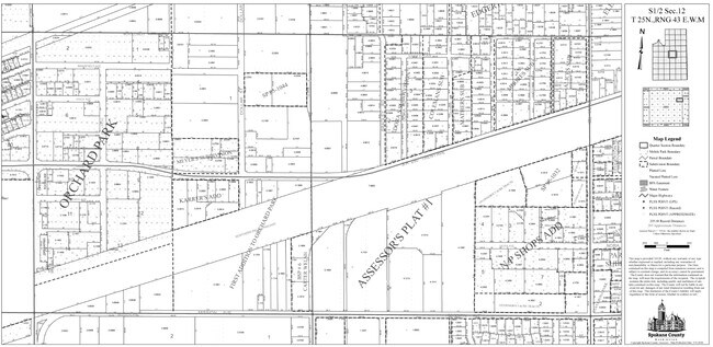
16-25-44(SE1/4): (CITY OF SPOKANE VALLEY) LT 2 OF RECORDED SURVEY AUDITORS #5740277 BK 135 PG 58 BEING A PTN OF TR 115 OF OPPORTUNITY. EXCEPT PORTION FOR ROAD PER AFN 7361313
Vacantlandnec
Spokane
X
Washington
53063C0566D
2
2025
0.39 AC
2025
West Valley
011900
Spokane
DEMOGRAPHICS near 0 E Unknown Ave
1 Mile
3 Mile
5 Mile
2024 Total Population
7,258
65,353
143,735
2029 Population
7,677
69,562
153,328
Pop Growth 2024-2029
+ 5.77%
+ 6.44%
+ 6.67%
Average Age
41
40
40
2024 Total Households
3,070
27,113
57,201
HH Growth 2024-2029
+ 5.83%
+ 6.61%
+ 6.82%
Median Household Inc
$56,244
$60,280
$64,437
Avg Household Size
2.30
2.30
2.40
2024 Avg HH Vehicles
2.00
2.00
2.00
Median Home Value
$302,817
$303,436
$325,525
Median Year Built
1967
1976
1978
Nearby Places
Map Layers
Map Styles
 Street
 Aerial
- Restaurants
- Banks
- Shops
- Fitness
- Groceries
PUBLIC TRANSPORTATION
COMMUTER RAIL
Spokane (Empire Builder - Amtrak)
DRIVE
WALK
Distance
Spokane (Empire Builder - Amtrak)
12 min
6.7 mi
AIRPORT
Spokane International
DRIVE
WALK
Distance
Spokane International
20 min
12.5 mi
Freight Ports
Port of Everett
DRIVE
WALK
Distance
Port of Everett
347 min
308.1 mi
Nearby Properties
Address
Land Use
TOTAL SIZE
Lot Size
Zoning
Address
Land Use
TOTAL SIZE
Lot Size
Zoning
917,113 SF
100.67 AC
LI
Address
Land Use
TOTAL SIZE
Lot Size
Zoning
355,192 SF
35.83 AC
I-2
Address
Land Use
TOTAL SIZE
Lot Size
Zoning
378,750 SF
17.38 AC
R-2
Address
Land Use
TOTAL SIZE
Lot Size
Zoning
161,130 SF
6.45 AC
GO
Address
Land Use
TOTAL SIZE
Lot Size
Zoning
84,600 SF
17.95 AC
MF-1
Address
Land Use
TOTAL SIZE
Lot Size
Zoning
58,522 SF
19.91 AC
HI
Address
Land Use
TOTAL SIZE
Lot Size
Zoning
175,936 SF
12.16 AC
MF-2
Address
Land Use
TOTAL SIZE
Lot Size
Zoning
96,424 SF
9.04 AC
I-1
Address
Land Use
TOTAL SIZE
Lot Size
Zoning
107,442 SF
5.57 AC
MF-2
Address
Land Use
TOTAL SIZE
Lot Size
Zoning
47,612 SF
3.38 AC
CMU
Address
Land Use
TOTAL SIZE
Lot Size
Zoning
134,104 SF
5.89 AC
HDR
Address
Land Use
TOTAL SIZE
Lot Size
Zoning
150,812 SF
17.49 AC
RC
Address
Land Use
TOTAL SIZE
Lot Size
Zoning
89,120 SF
5.83 AC
MDR
Address
Land Use
TOTAL SIZE
Lot Size
Zoning
123,938 SF
7.70 AC
MF-2
Address
Land Use
TOTAL SIZE
Lot Size
Zoning
102,441 SF
8.38 AC
Address
Land Use
TOTAL SIZE
Lot Size
Zoning
118,818 SF
7.96 AC
HDR
Address
Land Use
TOTAL SIZE
Lot Size
Zoning
72,903 SF
6.35 AC
MF-2
Address
Land Use
TOTAL SIZE
Lot Size
Zoning
418,875 SF
18.79 AC
I-1
Address
Land Use
TOTAL SIZE
Lot Size
Zoning
91,811 SF
6.02 AC
LI
Address
Land Use
TOTAL SIZE
Lot Size
Zoning
68,600 SF
5.25 AC
MF-2
Address
Land Use
TOTAL SIZE
Lot Size
Zoning
104,760 SF
6.96 AC
HDR
Address
Land Use
TOTAL SIZE
Lot Size
Zoning
38,889 SF
114.18 AC
LI
Address
Land Use
TOTAL SIZE
Lot Size
Zoning
200 SF
159.15 AC
LI
Address
Land Use
TOTAL SIZE
Lot Size
Zoning
100,035 SF
5.74 AC
CMU
Address
Land Use
TOTAL SIZE
Lot Size
Zoning
182,166 SF
6.61 AC
O
Address
Land Use
TOTAL SIZE
Lot Size
Zoning
90,423 SF
2.48 AC
C
Address
Land Use
TOTAL SIZE
Lot Size
Zoning
26,561 SF
2.73 AC
CMU
Address
Land Use
TOTAL SIZE
Lot Size
Zoning
102,875 SF
7.44 AC
RC
Address
Land Use
TOTAL SIZE
Lot Size
Zoning
78,194 SF
4.28 AC
MF-2
Address
Land Use
TOTAL SIZE
Lot Size
Zoning
157,357 SF
7.84 AC
HI
The World's #1 Commercial Real Estate Marketplace
Connect with us
© 2026 CoStar Group
The information above has been obtained from sources believed reliable. While we do not doubt its accuracy we have not verified it and make no guarantee, warranty or representation about it. It is your responsibility to independently confirm its accuracy and completeness. Any projections, opinions, assumptions, or estimates used are for example only and do not represent the current or future performance of the property. The value of this transaction to you depends on tax and other factors which should be evaluated by your tax, financial, and legal advisors. You and your advisors should conduct a careful, independent investigation of the property to determine to your satisfaction the suitability of the property for your needs.