Property Record
0 Fm 1942, Baytown, TX 77521

Property Detail
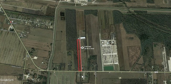
0 Fm 1942
Houston-Pasadena-The Woodlands, TX
TR 7B ABST 54 H NASH
0410100010007
HARRIS
Agriculturalland
Texas
AE The base floodplain where base flood elevations are provided. AE Zones are now used on new format FIRMs instead of A1-A30 Zones.
68.03 AC
2024
Northeast Outlier
2025
Houston
253202
NEARBY LISTINGS FOR SALE OR LEASE
DEMOGRAPHICS near 0 Fm 1942
1 mile
3 mile
5 mile
2025 Total Population
768
19,319
47,384
2030 Population
876
21,069
51,385
Pop Growth 2025-2030
+ 14.06%
+ 9.06%
+ 8.44%
Average Age
34
34
36
2025 Total Households
217
5,782
15,433
HH Growth 2025-2030
+ 13.82%
+ 9.01%
+ 8.47%
Median Household Inc
$93,749
$92,510
$80,231
Avg Household Size
3.50
3.30
3.00
2025 Avg HH Vehicles
3.00
2.00
2.00
Median Home Value
$327,333
$275,499
$259,505
Median Year Built
2010
2007
2002
Nearby Places
Map Layers
Map Styles
 Street
 Aerial
Layers
 Traffic
 Biking
Places
Listings with unknown addresses are not visible on the map
- Restaurants
- Banks
- Shops
- Fitness
- Groceries
PUBLIC TRANSPORTATION
AIRPORT
George Bush Intcntl/Houston
Drive
Walk
Distance
George Bush Intcntl/Houston
47 min
32.9 mi
William P Hobby
Drive
Walk
Distance
William P Hobby
53 min
33.6 mi
Freight Ports
Port of Houston
Drive
Walk
Distance
Port of Houston
39 min
25.6 mi
SALE & LEASE HISTORY
LISTING DATE
SALE/LEASE

Oct 10, 2018
For Sale
Nov 13, 2019
For Sale
Jan 31, 2019
For Sale
Nearby Properties
Address
Land Use
TOTAL SIZE
Lot Size
Zoning
Address
Land Use
TOTAL SIZE
Lot Size
Zoning
49.37 AC
Address
Land Use
TOTAL SIZE
Lot Size
Zoning
291,462 SF
13.43 AC
Address
Land Use
TOTAL SIZE
Lot Size
Zoning
Address
Land Use
TOTAL SIZE
Lot Size
Zoning
59.21 AC
Address
Land Use
TOTAL SIZE
Lot Size
Zoning
956.90 AC
Address
Land Use
TOTAL SIZE
Lot Size
Zoning
138,240 SF
2.95 AC
Address
Land Use
TOTAL SIZE
Lot Size
Zoning
76,536 SF
2.72 AC
Address
Land Use
TOTAL SIZE
Lot Size
Zoning
58,626 SF
2.39 AC
Address
Land Use
TOTAL SIZE
Lot Size
Zoning
115.77 AC
Address
Land Use
TOTAL SIZE
Lot Size
Zoning
130.24 AC
Address
Land Use
TOTAL SIZE
Lot Size
Zoning
154.79 AC
Address
Land Use
TOTAL SIZE
Lot Size
Zoning
179.91 AC
Address
Land Use
TOTAL SIZE
Lot Size
Zoning
135.73 AC
Address
Land Use
TOTAL SIZE
Lot Size
Zoning
153 AC
Address
Land Use
TOTAL SIZE
Lot Size
Zoning
20,853 SF
83.46 AC
Address
Land Use
TOTAL SIZE
Lot Size
Zoning
119.06 AC
Address
Land Use
TOTAL SIZE
Lot Size
Zoning
Address
Land Use
TOTAL SIZE
Lot Size
Zoning
36,908 SF
10 AC
Address
Land Use
TOTAL SIZE
Lot Size
Zoning
76.90 AC
Address
Land Use
TOTAL SIZE
Lot Size
Zoning
23,862 SF
2.95 AC
Address
Land Use
TOTAL SIZE
Lot Size
Zoning
21,020 SF
42.11 AC
Address
Land Use
TOTAL SIZE
Lot Size
Zoning
7.46 AC
Address
Land Use
TOTAL SIZE
Lot Size
Zoning
23,658 SF
2.92 AC
Address
Land Use
TOTAL SIZE
Lot Size
Zoning
70,650 SF
4.18 AC
Address
Land Use
TOTAL SIZE
Lot Size
Zoning
50,788 SF
2.24 AC
Address
Land Use
TOTAL SIZE
Lot Size
Zoning
34,480 SF
17.98 AC
Address
Land Use
TOTAL SIZE
Lot Size
Zoning
10,312 SF
1.61 AC
Address
Land Use
TOTAL SIZE
Lot Size
Zoning
15,120 SF
2.15 AC
Address
Land Use
TOTAL SIZE
Lot Size
Zoning
181.69 AC
Address
Land Use
TOTAL SIZE
Lot Size
Zoning
67,763 SF
2 AC
The World's #1 Commercial Real Estate Marketplace
Connect with us
© 2026 CoStar Group
The information above has been obtained from sources believed reliable. While we do not doubt its accuracy we have not verified it and make no guarantee, warranty or representation about it. It is your responsibility to independently confirm its accuracy and completeness. Any projections, opinions, assumptions, or estimates used are for example only and do not represent the current or future performance of the property. The value of this transaction to you depends on tax and other factors which should be evaluated by your tax, financial, and legal advisors. You and your advisors should conduct a careful, independent investigation of the property to determine to your satisfaction the suitability of the property for your needs.