Property Record
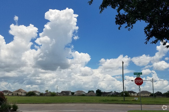
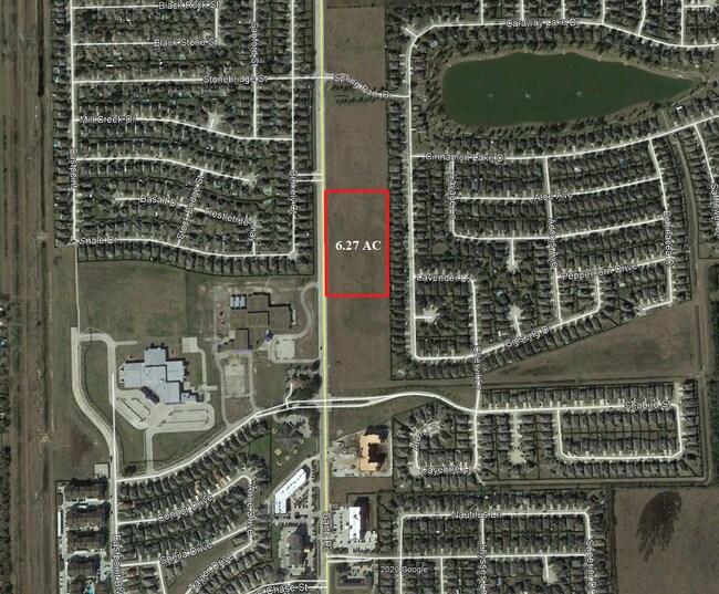
0 Garth Rd, Baytown, TX 77521

Property Detail
0 Garth Rd
Houston-Pasadena-The Woodlands, TX
RES C SPRINGFIELD ESTATES SEC 1 AMND
1224770000173
HARRIS
Agriculturalland
Texas
B and X Area of moderate flood hazard, usually the area between the limits of the 100-year and 500-year floods.
6.51 AC
2024
Northeast Outlier
2025
Houston
253202
NEARBY LISTINGS FOR SALE OR LEASE
DEMOGRAPHICS near 0 Garth Rd
1 mile
3 mile
5 mile
2025 Total Population
12,785
30,819
95,447
2030 Population
13,823
33,448
103,009
Pop Growth 2025-2030
+ 8.12%
+ 8.53%
+ 7.92%
Average Age
34
35
36
2025 Total Households
3,759
9,885
32,778
HH Growth 2025-2030
+ 8.09%
+ 8.45%
+ 7.98%
Median Household Inc
$94,265
$82,084
$72,604
Avg Household Size
3.40
3.10
2.90
2025 Avg HH Vehicles
2.00
2.00
2.00
Median Home Value
$271,699
$261,482
$246,716
Median Year Built
2008
2004
1995
Nearby Places
Map Layers
Map Styles
 Street
 Aerial
Transit
 Traffic
 Biking
Places
Listings with unknown addresses are not visible on the map
- Restaurants
- Banks
- Shops
- Fitness
- Groceries
PUBLIC TRANSPORTATION
AIRPORT
William P Hobby
Drive
Walk
Distance
William P Hobby
46 min
30.2 mi
George Bush Intcntl/Houston
Drive
Walk
Distance
George Bush Intcntl/Houston
43 min
34.3 mi
Freight Ports
Port of Houston
Drive
Walk
Distance
Port of Houston
32 min
22.2 mi
SALE & LEASE HISTORY
LISTING DATE
SALE/LEASE

May 21, 2018
For Sale
Jul 10, 2017
For Sale
Nearby Properties
Address
Land Use
TOTAL SIZE
Lot Size
Zoning
Address
Land Use
TOTAL SIZE
Lot Size
Zoning
49.37 AC
Address
Land Use
TOTAL SIZE
Lot Size
Zoning
291,462 SF
13.43 AC
Address
Land Use
TOTAL SIZE
Lot Size
Zoning
352,067 SF
19.78 AC
Address
Land Use
TOTAL SIZE
Lot Size
Zoning
284,794 SF
10.18 AC
Address
Land Use
TOTAL SIZE
Lot Size
Zoning
251,498 SF
16.36 AC
Address
Land Use
TOTAL SIZE
Lot Size
Zoning
Address
Land Use
TOTAL SIZE
Lot Size
Zoning
337,066 SF
25.51 AC
Address
Land Use
TOTAL SIZE
Lot Size
Zoning
103.45 AC
Address
Land Use
TOTAL SIZE
Lot Size
Zoning
59.21 AC
Address
Land Use
TOTAL SIZE
Lot Size
Zoning
454,992 SF
Address
Land Use
TOTAL SIZE
Lot Size
Zoning
122,554 SF
12.85 AC
Address
Land Use
TOTAL SIZE
Lot Size
Zoning
71,560 SF
17.89 AC
Address
Land Use
TOTAL SIZE
Lot Size
Zoning
103,107 SF
15.56 AC
Address
Land Use
TOTAL SIZE
Lot Size
Zoning
294,711 SF
4.34 AC
Address
Land Use
TOTAL SIZE
Lot Size
Zoning
221,571 SF
21.28 AC
Address
Land Use
TOTAL SIZE
Lot Size
Zoning
69,976 SF
7.37 AC
Address
Land Use
TOTAL SIZE
Lot Size
Zoning
138,240 SF
2.95 AC
Address
Land Use
TOTAL SIZE
Lot Size
Zoning
94,350 SF
8 AC
Address
Land Use
TOTAL SIZE
Lot Size
Zoning
224,472 SF
12 AC
Address
Land Use
TOTAL SIZE
Lot Size
Zoning
178,800 SF
Address
Land Use
TOTAL SIZE
Lot Size
Zoning
83,772 SF
8.09 AC
Address
Land Use
TOTAL SIZE
Lot Size
Zoning
39,869 SF
7.97 AC
Address
Land Use
TOTAL SIZE
Lot Size
Zoning
44,652 SF
12.33 AC
Address
Land Use
TOTAL SIZE
Lot Size
Zoning
79,777 SF
3.96 AC
Address
Land Use
TOTAL SIZE
Lot Size
Zoning
139,880 SF
2.97 AC
Address
Land Use
TOTAL SIZE
Lot Size
Zoning
247,604 SF
24.17 AC
Address
Land Use
TOTAL SIZE
Lot Size
Zoning
60,396 SF
11.42 AC
Address
Land Use
TOTAL SIZE
Lot Size
Zoning
62,588 SF
12.07 AC
Address
Land Use
TOTAL SIZE
Lot Size
Zoning
59,580 SF
4.10 AC
Address
Land Use
TOTAL SIZE
Lot Size
Zoning
128,430 SF
16.22 AC
The World's #1 Commercial Real Estate Marketplace
Connect with us
© 2026 CoStar Group
The information above has been obtained from sources believed reliable. While we do not doubt its accuracy we have not verified it and make no guarantee, warranty or representation about it. It is your responsibility to independently confirm its accuracy and completeness. Any projections, opinions, assumptions, or estimates used are for example only and do not represent the current or future performance of the property. The value of this transaction to you depends on tax and other factors which should be evaluated by your tax, financial, and legal advisors. You and your advisors should conduct a careful, independent investigation of the property to determine to your satisfaction the suitability of the property for your needs.