Property Record
2036 Grandview Rd, Ferndale, WA 98248
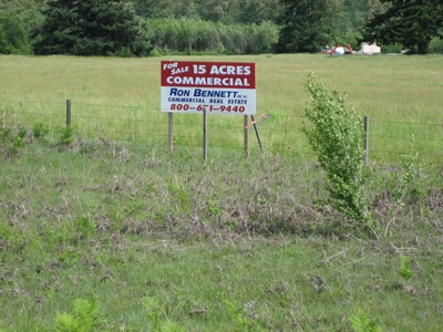
This Property Is For Sale
NEARBY LISTINGS FOR SALE OR LEASE
Property Detail
2036 Grandview Rd
390208-092480-0000
BEAP 664 FT E OF NW SEC COR WH PT IS CTR OF GRANDVIEW RD-TH TURN AN ANGLE 89 DEG 3200 S 1323 FT-TH E 330 FT-TH N 1323 FT TO CTR OF GRANDVIEW RD-TH W 332 FT TO POB-EXC PTN TO STATE FOR HWY DESC AF 897944
Commercialnec
Whatcom
X
Washington
53073C0690D
7.15 AC
2024
Bellingham/Northwest
2024
Other Market Areas
010505
Bellingham, WA
480 SF
DEMOGRAPHICS near 2036 Grandview Rd
1 Mile
3 Mile
5 Mile
2024 Total Population
1,397
16,642
29,364
2029 Population
1,456
17,326
30,479
Pop Growth 2024-2029
+ 4.22%
+ 4.11%
+ 3.80%
Average Age
40
39
40
2024 Total Households
488
5,815
10,337
HH Growth 2024-2029
+ 4.30%
+ 3.99%
+ 3.68%
Median Household Inc
$105,769
$86,586
$93,778
Avg Household Size
2.90
2.80
2.80
2024 Avg HH Vehicles
3.00
2.00
3.00
Median Home Value
$589,286
$493,877
$553,273
Median Year Built
1983
1987
1987
Nearby Places
- Restaurants
- Banks
- Shops
- Fitness
- Groceries
PUBLIC TRANSPORTATION
AIRPORT
Bellingham International
DRIVE
WALK
Distance
Bellingham International
13 min
9.8 mi
Abbotsford International
DRIVE
WALK
Distance
Abbotsford International
42 min
22.1 mi
Freight Ports
Port of Bellingham, WA
DRIVE
WALK
Distance
Port of Bellingham, WA
18 min
12.7 mi
Nearby Properties
Address
Land Use
TOTAL SIZE
Lot Size
Zoning
Address
Land Use
TOTAL SIZE
Lot Size
Zoning
116,159 SF
24.54 AC
P
Address
Land Use
TOTAL SIZE
Lot Size
Zoning
235,594 SF
56.20 AC
PBI
Address
Land Use
TOTAL SIZE
Lot Size
Zoning
203,305 SF
13.80 AC
LII
Address
Land Use
TOTAL SIZE
Lot Size
Zoning
2,044 SF
6.63 AC
P
Address
Land Use
TOTAL SIZE
Lot Size
Zoning
153,557 SF
39.70 AC
PBI
Address
Land Use
TOTAL SIZE
Lot Size
Zoning
60,446 SF
4.03 AC
PBI
Address
Land Use
TOTAL SIZE
Lot Size
Zoning
72,720 SF
3.94 AC
LII
Address
Land Use
TOTAL SIZE
Lot Size
Zoning
103,600 SF
7 AC
LII
Address
Land Use
TOTAL SIZE
Lot Size
Zoning
140,381 SF
9.76 AC
M
Address
Land Use
TOTAL SIZE
Lot Size
Zoning
109,540 SF
5.30 AC
LII
Address
Land Use
TOTAL SIZE
Lot Size
Zoning
23,499 SF
4.46 AC
MCD
Address
Land Use
TOTAL SIZE
Lot Size
Zoning
46,333 SF
2.03 AC
RM1.5
Address
Land Use
TOTAL SIZE
Lot Size
Zoning
505.89 AC
HII
Address
Land Use
TOTAL SIZE
Lot Size
Zoning
115,975 SF
9.21 AC
LII
Address
Land Use
TOTAL SIZE
Lot Size
Zoning
34,952 SF
2.63 AC
MCD
Address
Land Use
TOTAL SIZE
Lot Size
Zoning
25,854 SF
4.94 AC
RS8.5
Address
Land Use
TOTAL SIZE
Lot Size
Zoning
43,890 SF
6.90 AC
LII
Address
Land Use
TOTAL SIZE
Lot Size
Zoning
17,237 SF
10.43 AC
AG
Address
Land Use
TOTAL SIZE
Lot Size
Zoning
20,327 SF
1 AC
URR
Address
Land Use
TOTAL SIZE
Lot Size
Zoning
26,914 SF
2.59 AC
RM1.5
Address
Land Use
TOTAL SIZE
Lot Size
Zoning
31,811 SF
1.85 AC
RM1.5
Address
Land Use
TOTAL SIZE
Lot Size
Zoning
39.72 AC
M
Address
Land Use
TOTAL SIZE
Lot Size
Zoning
26,808 SF
1 AC
URR
Address
Land Use
TOTAL SIZE
Lot Size
Zoning
15,210 SF
4.15 AC
PBI
Address
Land Use
TOTAL SIZE
Lot Size
Zoning
143.75 AC
HII
Address
Land Use
TOTAL SIZE
Lot Size
Zoning
1,788 SF
19.60 AC
R5A
Address
Land Use
TOTAL SIZE
Lot Size
Zoning
25,653 SF
1.32 AC
RM1.5
Address
Land Use
TOTAL SIZE
Lot Size
Zoning
5,270 SF
6.38 AC
PBI
Address
Land Use
TOTAL SIZE
Lot Size
Zoning
59,038 SF
5.57 AC
LII
Address
Land Use
TOTAL SIZE
Lot Size
Zoning
31,675 SF
3.76 AC
RM1.5
The World's #1 Commercial Real Estate Marketplace
Connect with us
© 2025 CoStar Group
The information above has been obtained from sources believed reliable. While we do not doubt its accuracy we have not verified it and make no guarantee, warranty or representation about it. It is your responsibility to independently confirm its accuracy and completeness. Any projections, opinions, assumptions, or estimates used are for example only and do not represent the current or future performance of the property. The value of this transaction to you depends on tax and other factors which should be evaluated by your tax, financial, and legal advisors. You and your advisors should conduct a careful, independent investigation of the property to determine to your satisfaction the suitability of the property for your needs.