Property Record
Harbor Point Rd, Mabank, TX 75156

This Property Is For Sale
NEARBY LISTINGS FOR SALE OR LEASE
Property Detail
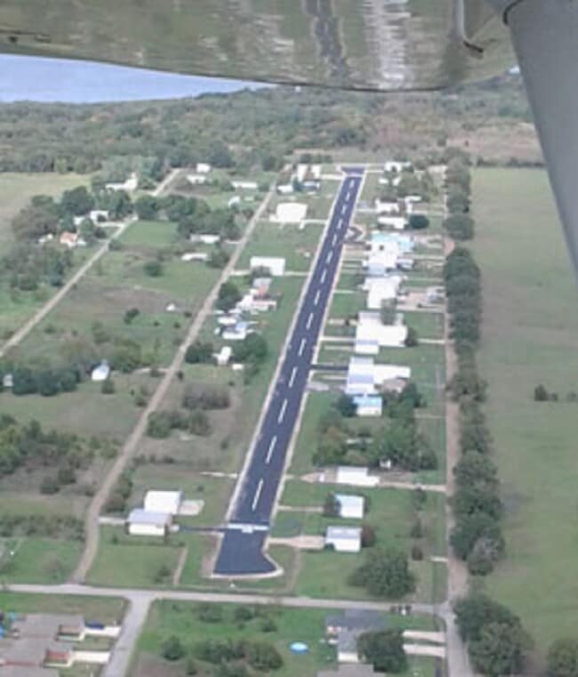
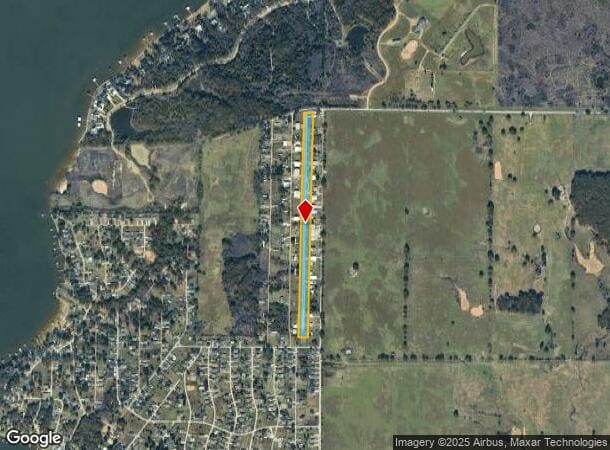
Harbor Point Rd
Athens, TX
Harbor Point #3
2940-0003-0290-50
AB 86 B F BASS SUR, HARBOR POINT #3, AIR STRIP (PT OF 8.566 AC TR)
Commercialnec
Henderson
X
Texas
48257C0575D
29
2024
6.41 AC
2025
Henderson County
950905
Dallas/Ft Worth
74,088 SF
DEMOGRAPHICS near Harbor Point Rd
1 Mile
3 Mile
5 Mile
2024 Total Population
1,343
10,667
24,042
2029 Population
1,523
12,844
29,031
Pop Growth 2024-2029
+ 13.40%
+ 20.41%
+ 20.75%
Average Age
39
41
42
2024 Total Households
510
4,208
9,500
HH Growth 2024-2029
+ 13.53%
+ 19.84%
+ 19.92%
Median Household Inc
$58,733
$58,268
$49,255
Avg Household Size
2.60
2.50
2.50
2024 Avg HH Vehicles
2.00
2.00
2.00
Median Home Value
$178,571
$224,944
$196,049
Median Year Built
1988
1988
1988
Nearby Places
- Restaurants
- Banks
- Shops
- Fitness
- Groceries
Nearby Properties
Address
Land Use
TOTAL SIZE
Lot Size
Zoning
Address
Land Use
TOTAL SIZE
Lot Size
Zoning
57,500 SF
21.05 AC
Address
Land Use
TOTAL SIZE
Lot Size
Zoning
132,806 SF
58.54 AC
Address
Land Use
TOTAL SIZE
Lot Size
Zoning
100,720 SF
18.73 AC
Address
Land Use
TOTAL SIZE
Lot Size
Zoning
38,369 SF
8 AC
Address
Land Use
TOTAL SIZE
Lot Size
Zoning
35,697 SF
9.21 AC
Address
Land Use
TOTAL SIZE
Lot Size
Zoning
161,900 SF
17.83 AC
Address
Land Use
TOTAL SIZE
Lot Size
Zoning
148,456 SF
21.41 AC
Address
Land Use
TOTAL SIZE
Lot Size
Zoning
45,576 SF
5.58 AC
Address
Land Use
TOTAL SIZE
Lot Size
Zoning
60,260 SF
21 AC
Address
Land Use
TOTAL SIZE
Lot Size
Zoning
35,084 SF
3.46 AC
Address
Land Use
TOTAL SIZE
Lot Size
Zoning
6,514 SF
3.77 AC
Address
Land Use
TOTAL SIZE
Lot Size
Zoning
6,115 SF
3.07 AC
Address
Land Use
TOTAL SIZE
Lot Size
Zoning
6,629 SF
6.40 AC
Address
Land Use
TOTAL SIZE
Lot Size
Zoning
32,987 SF
0.15 AC
Address
Land Use
TOTAL SIZE
Lot Size
Zoning
6,734 SF
1.07 AC
Address
Land Use
TOTAL SIZE
Lot Size
Zoning
6,374 SF
1.35 AC
Address
Land Use
TOTAL SIZE
Lot Size
Zoning
6,617 SF
1.01 AC
Address
Land Use
TOTAL SIZE
Lot Size
Zoning
6,608 SF
1.04 AC
Address
Land Use
TOTAL SIZE
Lot Size
Zoning
5,650 SF
2.03 AC
Address
Land Use
TOTAL SIZE
Lot Size
Zoning
19,120 SF
4 AC
Address
Land Use
TOTAL SIZE
Lot Size
Zoning
Address
Land Use
TOTAL SIZE
Lot Size
Zoning
5,760 SF
1.35 AC
Address
Land Use
TOTAL SIZE
Lot Size
Zoning
34,422 SF
4.21 AC
Address
Land Use
TOTAL SIZE
Lot Size
Zoning
2.48 AC
Address
Land Use
TOTAL SIZE
Lot Size
Zoning
61,419 SF
5.19 AC
Address
Land Use
TOTAL SIZE
Lot Size
Zoning
90,493 SF
3.45 AC
Address
Land Use
TOTAL SIZE
Lot Size
Zoning
11,204 SF
166.75 AC
Address
Land Use
TOTAL SIZE
Lot Size
Zoning
5,938 SF
1.06 AC
Address
Land Use
TOTAL SIZE
Lot Size
Zoning
5,378 SF
1.21 AC
Address
Land Use
TOTAL SIZE
Lot Size
Zoning
3,717 SF
1.39 AC
The World's #1 Commercial Real Estate Marketplace
Connect with us
© 2025 CoStar Group
The information above has been obtained from sources believed reliable. While we do not doubt its accuracy we have not verified it and make no guarantee, warranty or representation about it. It is your responsibility to independently confirm its accuracy and completeness. Any projections, opinions, assumptions, or estimates used are for example only and do not represent the current or future performance of the property. The value of this transaction to you depends on tax and other factors which should be evaluated by your tax, financial, and legal advisors. You and your advisors should conduct a careful, independent investigation of the property to determine to your satisfaction the suitability of the property for your needs.