Property Record
0 Harlem Rd, Westerville, OH 43081

NEARBY LISTINGS FOR SALE OR LEASE
Property Detail
0 Harlem Rd
Columbus, OH
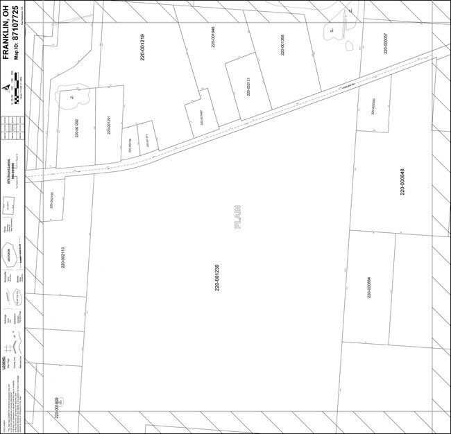
SMOTHERS ROAD R16 T2 1/4T2 LOT 5 5.001 ACRES
220-002113
Franklin
Religious
Ohio
0
5 5
2025
5 AC
007101
Westerville
4,448 SF
Columbus
DEMOGRAPHICS near 0 Harlem Rd
1 Mile
3 Mile
5 Mile
2024 Total Population
1,392
34,541
116,143
2029 Population
1,560
35,602
119,854
Pop Growth 2024-2029
+ 12.07%
+ 3.07%
+ 3.20%
Average Age
42
41
40
2024 Total Households
530
15,377
47,698
HH Growth 2024-2029
+ 12.08%
+ 2.58%
+ 2.91%
Median Household Inc
$101,515
$106,728
$100,454
Avg Household Size
2.60
2.20
2.40
2024 Avg HH Vehicles
2.00
2.00
2.00
Median Home Value
$446,969
$327,258
$312,352
Median Year Built
1981
2003
1997
Nearby Places
Map Layers
Map Styles
 Street
 Aerial
- Restaurants
- Banks
- Shops
- Fitness
- Groceries
PUBLIC TRANSPORTATION
AIRPORT
John Glenn Columbus International
DRIVE
WALK
Distance
John Glenn Columbus International
24 min
13.9 mi
Rickenbacker International
DRIVE
WALK
Distance
Rickenbacker International
43 min
27.4 mi
Nearby Properties
Address
Land Use
TOTAL SIZE
Lot Size
Zoning
Address
Land Use
TOTAL SIZE
Lot Size
Zoning
253,127 SF
31.59 AC
Address
Land Use
TOTAL SIZE
Lot Size
Zoning
112,126 SF
19.09 AC
Address
Land Use
TOTAL SIZE
Lot Size
Zoning
446,516 SF
95.88 AC
Address
Land Use
TOTAL SIZE
Lot Size
Zoning
132,276 SF
0.18 AC
Address
Land Use
TOTAL SIZE
Lot Size
Zoning
62,660 SF
41.24 AC
Address
Land Use
TOTAL SIZE
Lot Size
Zoning
195,837 SF
31.48 AC
Address
Land Use
TOTAL SIZE
Lot Size
Zoning
180,968 SF
12.77 AC
Address
Land Use
TOTAL SIZE
Lot Size
Zoning
3,263 SF
989.66 AC
Address
Land Use
TOTAL SIZE
Lot Size
Zoning
74,620 SF
9.03 AC
Address
Land Use
TOTAL SIZE
Lot Size
Zoning
45,849 SF
29.64 AC
Address
Land Use
TOTAL SIZE
Lot Size
Zoning
100,116 SF
18.80 AC
Address
Land Use
TOTAL SIZE
Lot Size
Zoning
151,892 SF
8.63 AC
Address
Land Use
TOTAL SIZE
Lot Size
Zoning
151,935 SF
9 AC
Address
Land Use
TOTAL SIZE
Lot Size
Zoning
17,088 SF
16.31 AC
Address
Land Use
TOTAL SIZE
Lot Size
Zoning
51,376 SF
12.65 AC
Address
Land Use
TOTAL SIZE
Lot Size
Zoning
25,208 SF
25.95 AC
Address
Land Use
TOTAL SIZE
Lot Size
Zoning
96,086 SF
12.23 AC
Address
Land Use
TOTAL SIZE
Lot Size
Zoning
106,080 SF
6.81 AC
Address
Land Use
TOTAL SIZE
Lot Size
Zoning
84,930 SF
11.97 AC
Address
Land Use
TOTAL SIZE
Lot Size
Zoning
133,524 SF
10.15 AC
Address
Land Use
TOTAL SIZE
Lot Size
Zoning
155,656 SF
18.90 AC
Address
Land Use
TOTAL SIZE
Lot Size
Zoning
106,080 SF
6.45 AC
Address
Land Use
TOTAL SIZE
Lot Size
Zoning
115,937 SF
16.21 AC
Address
Land Use
TOTAL SIZE
Lot Size
Zoning
127,591 SF
13.15 AC
Address
Land Use
TOTAL SIZE
Lot Size
Zoning
69,113 SF
9.84 AC
Address
Land Use
TOTAL SIZE
Lot Size
Zoning
94,991 SF
15.72 AC
Address
Land Use
TOTAL SIZE
Lot Size
Zoning
46,480 SF
5.92 AC
Address
Land Use
TOTAL SIZE
Lot Size
Zoning
77,831 SF
7.92 AC
Address
Land Use
TOTAL SIZE
Lot Size
Zoning
68,463 SF
8.77 AC
Address
Land Use
TOTAL SIZE
Lot Size
Zoning
43,260 SF
4.11 AC
The World's #1 Commercial Real Estate Marketplace
Connect with us
© 2026 CoStar Group
The information above has been obtained from sources believed reliable. While we do not doubt its accuracy we have not verified it and make no guarantee, warranty or representation about it. It is your responsibility to independently confirm its accuracy and completeness. Any projections, opinions, assumptions, or estimates used are for example only and do not represent the current or future performance of the property. The value of this transaction to you depends on tax and other factors which should be evaluated by your tax, financial, and legal advisors. You and your advisors should conduct a careful, independent investigation of the property to determine to your satisfaction the suitability of the property for your needs.