Property Record
9Th Ave, Sun Valley, NV 89433


NEARBY LISTINGS FOR SALE OR LEASE
Property Detail
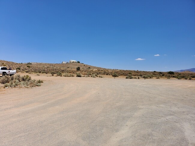
9Th Ave
Reno, NV
_Unspecified
508-020-04
FRAC S2 S2 SE4 SEC 8 TWP 20N RGE 20E
Vacantlandnec
Washoe
X
Nevada
32031C3032G
4.94 AC
2025
Sparks
2026
Reno/Sparks
002707
DEMOGRAPHICS near 9Th Ave
1 Mile
3 Mile
5 Mile
2024 Total Population
8,275
40,612
173,414
2029 Population
8,630
42,702
182,683
Pop Growth 2024-2029
+ 4.29%
+ 5.15%
+ 5.35%
Average Age
38
38
39
2024 Total Households
2,598
13,826
62,973
HH Growth 2024-2029
+ 4.39%
+ 5.27%
+ 5.53%
Median Household Inc
$74,814
$78,584
$75,059
Avg Household Size
3.10
2.90
2.70
2024 Avg HH Vehicles
2.00
2.00
2.00
Median Home Value
$327,238
$361,822
$404,142
Median Year Built
1992
1996
1992
Nearby Places
Map Layers
Map Styles
 Street
 Aerial
- Restaurants
- Banks
- Shops
- Fitness
- Groceries
PUBLIC TRANSPORTATION
COMMUTER RAIL
Reno (California Zephyr - Amtrak)
DRIVE
WALK
Distance
Reno (California Zephyr - Amtrak)
17 min
8.1 mi
AIRPORT
Reno/Tahoe International
DRIVE
WALK
Distance
Reno/Tahoe International
35 min
11.8 mi
Freight Ports
Port of Stockton
DRIVE
WALK
Distance
Port of Stockton
220 min
186.1 mi
SALE & LEASE HISTORY
LISTING DATE
SALE/LEASE

Oct 08, 2018
For Sale
Nearby Properties
Address
Land Use
TOTAL SIZE
Lot Size
Zoning
Address
Land Use
TOTAL SIZE
Lot Size
Zoning
406,338 SF
15.07 AC
NUD
Address
Land Use
TOTAL SIZE
Lot Size
Zoning
416,482 SF
21.84 AC
PD
Address
Land Use
TOTAL SIZE
Lot Size
Zoning
333,867 SF
14.71 AC
NUD
Address
Land Use
TOTAL SIZE
Lot Size
Zoning
271,111 SF
31.84 AC
NUD
Address
Land Use
TOTAL SIZE
Lot Size
Zoning
321,941 SF
36 AC
NUD
Address
Land Use
TOTAL SIZE
Lot Size
Zoning
279,596 SF
10.94 AC
NUD
Address
Land Use
TOTAL SIZE
Lot Size
Zoning
231,353 SF
11.52 AC
NUD
Address
Land Use
TOTAL SIZE
Lot Size
Zoning
188,281 SF
641.92 AC
OS 88% / G
Address
Land Use
TOTAL SIZE
Lot Size
Zoning
181,857 SF
8.19 AC
NUD
Address
Land Use
TOTAL SIZE
Lot Size
Zoning
203,303 SF
20.97 AC
C2
Address
Land Use
TOTAL SIZE
Lot Size
Zoning
146,255 SF
9.99 AC
MDU
Address
Land Use
TOTAL SIZE
Lot Size
Zoning
197,364 SF
11.34 AC
NUD
Address
Land Use
TOTAL SIZE
Lot Size
Zoning
186,572 SF
12.17 AC
NUD
Address
Land Use
TOTAL SIZE
Lot Size
Zoning
74,637 SF
6.04 AC
NUD
Address
Land Use
TOTAL SIZE
Lot Size
Zoning
148,346 SF
15.79 AC
NUD
Address
Land Use
TOTAL SIZE
Lot Size
Zoning
70,030 SF
36.71 AC
PSP
Address
Land Use
TOTAL SIZE
Lot Size
Zoning
115,817 SF
11.27 AC
NUD
Address
Land Use
TOTAL SIZE
Lot Size
Zoning
137,236 SF
10.02 AC
PD
Address
Land Use
TOTAL SIZE
Lot Size
Zoning
35.59 AC
NUD
Address
Land Use
TOTAL SIZE
Lot Size
Zoning
40.56 AC
NUD
Address
Land Use
TOTAL SIZE
Lot Size
Zoning
102,489 SF
10.99 AC
NUD
Address
Land Use
TOTAL SIZE
Lot Size
Zoning
87,888 SF
9.58 AC
C2
Address
Land Use
TOTAL SIZE
Lot Size
Zoning
101,002 SF
4.42 AC
TC
Address
Land Use
TOTAL SIZE
Lot Size
Zoning
61,048 SF
10.53 AC
NUD
Address
Land Use
TOTAL SIZE
Lot Size
Zoning
61,048 SF
13.10 AC
PSP
Address
Land Use
TOTAL SIZE
Lot Size
Zoning
27.02 AC
NUD
Address
Land Use
TOTAL SIZE
Lot Size
Zoning
25.38 AC
NUD
Address
Land Use
TOTAL SIZE
Lot Size
Zoning
34.89 AC
PD
Address
Land Use
TOTAL SIZE
Lot Size
Zoning
25.97 AC
NUD
Address
Land Use
TOTAL SIZE
Lot Size
Zoning
57,443 SF
26.56 AC
PSP
The World's #1 Commercial Real Estate Marketplace
Connect with us
© 2025 CoStar Group
The information above has been obtained from sources believed reliable. While we do not doubt its accuracy we have not verified it and make no guarantee, warranty or representation about it. It is your responsibility to independently confirm its accuracy and completeness. Any projections, opinions, assumptions, or estimates used are for example only and do not represent the current or future performance of the property. The value of this transaction to you depends on tax and other factors which should be evaluated by your tax, financial, and legal advisors. You and your advisors should conduct a careful, independent investigation of the property to determine to your satisfaction the suitability of the property for your needs.