Property Record
Hjelm Rd, Porter, IN 46304

NEARBY LISTINGS FOR SALE OR LEASE
Property Detail
Hjelm Rd
64-03-24-455-002.000-026
W275 S333 E1/2 SW1/4 SE1/4 24-37-6 2.06A TIF
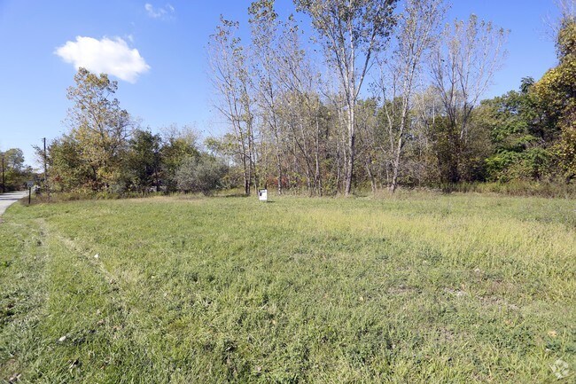
Recreationalacreage
Porter
X
Indiana
18127C0070E
1.91 AC
2023
Porter County
2024
Chicago
050202
Chicago-Naperville-Elgin, IL-IN-WI
DEMOGRAPHICS near Hjelm Rd
1 Mile
3 Mile
5 Mile
2024 Total Population
1,637
17,408
27,651
2029 Population
1,688
17,939
28,545
Pop Growth 2024-2029
+ 3.12%
+ 3.05%
+ 3.23%
Average Age
43
42
42
2024 Total Households
671
7,105
11,042
HH Growth 2024-2029
+ 3.28%
+ 3.08%
+ 3.26%
Median Household Inc
$106,818
$84,459
$88,170
Avg Household Size
2.40
2.40
2.50
2024 Avg HH Vehicles
2.00
2.00
2.00
Median Home Value
$280,605
$247,154
$265,721
Median Year Built
1971
1975
1984
Nearby Places
Map Layers
Map Styles
 Street
 Aerial
- Restaurants
- Banks
- Shops
- Fitness
- Groceries
PUBLIC TRANSPORTATION
COMMUTER RAIL
Dune Park (Chesterton) Station (South Shore Line - Northern Indiana Commuter Transportation District (South Shore Line))
DRIVE
WALK
Distance
Dune Park (Chesterton) Station (South Shore Line - Northern Indiana Commuter Transportation District (South Shore Line))
3 min
1.0 mi
Beverly Shores (South Shore Line - Northern Indiana Commuter Transportation District (South Shore Line))
DRIVE
WALK
Distance
Beverly Shores (South Shore Line - Northern Indiana Commuter Transportation District (South Shore Line))
10 min
5.0 mi
Freight Ports
Port Milwaukee
DRIVE
WALK
Distance
Port Milwaukee
166 min
132.1 mi
SALE & LEASE HISTORY
LISTING DATE
SALE/LEASE

Oct 18, 2017
For Sale
Nearby Properties
Address
Land Use
TOTAL SIZE
Lot Size
Zoning
Address
Land Use
TOTAL SIZE
Lot Size
Zoning
174,766 SF
87 SF
Address
Land Use
TOTAL SIZE
Lot Size
Zoning
167,850 SF
46.39 AC
Address
Land Use
TOTAL SIZE
Lot Size
Zoning
108,528 SF
10.28 AC
Address
Land Use
TOTAL SIZE
Lot Size
Zoning
52,765 SF
5.92 AC
Address
Land Use
TOTAL SIZE
Lot Size
Zoning
61,873 SF
44 SF
Address
Land Use
TOTAL SIZE
Lot Size
Zoning
38,337 SF
44 SF
Address
Land Use
TOTAL SIZE
Lot Size
Zoning
114,061 SF
6.26 AC
Address
Land Use
TOTAL SIZE
Lot Size
Zoning
34,360 SF
131 SF
Address
Land Use
TOTAL SIZE
Lot Size
Zoning
62,401 SF
44 SF
Address
Land Use
TOTAL SIZE
Lot Size
Zoning
60,861 SF
44 SF
Address
Land Use
TOTAL SIZE
Lot Size
Zoning
90,396 SF
6.82 AC
Address
Land Use
TOTAL SIZE
Lot Size
Zoning
63,357 SF
44 SF
Address
Land Use
TOTAL SIZE
Lot Size
Zoning
62,261 SF
44 SF
Address
Land Use
TOTAL SIZE
Lot Size
Zoning
20,400 SF
44 SF
Address
Land Use
TOTAL SIZE
Lot Size
Zoning
27,375 SF
174 SF
Address
Land Use
TOTAL SIZE
Lot Size
Zoning
419,212 SF
78.36 AC
Address
Land Use
TOTAL SIZE
Lot Size
Zoning
36,288 SF
44 SF
Address
Land Use
TOTAL SIZE
Lot Size
Zoning
25,646 SF
2.57 AC
Address
Land Use
TOTAL SIZE
Lot Size
Zoning
36,288 SF
2.61 AC
Address
Land Use
TOTAL SIZE
Lot Size
Zoning
56,807 SF
44 SF
Address
Land Use
TOTAL SIZE
Lot Size
Zoning
19,896 SF
2.09 AC
Address
Land Use
TOTAL SIZE
Lot Size
Zoning
42,159 SF
44 SF
Address
Land Use
TOTAL SIZE
Lot Size
Zoning
31,780 SF
1.76 AC
Address
Land Use
TOTAL SIZE
Lot Size
Zoning
3,682 SF
17.23 AC
Address
Land Use
TOTAL SIZE
Lot Size
Zoning
18,805 SF
87 SF
Address
Land Use
TOTAL SIZE
Lot Size
Zoning
22,733 SF
1.10 AC
Address
Land Use
TOTAL SIZE
Lot Size
Zoning
46,748 SF
87 SF
Address
Land Use
TOTAL SIZE
Lot Size
Zoning
25,457 SF
44 SF
Address
Land Use
TOTAL SIZE
Lot Size
Zoning
24,168 SF
0.84 AC
Address
Land Use
TOTAL SIZE
Lot Size
Zoning
10,958 SF
1.70 AC
The World's #1 Commercial Real Estate Marketplace
Connect with us
© 2025 CoStar Group
The information above has been obtained from sources believed reliable. While we do not doubt its accuracy we have not verified it and make no guarantee, warranty or representation about it. It is your responsibility to independently confirm its accuracy and completeness. Any projections, opinions, assumptions, or estimates used are for example only and do not represent the current or future performance of the property. The value of this transaction to you depends on tax and other factors which should be evaluated by your tax, financial, and legal advisors. You and your advisors should conduct a careful, independent investigation of the property to determine to your satisfaction the suitability of the property for your needs.