Property Record
0 Interstate 10 Hwy, Baytown, TX 77521

Save to a Folder
{{folder.Name}}
{{folder.ListingIds.length}} Properties
{{folder.ListingIds.length}} Property
Create a New Folder
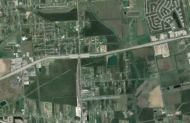
Property Detail
0 Interstate 10 Hwy
Houston-Pasadena-The Woodlands, TX
TR 1 BLK 4 ELENA FRUIT & COTTON FARMS D
0591440000004
HARRIS
Transportnec
Texas
C and X Area of minimal flood hazard, usually depicted on FIRMs as above the 500-year flood level.
34.92 AC
2025
Baytown
2025
Houston
253202
NEARBY LISTINGS FOR SALE OR LEASE
DEMOGRAPHICS near 0 Interstate 10 Hwy
1 mile
3 mile
5 mile
2025 Total Population
4,542
51,797
91,429
2030 Population
4,953
55,403
98,093
Pop Growth 2025-2030
+ 9.05%
+ 6.96%
+ 7.29%
Average Age
35
36
36
2025 Total Households
1,473
17,777
31,467
HH Growth 2025-2030
+ 8.96%
+ 6.93%
+ 7.34%
Median Household Inc
$54,681
$75,416
$68,094
Avg Household Size
3.00
2.90
2.80
2025 Avg HH Vehicles
2.00
2.00
2.00
Median Home Value
$208,333
$247,790
$241,032
Median Year Built
2002
2000
1992
Nearby Places
Map Layers
Map Styles
 Street
 Aerial
Layers
 Traffic
 Biking
Places
Listings with unknown addresses are not visible on the map
- Restaurants
- Banks
- Shops
- Fitness
- Groceries
PUBLIC TRANSPORTATION
AIRPORT
William P Hobby
Drive
Walk
Distance
William P Hobby
44 min
29.4 mi
George Bush Intcntl/Houston
Drive
Walk
Distance
George Bush Intcntl/Houston
41 min
33.5 mi
Freight Ports
Port of Houston
Drive
Walk
Distance
Port of Houston
31 min
21.4 mi
Nearby Properties
Address
Land Use
TOTAL SIZE
Lot Size
Zoning
Address
Land Use
TOTAL SIZE
Lot Size
Zoning
Address
Land Use
TOTAL SIZE
Lot Size
Zoning
815.98 AC
Address
Land Use
TOTAL SIZE
Lot Size
Zoning
857.55 AC
Address
Land Use
TOTAL SIZE
Lot Size
Zoning
Address
Land Use
TOTAL SIZE
Lot Size
Zoning
816.17 AC
Address
Land Use
TOTAL SIZE
Lot Size
Zoning
816.17 AC
Address
Land Use
TOTAL SIZE
Lot Size
Zoning
874.07 AC
Address
Land Use
TOTAL SIZE
Lot Size
Zoning
291,462 SF
13.43 AC
Address
Land Use
TOTAL SIZE
Lot Size
Zoning
352,067 SF
19.78 AC
Address
Land Use
TOTAL SIZE
Lot Size
Zoning
284,794 SF
10.18 AC
Address
Land Use
TOTAL SIZE
Lot Size
Zoning
251,498 SF
16.36 AC
Address
Land Use
TOTAL SIZE
Lot Size
Zoning
337,066 SF
25.51 AC
Address
Land Use
TOTAL SIZE
Lot Size
Zoning
103.45 AC
Address
Land Use
TOTAL SIZE
Lot Size
Zoning
279,460 SF
20.62 AC
Address
Land Use
TOTAL SIZE
Lot Size
Zoning
225,497 SF
10.90 AC
Address
Land Use
TOTAL SIZE
Lot Size
Zoning
260,750 SF
17.81 AC
Address
Land Use
TOTAL SIZE
Lot Size
Zoning
Address
Land Use
TOTAL SIZE
Lot Size
Zoning
238,488 SF
13 AC
Address
Land Use
TOTAL SIZE
Lot Size
Zoning
454,992 SF
Address
Land Use
TOTAL SIZE
Lot Size
Zoning
122,554 SF
12.85 AC
Address
Land Use
TOTAL SIZE
Lot Size
Zoning
71,560 SF
17.89 AC
Address
Land Use
TOTAL SIZE
Lot Size
Zoning
103,107 SF
15.56 AC
Address
Land Use
TOTAL SIZE
Lot Size
Zoning
205,859 SF
10.88 AC
Address
Land Use
TOTAL SIZE
Lot Size
Zoning
214,627 SF
13.77 AC
Address
Land Use
TOTAL SIZE
Lot Size
Zoning
294,711 SF
4.34 AC
Address
Land Use
TOTAL SIZE
Lot Size
Zoning
247,218 SF
12.44 AC
Address
Land Use
TOTAL SIZE
Lot Size
Zoning
816.17 AC
Address
Land Use
TOTAL SIZE
Lot Size
Zoning
282,661 SF
14.68 AC
Address
Land Use
TOTAL SIZE
Lot Size
Zoning
100,274 SF
17.63 AC
Address
Land Use
TOTAL SIZE
Lot Size
Zoning
221,571 SF
21.28 AC
The World's #1 Commercial Real Estate Marketplace
Connect with us
© 2026 CoStar Group
The information above has been obtained from sources believed reliable. While we do not doubt its accuracy we have not verified it and make no guarantee, warranty or representation about it. It is your responsibility to independently confirm its accuracy and completeness. Any projections, opinions, assumptions, or estimates used are for example only and do not represent the current or future performance of the property. The value of this transaction to you depends on tax and other factors which should be evaluated by your tax, financial, and legal advisors. You and your advisors should conduct a careful, independent investigation of the property to determine to your satisfaction the suitability of the property for your needs.