Property Record
5904 Highway 53, Harvest, AL 35749
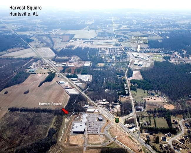

This Property Is For Sale
Property Detail
5904 Highway 53
Huntsville, AL
LOT 2B OF HARVEST SQUARE S/D PB # 20090601000361050 CORR PB # 20100805000435850
06-06-23-0-000-006.005
Madison
Restaurantdrivein
Alabama
B and X Area of moderate flood hazard, usually the area between the limits of the 100-year and 500-year floods.
2b
2025
1.31 AC
2025
North Madison County
010502
Huntsville
3,679 SF
NEARBY LISTINGS FOR SALE OR LEASE
-
-
View all Harvest listings for sale on LoopNet.com
DEMOGRAPHICS near 5904 Highway 53
1 mile
3 mile
5 mile
2025 Total Population
2,249
16,238
43,035
2030 Population
2,445
17,494
46,306
Pop Growth 2025-2030
+ 8.71%
+ 7.73%
+ 7.60%
Average Age
37
39
40
2025 Total Households
809
5,897
15,837
HH Growth 2025-2030
+ 9.02%
+ 7.99%
+ 7.83%
Median Household Inc
$104,529
$115,395
$114,369
Avg Household Size
2.70
2.70
2.60
2025 Avg HH Vehicles
3.00
2.00
2.00
Median Home Value
$323,264
$347,629
$342,060
Median Year Built
2006
2003
2002
Nearby Places
Map Layers
Map Styles
 Street
 Aerial
Transit
 Traffic
 Biking
Places
Listings with unknown addresses are not visible on the map
- Restaurants
- Banks
- Shops
- Fitness
- Groceries
PUBLIC TRANSPORTATION
AIRPORT
Huntsville International-Carl T Jones Field
Drive
Walk
Distance
Huntsville International-Carl T Jones Field
29 min
19.5 mi
Nearby Properties
Address
Land Use
TOTAL SIZE
Lot Size
Zoning
Address
Land Use
TOTAL SIZE
Lot Size
Zoning
45,790 SF
13.39 AC
Address
Land Use
TOTAL SIZE
Lot Size
Zoning
Address
Land Use
TOTAL SIZE
Lot Size
Zoning
11,414 SF
7.60 AC
Address
Land Use
TOTAL SIZE
Lot Size
Zoning
22,990 SF
18 AC
Address
Land Use
TOTAL SIZE
Lot Size
Zoning
Address
Land Use
TOTAL SIZE
Lot Size
Zoning
10,882 SF
7.21 AC
Address
Land Use
TOTAL SIZE
Lot Size
Zoning
8,712 SF
1.55 AC
Address
Land Use
TOTAL SIZE
Lot Size
Zoning
24,300 SF
9.28 AC
Address
Land Use
TOTAL SIZE
Lot Size
Zoning
30,000 SF
3.40 AC
Address
Land Use
TOTAL SIZE
Lot Size
Zoning
2.51 AC
Address
Land Use
TOTAL SIZE
Lot Size
Zoning
6,967 SF
3.25 AC
Address
Land Use
TOTAL SIZE
Lot Size
Zoning
5,760 SF
3.40 AC
Address
Land Use
TOTAL SIZE
Lot Size
Zoning
11,743 SF
0.95 AC
Address
Land Use
TOTAL SIZE
Lot Size
Zoning
10,000 SF
2.78 AC
Address
Land Use
TOTAL SIZE
Lot Size
Zoning
11,243 SF
9.10 AC
Address
Land Use
TOTAL SIZE
Lot Size
Zoning
7,870 SF
2.17 AC
Address
Land Use
TOTAL SIZE
Lot Size
Zoning
3,511 SF
1.12 AC
Address
Land Use
TOTAL SIZE
Lot Size
Zoning
3,440 SF
1.49 AC
Address
Land Use
TOTAL SIZE
Lot Size
Zoning
2,400 SF
0.89 AC
Address
Land Use
TOTAL SIZE
Lot Size
Zoning
1,152 SF
35 AC
Address
Land Use
TOTAL SIZE
Lot Size
Zoning
9,100 SF
1.68 AC
Address
Land Use
TOTAL SIZE
Lot Size
Zoning
2,790 SF
1.04 AC
Address
Land Use
TOTAL SIZE
Lot Size
Zoning
8,164 SF
6.50 AC
Address
Land Use
TOTAL SIZE
Lot Size
Zoning
Address
Land Use
TOTAL SIZE
Lot Size
Zoning
3,630 SF
1.09 AC
Address
Land Use
TOTAL SIZE
Lot Size
Zoning
1,508 SF
89 AC
Address
Land Use
TOTAL SIZE
Lot Size
Zoning
7,500 SF
1.32 AC
Address
Land Use
TOTAL SIZE
Lot Size
Zoning
3,600 SF
3 AC
Address
Land Use
TOTAL SIZE
Lot Size
Zoning
900 SF
4.90 AC
The World's #1 Commercial Real Estate Marketplace
Connect with us
© 2026 CoStar Group
The information above has been obtained from sources believed reliable. While we do not doubt its accuracy we have not verified it and make no guarantee, warranty or representation about it. It is your responsibility to independently confirm its accuracy and completeness. Any projections, opinions, assumptions, or estimates used are for example only and do not represent the current or future performance of the property. The value of this transaction to you depends on tax and other factors which should be evaluated by your tax, financial, and legal advisors. You and your advisors should conduct a careful, independent investigation of the property to determine to your satisfaction the suitability of the property for your needs.