Property Record
0 Jones Sausage Rd, Garner, NC 27529

NEARBY LISTINGS FOR SALE OR LEASE
Property Detail
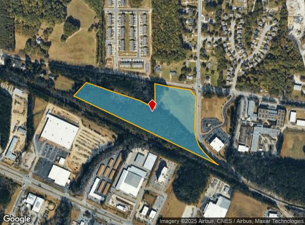
0 Jones Sausage Rd
Raleigh, NC
Garner & Jones Sausage Rd Sub
1721.17-10-4884-000
BNDY EAST GARNER & JONES SAUSAGE RD SUB
Vacantlandnec
Wake
X
North Carolina
3720172100K
15.48 AC
2025
Southeast Wake County
2025
Raleigh/Durham
052814
DEMOGRAPHICS near 0 Jones Sausage Rd
1 Mile
3 Mile
5 Mile
2024 Total Population
2,216
44,415
108,110
2029 Population
2,436
48,657
117,844
Pop Growth 2024-2029
+ 9.93%
+ 9.55%
+ 9.00%
Average Age
39
39
38
2024 Total Households
852
17,025
39,392
HH Growth 2024-2029
+ 9.98%
+ 9.62%
+ 9.14%
Median Household Inc
$46,416
$64,526
$65,756
Avg Household Size
2.50
2.50
2.60
2024 Avg HH Vehicles
2.00
2.00
2.00
Median Home Value
$248,853
$248,273
$240,801
Median Year Built
1989
1998
1996
Nearby Places
Map Layers
Map Styles
 Street
 Aerial
- Restaurants
- Banks
- Shops
- Fitness
- Groceries
PUBLIC TRANSPORTATION
COMMUTER RAIL
Raleigh Union Station (Piedmont - North Carolina by Train (NC Train))
DRIVE
WALK
Distance
Raleigh Union Station (Piedmont - North Carolina by Train (NC Train))
14 min
8.8 mi
AIRPORT
Raleigh-Durham International
DRIVE
WALK
Distance
Raleigh-Durham International
31 min
22.8 mi
Freight Ports
Port of Wilmington
DRIVE
WALK
Distance
Port of Wilmington
143 min
125.5 mi
Nearby Properties
Address
Land Use
TOTAL SIZE
Lot Size
Zoning
Address
Land Use
TOTAL SIZE
Lot Size
Zoning
2,583,746 SF
87.16 AC
HI
Address
Land Use
TOTAL SIZE
Lot Size
Zoning
517,912 SF
27.44 AC
R-10
Address
Land Use
TOTAL SIZE
Lot Size
Zoning
435,270 SF
57.90 AC
CMX
Address
Land Use
TOTAL SIZE
Lot Size
Zoning
390,672 SF
30.23 AC
CMX
Address
Land Use
TOTAL SIZE
Lot Size
Zoning
288,761 SF
19.61 AC
MF-B
Address
Land Use
TOTAL SIZE
Lot Size
Zoning
275,019 SF
17.04 AC
MF-A
Address
Land Use
TOTAL SIZE
Lot Size
Zoning
298,563 SF
24.19 AC
CMX
Address
Land Use
TOTAL SIZE
Lot Size
Zoning
279,123 SF
22.91 AC
CMX
Address
Land Use
TOTAL SIZE
Lot Size
Zoning
304,813 SF
19.08 AC
MF-A
Address
Land Use
TOTAL SIZE
Lot Size
Zoning
250,558 SF
23.49 AC
CMX
Address
Land Use
TOTAL SIZE
Lot Size
Zoning
203,766 SF
14.18 AC
MF-A
Address
Land Use
TOTAL SIZE
Lot Size
Zoning
420,962 SF
44 AC
IH
Address
Land Use
TOTAL SIZE
Lot Size
Zoning
220,352 SF
16.82 AC
MF-A
Address
Land Use
TOTAL SIZE
Lot Size
Zoning
275,215 SF
18.17 AC
HI
Address
Land Use
TOTAL SIZE
Lot Size
Zoning
112,243 SF
45.76 AC
RA
Address
Land Use
TOTAL SIZE
Lot Size
Zoning
259,480 SF
17.19 AC
HI
Address
Land Use
TOTAL SIZE
Lot Size
Zoning
2,527 SF
173.31 AC
CMX
Address
Land Use
TOTAL SIZE
Lot Size
Zoning
105,512 SF
19.47 AC
R-6
Address
Land Use
TOTAL SIZE
Lot Size
Zoning
110,680 SF
107.82 AC
IH
Address
Land Use
TOTAL SIZE
Lot Size
Zoning
156,078 SF
67.93 AC
HI
Address
Land Use
TOTAL SIZE
Lot Size
Zoning
166,859 SF
17.79 AC
R4
Address
Land Use
TOTAL SIZE
Lot Size
Zoning
98.77 AC
OX-3
Address
Land Use
TOTAL SIZE
Lot Size
Zoning
99,963 SF
26.84 AC
R2
Address
Land Use
TOTAL SIZE
Lot Size
Zoning
166,413 SF
12.47 AC
HI
Address
Land Use
TOTAL SIZE
Lot Size
Zoning
126,735 SF
9.89 AC
MF-A
Address
Land Use
TOTAL SIZE
Lot Size
Zoning
153,099 SF
38.98 AC
R2
Address
Land Use
TOTAL SIZE
Lot Size
Zoning
78,409 SF
45.91 AC
RA
Address
Land Use
TOTAL SIZE
Lot Size
Zoning
94,438 SF
37.79 AC
RA
Address
Land Use
TOTAL SIZE
Lot Size
Zoning
187,500 SF
12.43 AC
IH
Address
Land Use
TOTAL SIZE
Lot Size
Zoning
84,634 SF
19.30 AC
R4
The World's #1 Commercial Real Estate Marketplace
Connect with us
© 2025 CoStar Group
The information above has been obtained from sources believed reliable. While we do not doubt its accuracy we have not verified it and make no guarantee, warranty or representation about it. It is your responsibility to independently confirm its accuracy and completeness. Any projections, opinions, assumptions, or estimates used are for example only and do not represent the current or future performance of the property. The value of this transaction to you depends on tax and other factors which should be evaluated by your tax, financial, and legal advisors. You and your advisors should conduct a careful, independent investigation of the property to determine to your satisfaction the suitability of the property for your needs.