Property Record
0 Katy Hockley Rd, Hockley, TX 77447
NEARBY LISTINGS FOR SALE OR LEASE
-
-
View all Hockley listings for sale on LoopNet.com
Property Detail
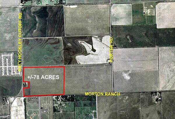
0 Katy Hockley Rd
Houston-The Woodlands-Sugar Land, TX
Abst 499 Q N Kinman
0431650000064
TRS 4B 4C 5B & 5C KATY OUTLOTS
Vacantlandnec
Harris
X
Texas
48201C0380N
0.94 AC
0
Katy/Grand Parkway West
2025
Houston
542800
DEMOGRAPHICS near 0 Katy Hockley Rd
1 Mile
3 Mile
5 Mile
2024 Total Population
8,584
61,041
150,555
2029 Population
8,924
66,906
165,788
Pop Growth 2024-2029
+ 3.96%
+ 9.61%
+ 10.12%
Average Age
37
35
35
2024 Total Households
2,719
19,271
48,761
HH Growth 2024-2029
+ 3.97%
+ 9.57%
+ 9.91%
Median Household Inc
$96,843
$102,537
$102,619
Avg Household Size
3.10
3.10
3.00
2024 Avg HH Vehicles
2.00
2.00
2.00
Median Home Value
$266,779
$272,340
$281,852
Median Year Built
1999
2010
2010
Nearby Places
Map Layers
Map Styles
 Street
 Aerial
- Restaurants
- Banks
- Shops
- Fitness
- Groceries
PUBLIC TRANSPORTATION
AIRPORT
George Bush Intcntl/Houston
DRIVE
WALK
Distance
George Bush Intcntl/Houston
57 min
38.0 mi
Freight Ports
Port of Houston
DRIVE
WALK
Distance
Port of Houston
67 min
46.7 mi
Nearby Properties
Address
Land Use
TOTAL SIZE
Lot Size
Zoning
Address
Land Use
TOTAL SIZE
Lot Size
Zoning
785.28 AC
Address
Land Use
TOTAL SIZE
Lot Size
Zoning
134.10 AC
Address
Land Use
TOTAL SIZE
Lot Size
Zoning
698.98 AC
Address
Land Use
TOTAL SIZE
Lot Size
Zoning
7,900 SF
833.34 AC
Address
Land Use
TOTAL SIZE
Lot Size
Zoning
520.66 AC
Address
Land Use
TOTAL SIZE
Lot Size
Zoning
568.93 AC
Address
Land Use
TOTAL SIZE
Lot Size
Zoning
34,298 SF
28.42 AC
Address
Land Use
TOTAL SIZE
Lot Size
Zoning
298.56 AC
Address
Land Use
TOTAL SIZE
Lot Size
Zoning
245.22 AC
Address
Land Use
TOTAL SIZE
Lot Size
Zoning
383.95 AC
Address
Land Use
TOTAL SIZE
Lot Size
Zoning
65.15 AC
Address
Land Use
TOTAL SIZE
Lot Size
Zoning
1,050 SF
714.14 AC
Address
Land Use
TOTAL SIZE
Lot Size
Zoning
Address
Land Use
TOTAL SIZE
Lot Size
Zoning
557.31 AC
Address
Land Use
TOTAL SIZE
Lot Size
Zoning
Address
Land Use
TOTAL SIZE
Lot Size
Zoning
Address
Land Use
TOTAL SIZE
Lot Size
Zoning
628.42 AC
Address
Land Use
TOTAL SIZE
Lot Size
Zoning
73.73 AC
Address
Land Use
TOTAL SIZE
Lot Size
Zoning
207.98 AC
Address
Land Use
TOTAL SIZE
Lot Size
Zoning
284.51 AC
Address
Land Use
TOTAL SIZE
Lot Size
Zoning
239.90 AC
Address
Land Use
TOTAL SIZE
Lot Size
Zoning
240.01 AC
Address
Land Use
TOTAL SIZE
Lot Size
Zoning
101.74 AC
Address
Land Use
TOTAL SIZE
Lot Size
Zoning
11,108 SF
4.02 AC
Address
Land Use
TOTAL SIZE
Lot Size
Zoning
621.57 AC
Address
Land Use
TOTAL SIZE
Lot Size
Zoning
89.90 AC
Address
Land Use
TOTAL SIZE
Lot Size
Zoning
527.61 AC
Address
Land Use
TOTAL SIZE
Lot Size
Zoning
8,122 SF
4.93 AC
Address
Land Use
TOTAL SIZE
Lot Size
Zoning
321.65 AC
Address
Land Use
TOTAL SIZE
Lot Size
Zoning
82,774 SF
4.85 AC
The World's #1 Commercial Real Estate Marketplace
Connect with us
© 2025 CoStar Group
The information above has been obtained from sources believed reliable. While we do not doubt its accuracy we have not verified it and make no guarantee, warranty or representation about it. It is your responsibility to independently confirm its accuracy and completeness. Any projections, opinions, assumptions, or estimates used are for example only and do not represent the current or future performance of the property. The value of this transaction to you depends on tax and other factors which should be evaluated by your tax, financial, and legal advisors. You and your advisors should conduct a careful, independent investigation of the property to determine to your satisfaction the suitability of the property for your needs.