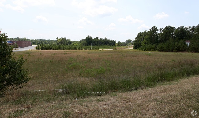
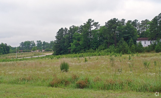
Property Record
0 Knightdale Blvd, Knightdale, NC 27545

NEARBY LISTINGS FOR SALE OR LEASE
Property Detail
0 Knightdale Blvd
Raleigh-Cary, NC
Lowes Home Center
1754.09-25-3263-000
LO3 LOWES HOME CENTERS INC BM2001-00100
Vacantlandnec
Wake
X
North Carolina
3720175400K
3
2025
12.50 AC
2025
Northeast Wake County
054115
Raleigh/Durham
DEMOGRAPHICS near 0 Knightdale Blvd
1 Mile
3 Mile
5 Mile
2024 Total Population
7,608
29,830
87,351
2029 Population
8,239
32,513
95,366
Pop Growth 2024-2029
+ 8.29%
+ 8.99%
+ 9.18%
Average Age
38
37
38
2024 Total Households
2,865
11,140
32,051
HH Growth 2024-2029
+ 8.34%
+ 9.04%
+ 9.24%
Median Household Inc
$66,483
$69,384
$80,957
Avg Household Size
2.60
2.60
2.70
2024 Avg HH Vehicles
2.00
2.00
2.00
Median Home Value
$280,209
$271,942
$264,435
Median Year Built
2000
2000
1999
Nearby Places
Map Layers
Map Styles
 Street
 Aerial
- Restaurants
- Banks
- Shops
- Fitness
- Groceries
PUBLIC TRANSPORTATION
AIRPORT
Raleigh-Durham International
DRIVE
WALK
Distance
Raleigh-Durham International
32 min
24.5 mi
Freight Ports
Port of Wilmington
DRIVE
WALK
Distance
Port of Wilmington
161 min
139.3 mi
Nearby Properties
Address
Land Use
TOTAL SIZE
Lot Size
Zoning
Address
Land Use
TOTAL SIZE
Lot Size
Zoning
358,360 SF
20.25 AC
HBCD
Address
Land Use
TOTAL SIZE
Lot Size
Zoning
507,000 SF
46.54 AC
MI PU
Address
Land Use
TOTAL SIZE
Lot Size
Zoning
320,135 SF
17.75 AC
NMX
Address
Land Use
TOTAL SIZE
Lot Size
Zoning
261,096 SF
17.30 AC
NMX
Address
Land Use
TOTAL SIZE
Lot Size
Zoning
263,074 SF
83.23 AC
GR8
Address
Land Use
TOTAL SIZE
Lot Size
Zoning
209,019 SF
5 AC
NMX P
Address
Land Use
TOTAL SIZE
Lot Size
Zoning
280,020 SF
15.44 AC
MI
Address
Land Use
TOTAL SIZE
Lot Size
Zoning
222,108 SF
21.81 AC
UR12
Address
Land Use
TOTAL SIZE
Lot Size
Zoning
250,778 SF
16.51 AC
UR12
Address
Land Use
TOTAL SIZE
Lot Size
Zoning
240,000 SF
16.77 AC
MI
Address
Land Use
TOTAL SIZE
Lot Size
Zoning
299,965 SF
16.34 AC
RMX
Address
Land Use
TOTAL SIZE
Lot Size
Zoning
206,543 SF
19.91 AC
UR12
Address
Land Use
TOTAL SIZE
Lot Size
Zoning
133,847 SF
47.62 AC
R-4
Address
Land Use
TOTAL SIZE
Lot Size
Zoning
411,764 SF
59.16 AC
MI
Address
Land Use
TOTAL SIZE
Lot Size
Zoning
204,000 SF
19.83 AC
MI CD
Address
Land Use
TOTAL SIZE
Lot Size
Zoning
165,191 SF
17.76 AC
HB
Address
Land Use
TOTAL SIZE
Lot Size
Zoning
250,120 SF
17.38 AC
MI CD
Address
Land Use
TOTAL SIZE
Lot Size
Zoning
208,125 SF
26.29 AC
MI
Address
Land Use
TOTAL SIZE
Lot Size
Zoning
180,000 SF
24.61 AC
MI CD
Address
Land Use
TOTAL SIZE
Lot Size
Zoning
155,462 SF
4.57 AC
NMX P
Address
Land Use
TOTAL SIZE
Lot Size
Zoning
99,834 SF
21 AC
AP
Address
Land Use
TOTAL SIZE
Lot Size
Zoning
159,522 SF
9.66 AC
MI
Address
Land Use
TOTAL SIZE
Lot Size
Zoning
121,658 SF
5.51 AC
NMX
Address
Land Use
TOTAL SIZE
Lot Size
Zoning
96,023 SF
18.79 AC
MI
Address
Land Use
TOTAL SIZE
Lot Size
Zoning
150,000 SF
7.09 AC
MI
Address
Land Use
TOTAL SIZE
Lot Size
Zoning
148,661 SF
7.80 AC
MI
Address
Land Use
TOTAL SIZE
Lot Size
Zoning
138,588 SF
19.07 AC
HB CD
Address
Land Use
TOTAL SIZE
Lot Size
Zoning
136,430 SF
52.66 AC
GR8
Address
Land Use
TOTAL SIZE
Lot Size
Zoning
63,414 SF
95.15 AC
RT
Address
Land Use
TOTAL SIZE
Lot Size
Zoning
103,924 SF
16.92 AC
GR8
The World's #1 Commercial Real Estate Marketplace
Connect with us
© 2026 CoStar Group
The information above has been obtained from sources believed reliable. While we do not doubt its accuracy we have not verified it and make no guarantee, warranty or representation about it. It is your responsibility to independently confirm its accuracy and completeness. Any projections, opinions, assumptions, or estimates used are for example only and do not represent the current or future performance of the property. The value of this transaction to you depends on tax and other factors which should be evaluated by your tax, financial, and legal advisors. You and your advisors should conduct a careful, independent investigation of the property to determine to your satisfaction the suitability of the property for your needs.