Property Record
1254 Mcallistar Dr, Locust Grove, GA 30248
NEARBY LISTINGS FOR SALE OR LEASE
Property Detail
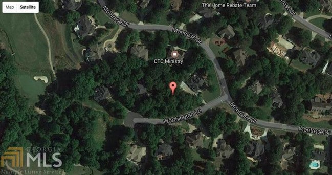
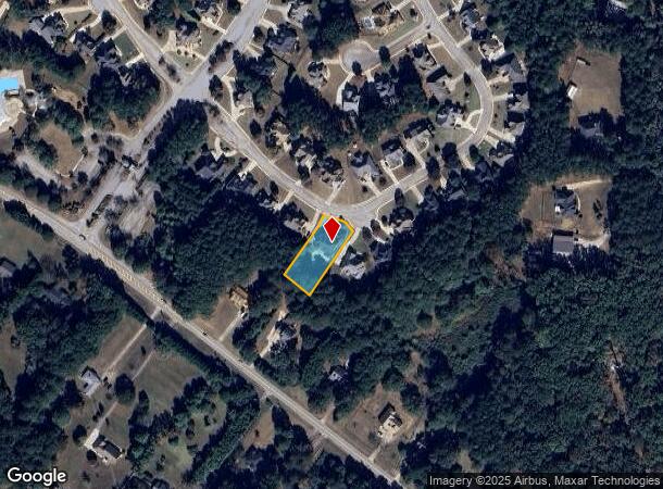
1254 Mcallistar Dr
Atlanta-Sandy Springs-Roswell, GA
Eagles Brooke
097C-02-001-000
Henry
Sfr
Georgia
X
0.51 AC
13255C0085E
South Clayton/Henry Cnty
3,571 SF
Atlanta
DEMOGRAPHICS near 1254 Mcallistar Dr
1 Mile
3 Mile
5 Mile
2024 Total Population
1,438
16,252
47,306
2029 Population
1,620
17,978
52,088
Pop Growth 2024-2029
+ 12.66%
+ 10.62%
+ 10.11%
Average Age
39
37
37
2024 Total Households
502
5,479
16,198
HH Growth 2024-2029
+ 12.95%
+ 10.75%
+ 10.20%
Median Household Inc
$84,765
$80,368
$74,903
Avg Household Size
2.80
2.90
2.90
2024 Avg HH Vehicles
2.00
2.00
2.00
Median Home Value
$392,499
$269,242
$222,663
Median Year Built
2006
2006
2005
Nearby Places
Map Layers
Map Styles
 Street
 Aerial
- Restaurants
- Banks
- Shops
- Fitness
- Groceries
PUBLIC TRANSPORTATION
AIRPORT
Hartsfield - Jackson Atlanta International
DRIVE
WALK
Distance
Hartsfield - Jackson Atlanta International
40 min
30.1 mi
Freight Ports
Georgia Ports - Savannah
DRIVE
WALK
Distance
Georgia Ports - Savannah
241 min
215.6 mi
SALE & LEASE HISTORY
LISTING DATE
SALE/LEASE

Oct 10, 2017
For Sale
Nearby Properties
Address
Land Use
TOTAL SIZE
Lot Size
Zoning
Address
Land Use
TOTAL SIZE
Lot Size
Zoning
1,012,028 SF
98.01 AC
M1
Address
Land Use
TOTAL SIZE
Lot Size
Zoning
1,079,756 SF
92.38 AC
M1
Address
Land Use
TOTAL SIZE
Lot Size
Zoning
1,010,600 SF
78.40 AC
M1
Address
Land Use
TOTAL SIZE
Lot Size
Zoning
1,126,973 SF
88.82 AC
M1
Address
Land Use
TOTAL SIZE
Lot Size
Zoning
1,038,514 SF
141.54 AC
M1
Address
Land Use
TOTAL SIZE
Lot Size
Zoning
247,544 SF
43.30 AC
Address
Land Use
TOTAL SIZE
Lot Size
Zoning
4,307,236 SF
66.85 AC
M1
Address
Land Use
TOTAL SIZE
Lot Size
Zoning
765,316 SF
85.65 AC
M1
Address
Land Use
TOTAL SIZE
Lot Size
Zoning
7,005,327 SF
56.89 AC
M1
Address
Land Use
TOTAL SIZE
Lot Size
Zoning
415,997 SF
41.35 AC
Address
Land Use
TOTAL SIZE
Lot Size
Zoning
22,633 SF
31 AC
RM
Address
Land Use
TOTAL SIZE
Lot Size
Zoning
4,982 SF
34.62 AC
RM
Address
Land Use
TOTAL SIZE
Lot Size
Zoning
21,308 SF
14.22 AC
M1
Address
Land Use
TOTAL SIZE
Lot Size
Zoning
660,000 SF
129.11 AC
M1
Address
Land Use
TOTAL SIZE
Lot Size
Zoning
5,681,569 SF
37.80 AC
M1
Address
Land Use
TOTAL SIZE
Lot Size
Zoning
351,848 SF
41.63 AC
C2
Address
Land Use
TOTAL SIZE
Lot Size
Zoning
6,101,324 SF
42.27 AC
M1
Address
Land Use
TOTAL SIZE
Lot Size
Zoning
427,200 SF
67.92 AC
PD
Address
Land Use
TOTAL SIZE
Lot Size
Zoning
3,783,900 SF
43.09 AC
M1
Address
Land Use
TOTAL SIZE
Lot Size
Zoning
678,692 SF
47.81 AC
M1
Address
Land Use
TOTAL SIZE
Lot Size
Zoning
3,060,922 SF
27.99 AC
M1
Address
Land Use
TOTAL SIZE
Lot Size
Zoning
977,344 SF
32.79 AC
M1
Address
Land Use
TOTAL SIZE
Lot Size
Zoning
297,051 SF
33.41 AC
M1
Address
Land Use
TOTAL SIZE
Lot Size
Zoning
3,514,660 SF
25.51 AC
M1
Address
Land Use
TOTAL SIZE
Lot Size
Zoning
3,454,970 SF
15.47 AC
M1
Address
Land Use
TOTAL SIZE
Lot Size
Zoning
1,352,289 SF
25.38 AC
M1
Address
Land Use
TOTAL SIZE
Lot Size
Zoning
138,766 SF
14.46 AC
M1
Address
Land Use
TOTAL SIZE
Lot Size
Zoning
801,000 SF
22.34 AC
M1
Address
Land Use
TOTAL SIZE
Lot Size
Zoning
205,200 SF
16.25 AC
M1
The World's #1 Commercial Real Estate Marketplace
Connect with us
© 2025 CoStar Group
The information above has been obtained from sources believed reliable. While we do not doubt its accuracy we have not verified it and make no guarantee, warranty or representation about it. It is your responsibility to independently confirm its accuracy and completeness. Any projections, opinions, assumptions, or estimates used are for example only and do not represent the current or future performance of the property. The value of this transaction to you depends on tax and other factors which should be evaluated by your tax, financial, and legal advisors. You and your advisors should conduct a careful, independent investigation of the property to determine to your satisfaction the suitability of the property for your needs.