Property Record
0 Marbach Ln, Garden Ridge, TX 78266


Current Lease Availabilities
NEARBY LISTINGS FOR SALE OR LEASE
Property Detail
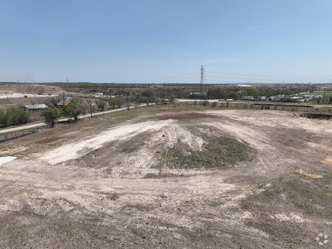
0 Marbach Ln
San Antonio-New Braunfels, TX
A-383 Sur-114 V Micheli
74-0383-0010-02
A-383 SUR-114 V MICHELI, ACRES 13.6
Vacantlandnec
Comal
AE
Texas
48029C0280F
13.60 AC
2024
Comal County
2025
San Antonio
310801
DEMOGRAPHICS near 0 Marbach Ln
1 Mile
3 Mile
5 Mile
2024 Total Population
634
17,250
108,325
2029 Population
859
20,203
118,847
Pop Growth 2024-2029
+ 35.49%
+ 17.12%
+ 9.71%
Average Age
42
38
38
2024 Total Households
225
6,340
39,378
HH Growth 2024-2029
+ 35.11%
+ 17.11%
+ 9.77%
Median Household Inc
$139,642
$102,207
$82,353
Avg Household Size
2.80
2.70
2.70
2024 Avg HH Vehicles
3.00
2.00
2.00
Median Home Value
$665,137
$296,735
$247,519
Median Year Built
2005
2007
2000
Nearby Places
Map Layers
Map Styles
 Street
 Aerial
- Restaurants
- Banks
- Shops
- Fitness
- Groceries
PUBLIC TRANSPORTATION
AIRPORT
San Antonio International
DRIVE
WALK
Distance
San Antonio International
25 min
15.6 mi
Freight Ports
Calhoun Port
DRIVE
WALK
Distance
Calhoun Port
185 min
151.2 mi
Nearby Properties
Address
Land Use
TOTAL SIZE
Lot Size
Zoning
Address
Land Use
TOTAL SIZE
Lot Size
Zoning
538,168 SF
176.13 AC
Address
Land Use
TOTAL SIZE
Lot Size
Zoning
566,929 SF
89.66 AC
Address
Land Use
TOTAL SIZE
Lot Size
Zoning
37,195 SF
1,118.06 AC
Address
Land Use
TOTAL SIZE
Lot Size
Zoning
523,268 SF
22.57 AC
Address
Land Use
TOTAL SIZE
Lot Size
Zoning
345,622 SF
26.98 AC
Address
Land Use
TOTAL SIZE
Lot Size
Zoning
246,965 SF
11.73 AC
Address
Land Use
TOTAL SIZE
Lot Size
Zoning
95,470 SF
35.26 AC
Address
Land Use
TOTAL SIZE
Lot Size
Zoning
Address
Land Use
TOTAL SIZE
Lot Size
Zoning
280,516 SF
12.92 AC
Address
Land Use
TOTAL SIZE
Lot Size
Zoning
251,110 SF
12.26 AC
Address
Land Use
TOTAL SIZE
Lot Size
Zoning
214,405 SF
11.85 AC
Address
Land Use
TOTAL SIZE
Lot Size
Zoning
223,980 SF
17.11 AC
Address
Land Use
TOTAL SIZE
Lot Size
Zoning
55,640 SF
24.17 AC
Address
Land Use
TOTAL SIZE
Lot Size
Zoning
511,000 SF
32.40 AC
Address
Land Use
TOTAL SIZE
Lot Size
Zoning
430,320 SF
25.03 AC
Address
Land Use
TOTAL SIZE
Lot Size
Zoning
111,269 SF
73.47 AC
Address
Land Use
TOTAL SIZE
Lot Size
Zoning
7,176 SF
24.22 AC
Address
Land Use
TOTAL SIZE
Lot Size
Zoning
358,036 SF
20.77 AC
Address
Land Use
TOTAL SIZE
Lot Size
Zoning
65,271 SF
1,351.01 AC
Address
Land Use
TOTAL SIZE
Lot Size
Zoning
312,696 SF
18.01 AC
Address
Land Use
TOTAL SIZE
Lot Size
Zoning
308,264 SF
26.51 AC
Address
Land Use
TOTAL SIZE
Lot Size
Zoning
307,240 SF
20.16 AC
Address
Land Use
TOTAL SIZE
Lot Size
Zoning
576 SF
41.86 AC
Address
Land Use
TOTAL SIZE
Lot Size
Zoning
321,016 SF
18.67 AC
Address
Land Use
TOTAL SIZE
Lot Size
Zoning
267,716 SF
21.11 AC
Address
Land Use
TOTAL SIZE
Lot Size
Zoning
109,469 SF
5.88 AC
Address
Land Use
TOTAL SIZE
Lot Size
Zoning
187,650 SF
42.50 AC
Address
Land Use
TOTAL SIZE
Lot Size
Zoning
446,278 SF
26.67 AC
Address
Land Use
TOTAL SIZE
Lot Size
Zoning
153,700 SF
9.03 AC
Address
Land Use
TOTAL SIZE
Lot Size
Zoning
197,100 SF
11.43 AC
The World's #1 Commercial Real Estate Marketplace
Connect with us
© 2026 CoStar Group
The information above has been obtained from sources believed reliable. While we do not doubt its accuracy we have not verified it and make no guarantee, warranty or representation about it. It is your responsibility to independently confirm its accuracy and completeness. Any projections, opinions, assumptions, or estimates used are for example only and do not represent the current or future performance of the property. The value of this transaction to you depends on tax and other factors which should be evaluated by your tax, financial, and legal advisors. You and your advisors should conduct a careful, independent investigation of the property to determine to your satisfaction the suitability of the property for your needs.