Property Record
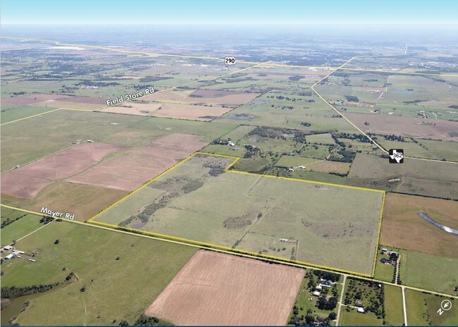
0 Mayer Rd, Waller, TX 77484
Property Detail
0 Mayer Rd
Houston-Pasadena-The Woodlands, TX
TR 3 ABST 966 I&GNRR CO
0460660000005
HARRIS
Agriculturalland
Texas
B and X Area of moderate flood hazard, usually the area between the limits of the 100-year and 500-year floods.
49.98 AC
2023
Northwest Outlier
2025
Houston
556000
NEARBY LISTINGS FOR SALE OR LEASE
DEMOGRAPHICS near 0 Mayer Rd
1 mile
3 mile
5 mile
2025 Total Population
87
2,092
9,508
2030 Population
92
2,315
10,452
Pop Growth 2025-2030
+ 5.75%
+ 10.66%
+ 9.93%
Average Age
40
38
38
2025 Total Households
32
784
3,449
HH Growth 2025-2030
+ 6.25%
+ 10.71%
+ 9.92%
Median Household Inc
$87,500
$58,787
$58,816
Avg Household Size
2.70
2.70
2.80
2025 Avg HH Vehicles
2.00
2.00
2.00
Median Home Value
$450,000
$325,735
$299,999
Median Year Built
1991
1993
1992
Nearby Places
Map Layers
Map Styles
 Street
 Aerial
Transit
 Traffic
 Biking
Places
Listings with unknown addresses are not visible on the map
- Restaurants
- Banks
- Shops
- Fitness
- Groceries
SALE & LEASE HISTORY
LISTING DATE
SALE/LEASE

Nov 27, 2017
For Sale
Nearby Properties
Address
Land Use
TOTAL SIZE
Lot Size
Zoning
Address
Land Use
TOTAL SIZE
Lot Size
Zoning
Address
Land Use
TOTAL SIZE
Lot Size
Zoning
123,444 SF
23.37 AC
Address
Land Use
TOTAL SIZE
Lot Size
Zoning
121,600 SF
10.06 AC
Address
Land Use
TOTAL SIZE
Lot Size
Zoning
24,572 SF
67 AC
Address
Land Use
TOTAL SIZE
Lot Size
Zoning
83,411 SF
9.10 AC
Address
Land Use
TOTAL SIZE
Lot Size
Zoning
75,040 SF
22.23 AC
Address
Land Use
TOTAL SIZE
Lot Size
Zoning
1,056 SF
345.66 AC
Address
Land Use
TOTAL SIZE
Lot Size
Zoning
611.96 AC
Address
Land Use
TOTAL SIZE
Lot Size
Zoning
186.99 AC
Address
Land Use
TOTAL SIZE
Lot Size
Zoning
288.90 AC
Address
Land Use
TOTAL SIZE
Lot Size
Zoning
43,240 SF
11.20 AC
Address
Land Use
TOTAL SIZE
Lot Size
Zoning
215.75 AC
Address
Land Use
TOTAL SIZE
Lot Size
Zoning
199.48 AC
Address
Land Use
TOTAL SIZE
Lot Size
Zoning
176.10 AC
Address
Land Use
TOTAL SIZE
Lot Size
Zoning
7,578 SF
5.99 AC
Address
Land Use
TOTAL SIZE
Lot Size
Zoning
71.79 AC
Address
Land Use
TOTAL SIZE
Lot Size
Zoning
198.50 AC
Address
Land Use
TOTAL SIZE
Lot Size
Zoning
Address
Land Use
TOTAL SIZE
Lot Size
Zoning
98.35 AC
Address
Land Use
TOTAL SIZE
Lot Size
Zoning
2,082 SF
149.87 AC
Address
Land Use
TOTAL SIZE
Lot Size
Zoning
120 AC
Address
Land Use
TOTAL SIZE
Lot Size
Zoning
12,000 SF
19.91 AC
Address
Land Use
TOTAL SIZE
Lot Size
Zoning
83.67 AC
Address
Land Use
TOTAL SIZE
Lot Size
Zoning
96,548 SF
23.10 AC
Address
Land Use
TOTAL SIZE
Lot Size
Zoning
150 AC
Address
Land Use
TOTAL SIZE
Lot Size
Zoning
1,308 SF
41.83 AC
Address
Land Use
TOTAL SIZE
Lot Size
Zoning
140.05 AC
Address
Land Use
TOTAL SIZE
Lot Size
Zoning
2,500 SF
21.85 AC
Address
Land Use
TOTAL SIZE
Lot Size
Zoning
8,117 SF
2.14 AC
Address
Land Use
TOTAL SIZE
Lot Size
Zoning
4,373 SF
26.60 AC
The World's #1 Commercial Real Estate Marketplace
Connect with us
© 2026 CoStar Group
The information above has been obtained from sources believed reliable. While we do not doubt its accuracy we have not verified it and make no guarantee, warranty or representation about it. It is your responsibility to independently confirm its accuracy and completeness. Any projections, opinions, assumptions, or estimates used are for example only and do not represent the current or future performance of the property. The value of this transaction to you depends on tax and other factors which should be evaluated by your tax, financial, and legal advisors. You and your advisors should conduct a careful, independent investigation of the property to determine to your satisfaction the suitability of the property for your needs.