Property Record
0 Mc Cabe Rd, La Porte, TX 77571


Save to a Folder
{{folder.Name}}
{{folder.ListingIds.length}} Properties
{{folder.ListingIds.length}} Property
Create a New Folder
Property Detail
0 Mc Cabe Rd
Houston-Pasadena-The Woodlands, TX
TRS 5F 5F-1 8 8A 9B 10 11 49 & 49A ABST 30 W P HARRIS
0402440010013
HARRIS
Commercialacreage
Texas
AE The base floodplain where base flood elevations are provided. AE Zones are now used on new format FIRMs instead of A1-A30 Zones.
106.55 AC
2023
Gulf Freeway/Pasadena
2025
Houston
343200
NEARBY LISTINGS FOR SALE OR LEASE
DEMOGRAPHICS near 0 Mc Cabe Rd
1 mile
3 mile
5 mile
2025 Total Population
3,697
19,358
69,351
2030 Population
3,992
21,041
74,638
Pop Growth 2025-2030
+ 7.98%
+ 8.69%
+ 7.62%
Average Age
41
40
40
2025 Total Households
1,434
7,141
26,671
HH Growth 2025-2030
+ 8.09%
+ 8.47%
+ 7.73%
Median Household Inc
$90,184
$98,052
$100,331
Avg Household Size
2.60
2.60
2.60
2025 Avg HH Vehicles
2.00
2.00
2.00
Median Home Value
$279,786
$280,970
$297,353
Median Year Built
1982
1987
1987
Nearby Places
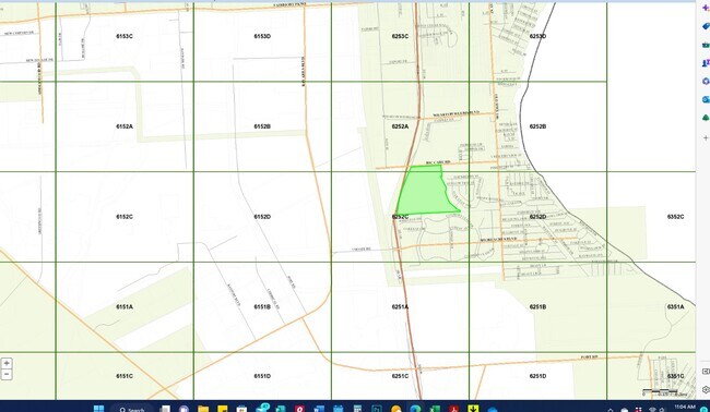
Map Layers
Map Styles
 Street
 Aerial
Layers
 Traffic
 Biking
Places
Listings with unknown addresses are not visible on the map
- Restaurants
- Banks
- Shops
- Fitness
- Groceries
PUBLIC TRANSPORTATION
AIRPORT
William P Hobby
Drive
Walk
Distance
William P Hobby
37 min
19.6 mi
Freight Ports
Port of Houston
Drive
Walk
Distance
Port of Houston
33 min
22.8 mi
SALE & LEASE HISTORY
LISTING DATE
SALE/LEASE

Jun 09, 2020
For Sale
Apr 27, 2023
For Sale
Nearby Properties
Address
Land Use
TOTAL SIZE
Lot Size
Zoning
Address
Land Use
TOTAL SIZE
Lot Size
Zoning
176.73 AC
Address
Land Use
TOTAL SIZE
Lot Size
Zoning
Address
Land Use
TOTAL SIZE
Lot Size
Zoning
8,762,629 SF
237.51 AC
Address
Land Use
TOTAL SIZE
Lot Size
Zoning
179.52 AC
Address
Land Use
TOTAL SIZE
Lot Size
Zoning
Address
Land Use
TOTAL SIZE
Lot Size
Zoning
3,972,042 SF
110.27 AC
Address
Land Use
TOTAL SIZE
Lot Size
Zoning
Address
Land Use
TOTAL SIZE
Lot Size
Zoning
2,312,750 SF
70.59 AC
Address
Land Use
TOTAL SIZE
Lot Size
Zoning
Address
Land Use
TOTAL SIZE
Lot Size
Zoning
20.83 AC
Address
Land Use
TOTAL SIZE
Lot Size
Zoning
47.21 AC
Address
Land Use
TOTAL SIZE
Lot Size
Zoning
156.07 AC
Address
Land Use
TOTAL SIZE
Lot Size
Zoning
914.75 AC
Address
Land Use
TOTAL SIZE
Lot Size
Zoning
Address
Land Use
TOTAL SIZE
Lot Size
Zoning
21.18 AC
Address
Land Use
TOTAL SIZE
Lot Size
Zoning
61.40 AC
Address
Land Use
TOTAL SIZE
Lot Size
Zoning
784,496 SF
37.65 AC
Address
Land Use
TOTAL SIZE
Lot Size
Zoning
7.04 AC
Address
Land Use
TOTAL SIZE
Lot Size
Zoning
343,865 SF
16.92 AC
Address
Land Use
TOTAL SIZE
Lot Size
Zoning
Address
Land Use
TOTAL SIZE
Lot Size
Zoning
748,500 SF
42.13 AC
Address
Land Use
TOTAL SIZE
Lot Size
Zoning
21.49 AC
Address
Land Use
TOTAL SIZE
Lot Size
Zoning
642,432 SF
41.55 AC
Address
Land Use
TOTAL SIZE
Lot Size
Zoning
610,402 SF
34.69 AC
Address
Land Use
TOTAL SIZE
Lot Size
Zoning
Address
Land Use
TOTAL SIZE
Lot Size
Zoning
602,060 SF
34.15 AC
Address
Land Use
TOTAL SIZE
Lot Size
Zoning
30.58 AC
Address
Land Use
TOTAL SIZE
Lot Size
Zoning
480,480 SF
22.95 AC
Address
Land Use
TOTAL SIZE
Lot Size
Zoning
480,480 SF
20.09 AC
Address
Land Use
TOTAL SIZE
Lot Size
Zoning
348,294 SF
18.02 AC
The World's #1 Commercial Real Estate Marketplace
Connect with us
© 2026 CoStar Group
The information above has been obtained from sources believed reliable. While we do not doubt its accuracy we have not verified it and make no guarantee, warranty or representation about it. It is your responsibility to independently confirm its accuracy and completeness. Any projections, opinions, assumptions, or estimates used are for example only and do not represent the current or future performance of the property. The value of this transaction to you depends on tax and other factors which should be evaluated by your tax, financial, and legal advisors. You and your advisors should conduct a careful, independent investigation of the property to determine to your satisfaction the suitability of the property for your needs.