Property Record
0 Ne Stephens St, Roseburg, OR 97470


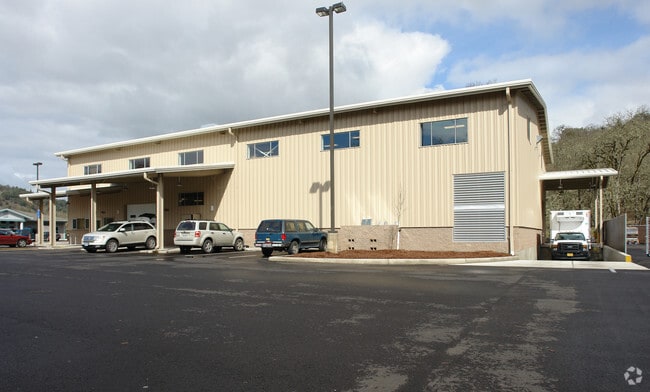
Property Detail
0 Ne Stephens St
R55908
P.P. 2007-98, PARCEL 2 & PT 1: P.P. 2009-40, PT PARCEL 1 (OUT SAN) SEE R130862 FOR BAL TL, ACRES 1.50
Charitableorganization
DOUGLAS
PR
Oregon
0
1.50 AC
2025
Oregon West Area
120001
Other Market Areas
10,684 SF
Roseburg, OR
NEARBY LISTINGS FOR SALE OR LEASE
-
-
View all Roseburg listings for sale on LoopNet.com
DEMOGRAPHICS near 0 Ne Stephens St
1 mile
3 mile
5 mile
2024 Total Population
3,173
17,193
37,139
2029 Population
3,227
17,379
37,611
Pop Growth 2024-2029
+ 1.70%
+ 1.08%
+ 1.27%
Average Age
47
46
44
2024 Total Households
1,382
7,448
15,656
HH Growth 2024-2029
+ 1.66%
+ 1.07%
+ 1.28%
Median Household Inc
$63,241
$57,223
$59,700
Avg Household Size
2.10
2.20
2.20
2024 Avg HH Vehicles
2.00
2.00
2.00
Median Home Value
$219,117
$330,147
$340,215
Median Year Built
1983
1981
1976
Nearby Places
Map Layers
Map Styles
 Street
 Aerial
Transit
 Traffic
 Biking
Places
Listings with unknown addresses are not visible on the map
- Restaurants
- Banks
- Shops
- Fitness
- Groceries
Nearby Properties
Address
Land Use
TOTAL SIZE
Lot Size
Zoning
Address
Land Use
TOTAL SIZE
Lot Size
Zoning
276,720 SF
18.77 AC
PR
Address
Land Use
TOTAL SIZE
Lot Size
Zoning
149.62 AC
PR
Address
Land Use
TOTAL SIZE
Lot Size
Zoning
32,749 SF
97.09 AC
PR
Address
Land Use
TOTAL SIZE
Lot Size
Zoning
102.28 AC
AP
Address
Land Use
TOTAL SIZE
Lot Size
Zoning
138,337 SF
16.25 AC
MU
Address
Land Use
TOTAL SIZE
Lot Size
Zoning
199,245 SF
13.97 AC
C3
Address
Land Use
TOTAL SIZE
Lot Size
Zoning
152,625 SF
20.21 AC
C3
Address
Land Use
TOTAL SIZE
Lot Size
Zoning
71,302 SF
1.84 AC
PR
Address
Land Use
TOTAL SIZE
Lot Size
Zoning
230,093 SF
17.80 AC
C3
Address
Land Use
TOTAL SIZE
Lot Size
Zoning
82,532 SF
2.43 AC
C3
Address
Land Use
TOTAL SIZE
Lot Size
Zoning
115,574 SF
4.32 AC
C3
Address
Land Use
TOTAL SIZE
Lot Size
Zoning
32.37 AC
M3
Address
Land Use
TOTAL SIZE
Lot Size
Zoning
43,384 SF
9.16 AC
PR
Address
Land Use
TOTAL SIZE
Lot Size
Zoning
124,320 SF
13.02 AC
MR40
Address
Land Use
TOTAL SIZE
Lot Size
Zoning
103,469 SF
10.45 AC
MU
Address
Land Use
TOTAL SIZE
Lot Size
Zoning
2.11 AC
MU
Address
Land Use
TOTAL SIZE
Lot Size
Zoning
119,646 SF
10.03 AC
MR18
Address
Land Use
TOTAL SIZE
Lot Size
Zoning
42,708 SF
0.78 AC
PR
Address
Land Use
TOTAL SIZE
Lot Size
Zoning
68,135 SF
8.13 AC
C3
Address
Land Use
TOTAL SIZE
Lot Size
Zoning
4.76 AC
PR
Address
Land Use
TOTAL SIZE
Lot Size
Zoning
37,755 SF
2.80 AC
C3
Address
Land Use
TOTAL SIZE
Lot Size
Zoning
57,685 SF
5.34 AC
C3
Address
Land Use
TOTAL SIZE
Lot Size
Zoning
21,852 SF
2.70 AC
C3
Address
Land Use
TOTAL SIZE
Lot Size
Zoning
23,996 SF
2.23 AC
C3
Address
Land Use
TOTAL SIZE
Lot Size
Zoning
42,900 SF
5.11 AC
MU
Address
Land Use
TOTAL SIZE
Lot Size
Zoning
1,000 SF
26.34 AC
PR
Address
Land Use
TOTAL SIZE
Lot Size
Zoning
70,897 SF
4.32 AC
C3
Address
Land Use
TOTAL SIZE
Lot Size
Zoning
55,836 SF
3.97 AC
C3
Address
Land Use
TOTAL SIZE
Lot Size
Zoning
72,722 SF
2.05 AC
C3
Address
Land Use
TOTAL SIZE
Lot Size
Zoning
1.99 AC
PR
The World's #1 Commercial Real Estate Marketplace
Connect with us
© 2026 CoStar Group
The information above has been obtained from sources believed reliable. While we do not doubt its accuracy we have not verified it and make no guarantee, warranty or representation about it. It is your responsibility to independently confirm its accuracy and completeness. Any projections, opinions, assumptions, or estimates used are for example only and do not represent the current or future performance of the property. The value of this transaction to you depends on tax and other factors which should be evaluated by your tax, financial, and legal advisors. You and your advisors should conduct a careful, independent investigation of the property to determine to your satisfaction the suitability of the property for your needs.